by Nick | Jan 4, 2021 | Blog, Hike
A Kulen Mountain Adventure
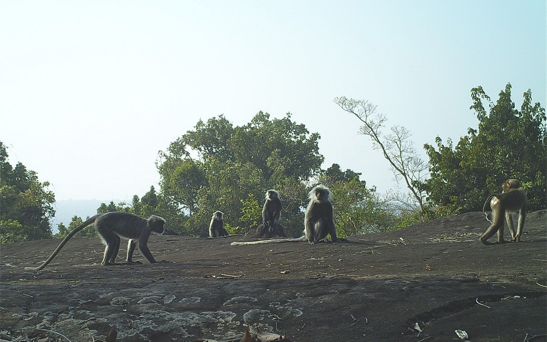
Our quest was to seek out the Silver Langur in the forests of Kulen Mountain and whatever other wildlife came our way.
‘Nick I’ve been to Corbett, Kana and Tadoba in India. The Serengeti, The Okavango, etc in Africa, but I don’t expect much.’ Hmmm – no pressure then, I thought. Kulen’s steeped in historical significance as the birthplace of the Angkorian Empire with some amazing relics hidden in the forest. There is wildlife including the fabled langur but it’s not, I hesitated, quite in the same league. ‘No worries, no worries,’ muttered John, our guest for the adventure.
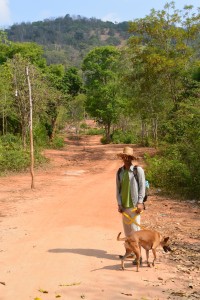
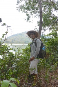
Our next hurdle was the army who suspiciously studied our van, even a barang (foreigner) couldn’t need that amount of stuff for one day on Kulen, eventually they let us past the toll. Safely ensconced in the ramshackle Ministry of Environment (MoE) HQ, the different strands of expedition started to come together beginning with strong black Vietnamese coffee from the stall opposite. After the usual pfaff we set off, striding through the forest with Mr Nai our MoE ranger and dog, she hadn’t got a name.
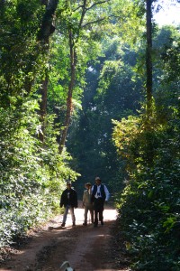 Setting off on The Kulen Trail with Buntha, Nai & John
It was a lovely walk shaded from the sun by the dark green canopies of tall trees still flushed with rain. As we passed Phum Thmei (lit; new village), the stony ground had little moisture so the mixed evergreen gave way to a warmer shade of dry deciduous forest. It was a beautiful morning, the hot sun shining in a blue sky cooled by winds from the North. The humidity had plummeted and sweat vaporised while doing its job.
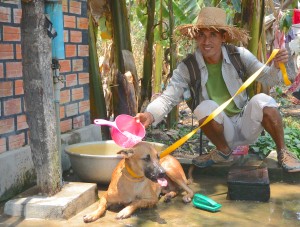
Dog had stuck with us, prancing with excitement at the slightest whiff of wildlife, which didn’t exactly help our chances of seeing any. She also had a habit of rolling in whatever stagnant liquid we passed by though there was no way she was going near the nice clean cool clear streams we had to cross, so we smelt her presence as well as heard and saw it.
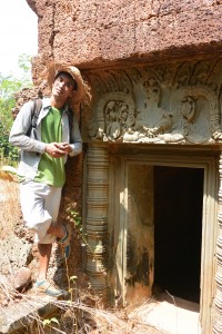
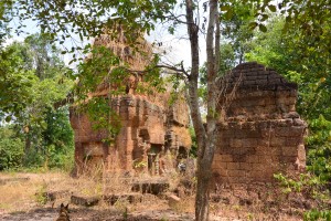
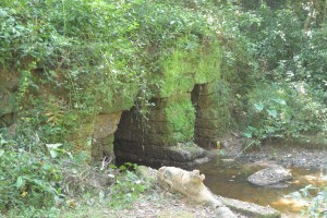
The Sra Domrey was every bit as magical as always. A two-thirds life size elephant carved out of the rock surrounded by three slightly doubtful lions and a distinctly dubious Nandi the bull.
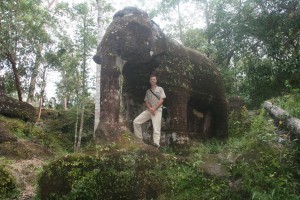 Sra Domrey a VIV century Hindu carving
We let the sense of mystical spirituality soak into our souls as we munched Dean’s sobu noodle salad.
Inexplicably the monks beside the bat cave were clad in fake leopard skin as we passed by a little unsure as to the appropriate etiquette for the situation and entered into the dark smelly dampness. Small bats stirred in the powerful beam of my torch and forayed across the kitch gilt of a Buddhist shrine. More kitch in the form of golden Buddhas, silver stupas and white concrete elephants at Wat Preah Kraal, perched on the crest of a hill with views back over the plains of Siem Reap Province to the Tonle Sap Lake.
Downhill all the way to our campsite where Kuong, our van driver and Chomran from the local village had done us proud and chosen a stunning location perfectly placed above the banks of the fast flowing Kulen River. John’s tent was up and a kettle boiling on the campfire. With a sigh of contentment we drank our tea and ate adventure bars.
The water was cool, deep and invigorating after our long walk. As dusk descended dinner was served, a duck casserole courtesy of Miss Wong with vegetables and rice cooked by Chomran followed by fruit salad.
The trees towering above us appeared vast in the dim light. We caught glimpses of a star studded night sky in between the branches. Dog, who was actually very sweet, was still with us but sensing the seriousness of our quest as we set off on a night walk, kept quiet as our torch beams played through the forest in search of it’s tenants. We walked all the way to the Bat Cave keeping our voices to whispers as we anticipated what we might meet. Are there still leopards on Kulen? I thought, but to no avail.
 Our Campsite beside the Kulen River
A couple of sleeping birds concluded out watch list. A scratching sound coming from the ground intrigued me until I shone my torch over a troop of termites marching through the leaves. There were spiders of course but no langurs. The forest magical and mysterious at night was reward enough for our efforts.
John could keep his cot and safari tent, my view of the stars shining bright in the clear sky was more than compensation for the slightly strange angle I lay contorted by the hammock and anyway what were Valium for.
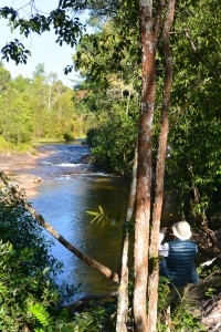
The next morning when we woke the coffee was brewed and the table laid. It was a champagne day. We were in no particular hurry, content to eat fruit, sip coffee and watch and listen to the clear water rushing over the rocks below us.
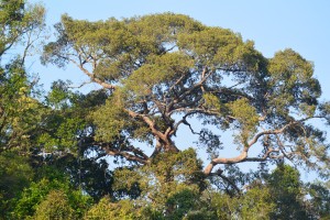 A forest giant
The Langur Trail is a lovely walk, winding its way under a leafy roof many metres above. The Bat Cave marks the beginning of boulder forest, fantastical formations of sandstone the size of houses. One such known as Mushroom Rock afforded views over what appeared as an unbroken wooded valley. Birdsong rang, squirrels barked and insects of every imaginable shape and form fluttered, flew, crouched, quivered and hung but the langurs remained resolutely reclused.
We’d made it back to where we started from, Preah Ang Thom for another cup of muddy Vietnamese coffee and road kill chicken (so named because its flattened to facilitate cooking over the charcoal fire). John went to look at the linga and reclining Buddha with Buntha while I arranged our pick up with Kuong.
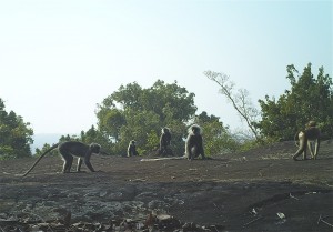 Mushroom Rock in the boulder forest (actually taken by camera trap capturing not only the Silver Langurs but also Pig-tailed Macaque)
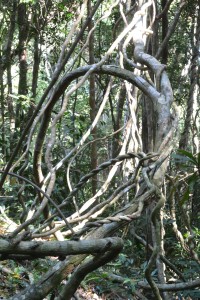 A forest of lianas on the way to Preah Ang Chup
Phnom Kulen was an isolated island until the beginning of this century when the road was built. A set of steep steps up to Preah Ang Chup was the only way up before and now our route on our final leg of the Kulen adventure. The more times I walk the different trails the more identity they assume. One is not like another but it’s beyond my ability to describe the difference. Suffice to say our last 5km was not the same as where we had been before and fuelled our excitement and enthusiasm to the end. Who needs langurs.
Indochine Exploration organises day trips and overnight expeditions (or longer) to experience the forest and its wildlife, including langurs – sometimes. Either on foot or on challenging mountain bike rides.
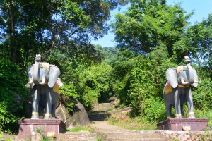 The steps up to Preah Ang Chup, the only entry point to Kulen until early 20th century (compare the current concrete domreys with their Angkorian cousin in the forest)
by Nick | Dec 15, 2020 | Angkor, Blog, Hike
Ngin and Nicola’s Temple Hunting Saturday Morning Adventure
An essential Large Little Red Fox latte while Loklak snapped at a French lady then into Panya’s tuktuk for the ride to Phnom Bok.
Panya had the unnecessary ability to find every pothole on the admittedly disintegrating road to Pradark. At Phnom Bok we were greeted with an after party dance party. A wall of speakers sent a reverberating thud up the mountain as we set off through the forest in search of temples.
It’s hot work chasing temples in the woods so Loklak, who remembered the trail from his walk with Emma, a posh dog – charged off to the lake on the other side and was splashing amongst the lotus leaves by the time we arrived.
 Loklak checking out the temple trail
The road runs along a raised bank beside the lake, which suggests it was an Angkorian reservoir. Half way through April and about as dry as it gets, it had shrunk to a quarter of its rainy season area. Manus suggested kayaking when it is full.
 Manus framed by Phnom Bok and it’s lake
It wasn’t very difficult, there was a sign but Manus was very proud to have seen it and to be fair Buntha and I had passed by many times oblivious to the little temple that lay about fifty meters from the road
We crossed the empty but still green moat to a central mound and three laterite towers with a looted lintel over the doorway.
The temple was built in the 13th century by a Brahmin priest and intriguingly lies at the corner of two Angkorian reservoirs and a sluice to control the water between them.
 Prasat Toh
Apparently the moat wasn’t completely empty. Loklak had found a muddy wallow and ran out the same colour as a wet water buffalo then rolled in the sand and became a fantastical demon from an Angkorian legend.
 Angkorian demon (left) and Oxcart (below)
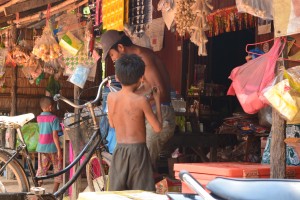
We walked into the village of Phum Samre near Banteay Samre.
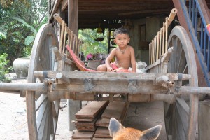
A small boy sat on an oxcart and asked for a hopeful dollar, a sugar palm juice collector had two full pots suspended from a pole over his shoulder and wet jeans so low you could almost see his linga.
 Phum Samre Market
Sticky rice wrapped in banana leaves from the little market and sugar palm juice from the man with the wet jeans, Manus knew him. They’d been in a movie together. I’m waiting for it to make the multiplex in Phnom Penh.
Past the village the houses were bigger, the taller trees and pineapples grew in the filtered sunlight.
Loklak was getting hot and with a loud sigh punctuating his panting collapsed in each thicket of shade we passed.
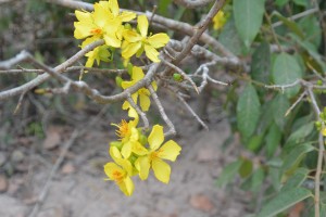 Chinese New Year Flower
We turned left instead of right to look for the temple Mr Heng our taxi driver had told me about. In front of us lay baking brown rice paddy’s on what felt like the hottest day of the year. A welcome relief when we entered the gloom under the tall trees near Wat Pradark and a spooky trail between burial mounds strewn with forlorn streamers.
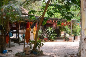 Pradark Pagoda
A boy monk told us where the temple actually was but first the pagoda pool for another Loklak wallow watched by a frog on a lotus leaf.
A lady wrapped in a wet kroma pointed and in the hundred degree heat we came upon the archaeological excavation of Prasat Kamnap, stepped trenches showed the extent of the structure but gave no secrets away such as why was it buried*
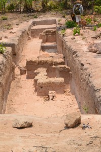 Prasat Kamnap
*I later found out that a dig had unearthed Sanskrit inscribed stele from what had been an Angkorian monastery, once the secrets had been gleaned in accordance with archaeological practise they were reburied.
We stopped at a stall for Loklak to slurp water from Manus’s cupped hands but that didn’t last long so Loklak beyond caring got carted like a sack of rice until we left the hot red earth road.
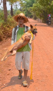
We followed a path under tall sugar palm trees between paddy fields until we came on a woman sluicing herself under a pump. Manus asked if he could sluice Loklak instead and ladled water over the hot dog
 Rehydrating Loklak
Ripping my scalp on a projecting thorn we made it through for Loklak with a last gasp to get to the muddy waters of the shrinking baray where he sat with an expression of ‘no more’ across his face.
 A beer beside the baray
Our final obstacle was a belt of thick vegetation around the West Baray where Panya might be waiting, and our lunch of road kill chicken, rice and most currently appealing cold Cambodia beer.
Something was not quite right? A tough countryside dog gasping his way through a Saturday morning stroll, while the only concern of the admittedly sweat soaked barang was a cold beer. Manus of course was oblivious to the exercise and played games on his phone.
He went to find our lunch while Loklak and I sat amongst the post Khmer New Year debris on the banks of the baray and watched the buffalo bathe. Or at least I did, Loklak had summoned up enough energy to steal a fish head from a small boy then growled when the boy tried to get it back. He ran screaming to his daddy and I looked the other way.
Indochine Exploration would love to take you on a hiking or cycling temple discovery adventure along the paths described in this blog
by Nick | Jun 6, 2019 | Angkor, Bike, Blog, Culture, Hike
HYDROLOGY MADE SEXY
Introduction
Angkor is an amazing place. You cannot fail to be impressed even stunned by the grandeur, detail and scale of the monuments. The true wonder of the Angkorian Empire and what it had achieved only started to dawn on me in the last few years. It was when the findings of the Lidar survey were published that I grasped the extent of what was one of the world’s greatest civilisations.
Lidar in layman terms emits an electromagnetic pulse – a laser that is strapped to a helicopter and fired as it passes over the ground to be surveyed. The reflected light is fed through software that strips away the vegetation to reveal the topography and previously unidentified structures.
The results are phenomenal! Phnom Kulen had a city on top. Angkor Thom was laid out in a grid of roads and canals framing wooden houses and their trapaeng or pools. There were thousands of temples not hundreds, and it was all made possible by the management of water in a climate where at the best of times 6 months of rain is followed by 6 months of drought.
I also began to realise that many of our cycle routes, hiking trails and even kayaking adventures followed these ancient waterways. I’d heard Roland Fletcher give fascinating talks at the Amansara Resort and on the banks of the West Baray. It wasn’t until Damian Evans (also from Sydney University) spoke to the guides I was managing that I knew he could tell us what we needed to understand Angkor.
The Water Connection
Boeung Ta Neue – our Secret Lake where we kayak, was an Angkorian reservoir formed by an extension of the North Wall of the East Baray, a much larger reservoir connected with the Angkorian cities of Ta Prohm and Angkor Thom. Boeung Ta Neue caught the rain run off from the
Kulen Hills to the North, which fed the Baray and in turn the conurbations of Angkor.
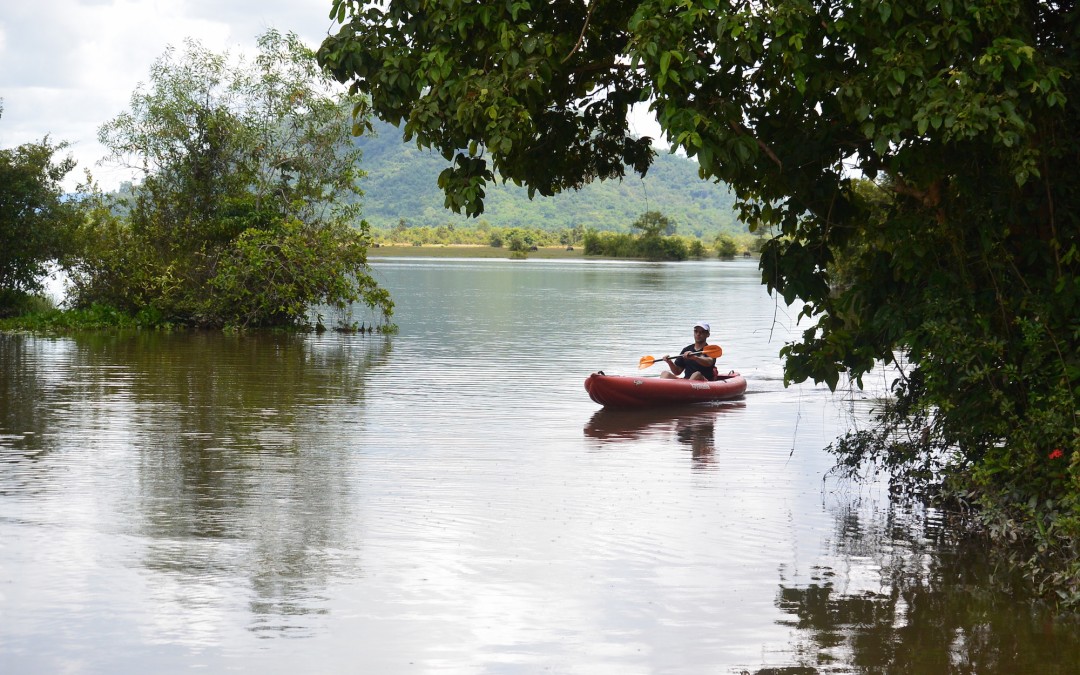
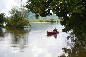 Kayaking on Boeung Ta Neue Angkorian Reservoir (Secret Lake)
Nearby where the Baray finishes and the wall extension starts, is the 7 arched Spean Tor Bridge. Clearly visible by kayak from the water, we managed to reach it through the bush from the red earth road where Damian* had parked.
*Damian Evans archeologist working for Sydney University
We searched on the Baray side of the road for an exit but with none to be seen we couldn’t work out the purpose of the bridge though to be sure a thousand years ago it had one.
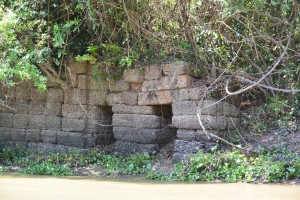 Spean Toh Bridge (named after the nearby temple Prasat Toh
The main water flow into and out of the East Baray was through Kral Romeas, a sluice built into the banks of the East Wall. Cycling and hiking through Phum Samre, the village that lines the walls I’d noticed large laterite blocks and dismissed them as scattered from some Angkorian ruin, which they were. Closer inspection revealed 1 large thick wall and 30 metres away another running parallel forming two sides of the sluice. The raised ground in front of us was a laterite weir. Kral Romeas depending on time of year and water level, acted as an inlet and outlet to the East Baray and may have been connected by another laterite wall running parallel with the East Bank, to Boeung Ta Neue via Spean Toh.
An outlet has also been discovered opposite in the West Bank of the Baray, which fed into the Ta Prohm moat and then onto Angkor Thom. The East Baray at 14 square kilometers, 7km long and 2km wide would have supplied water to the two cities of Ta Prohm, Angkor Thom as well as the houses in between. It would also have been used for irrigation.
Damian explained the scale by comparing the East with the West Baray of similar size containing 50 million litre3 in the West Baray which provided irrigation for 5000 ha of rice, perhaps 10,000 tonnes for each crop. Feeding a population of hundreds of thousands of priests, the aristocracy and merchants who lived in and around these temple cities.
 The West Baray at the end of the rainy season
It was also unlikely that the 3 great water reservoirs of the West, East and North Barays were in simultaneous use but acted as a stabilising backup during times of drought and flood.
The scale of these man made hydraulics are unparalleled in human history and truly mind-boggling. The 3 spatial dimensions have to be combined with a 4th chronological dimension as the kings and climate changed over time. History seems to have been determined as much by the weather as the peaks in the empire. First during the reign of Suryavarman II in the 12th century then under Jayavarman VII in the 13th century, which coincided with the peaks in rainfall we saw from the ancient records on Damian’s computer screen and heralded the construction of the great temples of Angkor.
It is now suggested that the ultimate decline of Angkor was linked to periods of extreme drought followed by floods, which washed away the channels needed to supply water during the dry season. This is most clearly seen at Spean Thmor between Ta Keo and Angkor Thom where the old bridge lies high up the banks of the river now running meters below.
An as yet unexplained mystery is the adjacent 10 x 10 grid of a 100 mounds a few hundred meters from Prasat Toh. Similar grids have been found beside the ‘River of a Thousand Linga’s’ at Kbal Spean and Sambor Prei Kup near Kampong Thom, both associated with major water systems. No artifacts or remains have been found at either site that give any clues as to what the mounds are.
Walking through the site with Damian we spotted fragments of curved roof tiles in a papaya plantation that in an act of unintended vandalism, has been planted right over the mounds.
Most of what is known about Prasat Toh comes from a 4 sided stele (a stone pillar with carved enscriptions) discovered by the French in the 1930’s and now stored in The Angkor Centre for Conservation in Siem Reap. The Sanskrit engravings were translated and available on line. They explained that the stele had been installed by a Brahmin priest during the 13th century and referred to the Great King Jayavarman VII. The inscription mentions the Ganges River in association with water, which may have had something to do with the Kral Romeas sluice and was the same as an inscription found at Phnom Dai temple to the North, the site of another grid of mounds. The temple itself appears to predate the stele and is maybe contemporary with the 10th century East Baray.
 Prasat Toh and its 3 laterite towers situated near the North West corner of the East Baray
Randomly cast on the ground were the now eroded but once richly carved sandstone blocks that had adorned the structure including the stone crown that sat atop the central tower. Interestingly it had a hole in the middle, where a bronze finial in the form of a trident could have been positioned. Possibly removed at certain auspicious times of the year to bathe the Goddess Shiva sitting 15 meters below in sunlight.
Set amongst brilliant green paddy fields on the other side of Beoung Ta Neue is Leak Neang or Hidden Lady Temple. Dated to the 10th century and built at the same time as the spectacular brick temple of Preah Rup. A stele, which may give some clues to its origins has transferred to the Angkor Conservation for translation.
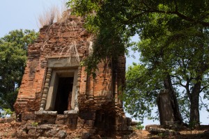 Leak Neang with its single brick tower
The bricks used in the construction of the structure are themselves a mystery as no kiln has ever been found. A theory speculates that the bricks were fired in a dedicated kiln close to the temples made of bricks, which were also used. The apparent black scorching seen on the walls seemed to support this idea.
Not only was this masterly management of water used to supply The Angkorians and irrigate their crops, it also conveyed the enormous amount of stone required to build the temples. Laterite is an iron rich clay that is soft and easy to dress into blocks when it comes out of the ground. On exposure to the sun it becomes very hard but relatively light making it ideal for the foundations but not the decoration as its pock-marked surface is not easily carved. The laterite quarries lay in the hills to the North West. Dams collected water from streams which was released into the Great North Channel that carried the stone blocks South to the North Baray from where they were used in the construction of Angkor.
At the Eastern end of the Kulen escarpment were quarries that supplied the sandstone, which was carved into the marvelous facades of the temples. As part of this network another channel ran from Beng Melea near the Eastern Kulen escarpment, past the Temples of Banteay Ampil and Chau Srey Vibol to Prasat Batchum inside Angkor Park. A path still connects these sites and makes for a great cycle ride.
We were beginning to get a handle on the Eastern end of the water connection, now it was time to explore the West. The Siem Reap River flows South from the Kulen Hills to the city and then onto the Tonle Sap Great Lake but during Angkor it was diverted into the North East corner of the Angkor Thom Moat. History is being repeated as subsequent to the floods of 2011 the channels have been reopened and another dug in parallel on the North side of the moat as the river is diverted into the West Baray with the aim of stopping the floods in Siem Reap. The fact that now the town of Puok to the West floods instead is not part of the discussion – tourists don’t go there.
Angkor Thom the largest of all the Angkorian Cities, was the capitol under Jayavarman VII. its wall’s 3km long enclose 900 hectares or 9 km2. Now forested but once the site of a thriving metropolis of wooden houses and trapeang (pools), surrounded by a grid of canals and roads as the Lidar survey revealed.
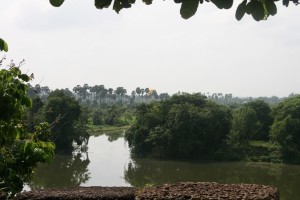 View over the moat from the walls at the S.E corner of Angkor Thom
The data was detailed enough to show the individual houses, which can be extrapolated to give a guessed population of 70,000 based on an assumed family size. This would need a lot of water but during the rainy season any excess flowed out of Boeung Thom reservoir in the South West of Angkor Thom and through Runta Dev a canal that runs under the walls of the city into the moat. We’ve got a stunning cycle route that runs along the 8m high walls of Angkor Thom to Prasat Chrung or corner temple. A great late afternoon spot for watching the sun set over the moat, paddy fields and palm trees beyond. We didn’t realise the engineering marvel that lay 8 meters below us until Damian lead us down the inner banks to a stream that on closer inspection disappeared into a laterite tunnel under the walls and out to the glinting light of the moat 30m away.
The West Baray 500m to the West is yet another mystery. How was this vast body of water replenished and released during times of flood? The current outlet of the Angkor Thom moat is a canal running parallel with the road through the West Gate dug by the French, which destroyed any trace of what was there before. It is possible it was a replacement otherwise how did 50 million litres of water get into The Baray?
 Runta Dev runs under the walls of Angkor Thom
What had we learnt that morning?
We understood that water running off the Kulen Hills to the North fed streams, which flowed into the reservoir of Beoung Ta Neue in turn feeding the East Baray, which was a water supply for the population of Angkor Thom and Ta Prohm.
Damian confirmed that our cycling path to Chau Srei Vibol and on to Banteay Ampil, lay along the route a canal had taken bringing sandstone from the quarries at the Eastern end of the Kulen escarpment via Beng Melea to Angkor.
He explained how the laterite blocks used to build the foundations of the Jayavarman VII temples were carried by water released into the Great North Canal which flowed from the quarries at the Western End of the Kulen Hills to the North Baray and father temple of Preah Khan.
And the Western hydrological connection was made by the Siem Reap River coming from the Western end of Kulen flowing into the Angkor Thom moat and maybe on into the West Baray.
And much else besides!
With great thanks to Damian Evans for a really fascinating morning and apologies for any misinterpretations.
Indochine Exploration with Smiling Albino Cambodia is pleased to take our guests on a introductory investigation of the main temples along the water courses described or an adventure to experience this incredible landscape on foot, by bicycle or kayaking.
by Nick | Dec 10, 2017 | Blog, Conservation, Hike
An Audience with a Northern Buff Cheeked Crested Gibbon
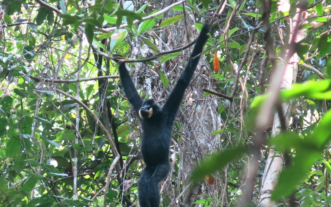
Etiquette is important in the ape world, or are they monkeys? It all depends on how long the arms are – long, so apes like us, which makes us relatives and our meeting a family call.
We invited the Northern …. Lets say NBCCG’s to visit us in Siem Reap and in days gone by when the North of Cambodia was covered in forest, they would have obliged and swung their way across the country, the slight issue of the Mekong River aside. The patches of trees left are barely enough to sustain a soaring stork so we were on our way via said Mekong to The Terres Rouge Lodge in Banlung.
 Male Northern Buff Cheeked Crested Gibbon (NBCCG)
We being Jady & I accompanied by Naven from Conservation International and driven by Dy. He’s nearly one of the family now as he’s courting a Chheang, Sreymom, who excepting me pretty much run ICE. It’s a straight forward seven hour journey heading East towards Vietnam on new roads. The orgy of logging is desperate but that’s Cambodia for you.
We opened the car doors to delicious cool and colonial charm of The Terres Rouge Lodge beside Banlung Lake.
Jammy from Red Parrot tours was waiting at his restaurant The Green Carrot. It might have been the other way round. A true entrepreneur he was advertising the unique selling point of his company, which was apparently a free toilet. He’d made a laminate sheet with an explicit cartoon of a man doing his business under a double decker bus.
 The Terres Rouge Lodge in the old Governors building
There was an adventure to be planned over the red wine and fish oops beer and chicken, a boat up the Sesan River and a trek to a waterfall, an indigenous cemetery then a motorbike ride to the edge of our cousins territory.
The morning light over the lake was a delight as we drank our Khmer coffee and waited for Naven. A smooth red earth road headed North as it descended into the Sesan floodplain and Kchang village where Sresh our boatman and guide for the day’s adventure was waiting for us.
We brushed aside some confusion as to what we were doing, with what and who and boarded Sresh’s narrow wooden long tail. A step up from the usual Sesan river craft as we sat on a dry mat not in the customary half inch of sludge.
Blurred blue hills fringed the horizon as we sped upstream past clumps of stilted houses nestling under shade trees. Ferry’s traversed the river while the inevitable sound of chainsaws reverberated across the water.
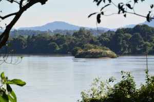 The Sesan River
Our boatman was emerging as Sresh our guide. Clad in not much more than rags hanging off his skinny frame, we found that he’d taught himself rudimentary English when he answered our questions in a gentle toned timbre.
Note; The day’s adventure was an adjunct to our appointment with the cousins as they were busy entertaining Lucky Carrot guests today.
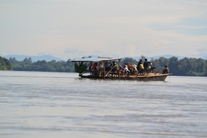 Ferry across The Sesan
Sresh strode ahead in Wellington boots and ripped tracksuit bottoms. Jady and Naven reminisced on the biodiversity workshops they’d attended, while I hobbled behind on a dodgy hip. A cashew nut grove, a cow field then into the open dry deciduous forest with a picture post card view of a village spied through the trees. Bright green paddy fields surrounded thatched roof huts.
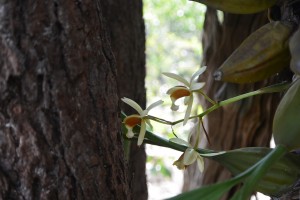
We wound our way up a rocky path and spotted a lump of dried turd. ‘Hmm?’ Said Jady, and ‘take a photo,’ ‘a new species?’ Perhaps a serow we mused. ‘Another photo,’ Jady pointed to an orchid implanted on a tree trunk. Our route descended into a riparian forest of bamboo. Sresh hacked at a stem and fashioned a cup, which he gave to me. I was a little crestfallen when the others got one too.
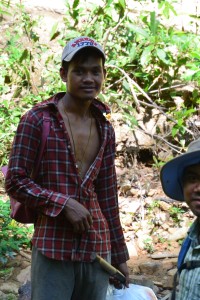 Sresh (below) and an orchid (above)
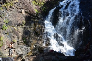
A beautiful walk beside a stream to where a waterfall fell out of the forest a level above. Cascades of spume enshrined the rock face and fell into an oval pool. We needed no invitation to plunge into the cool clear water. Draping ourselves over the warm black rocks, contentedly munching ham and baguettes while staring at the hypnotic diamond droplets of exploding water.
Back on board Sresh’s long tail our next stop was a gloomy tribal graveyard shaded by tall trees. Huts adorned with brightly painted 2D ships for the journey ahead or the one past. A man with shades and woman with boobs stood guard to keep an eye on an electric fan in case it got hot. Empty beer cans, you can get 50 Riel for the aluminum and mummified rice, which lasts forever.
 Koh Peap Waterfall (above) and village cemetery (right)
The English speaking guides (that didn’t) including the handsome Noi were waiting for us at Veunsai to take us to the CI Station. Jady and I would have probably preferred to go back to The Banlung Lodge but we had an appointment to keep so we duly sat aside the beaten up old bikes, dangled our legs as there were no foot rests and squeezed the driver in my case Noi, with my thighs.
An earthmover had cleared the way and bulldozed the trees a year before which meant the road was deeply rutted and bereft of shade but interesting enough. At ITub Village we turned off to cross a marsh leaving us wading through the wetland to rejoin our bikes before the forest. Chamkar or slash and burn agriculture aside the trees became taller and our route easier under the canopy.
A crude wooden bridge crossed the river beside the station and on the other side a fenced compound of tall timbered buildings where we’d stay the night. A pleasant evening with Jady and cold beer, chatting with Noi the handsome (did I say that before) English speaking guide who tried but didn’t. There was a fan in my room until 9 when the generator was turned off but rain had cooled the evening and it felt good to be in the middle of the forest sipping whisky and listening to In The Psychiatrists Chair in the dark.
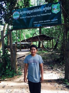 Conservation International Station at Veun Sai Siem Pang
6 hours later I was fumbling in the dark to find my phone and a light. I stumbled to the deserted kitchen shack and managed to light the gas for a cup of tea. Growled at Naven coz no one was awake then hobbled off through the mud in the pitch black following a ranger who seemed unaware I was there.
Note that although priority No 1 was to meet the family we’d also hope that the process of getting there would be up to the Albino standard, it wasn’t.
Grumpy by default at 5am in the morning I blundered on behind. So what if I got lost, well that would be their fault! Jady hung back to make sure I didn’t and as the predawn glow penetrated the trees my mood lifted with the mist.
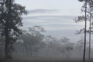 Dawn at the edge of the forest
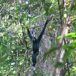
We’d agreed that the NBCCG’s would call leading us to their front door but damp from the night’s rain they were taking longer over their toilet than usual. We set off into the forest anyway in the hope of meeting at a favorite breakfast spot. Pockets of idyll remain and this was one of them. Like a priest in a cathedral our Gibbon conducted the service from his pulpit 10 meters above.
Sarah, a phd researcher and Naven referred to him as JII, which meant he’d built Angkor Wat. We could just make his buff cheeks (this is an objective statement). A little further and the female was spotted followed by 3 juveniles. Our breakfast was waiting on a crude table beside the trees though we’d have killed for a cup of coffee.
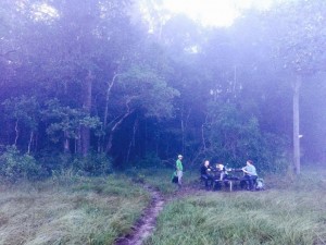 Breakfast at the edge of the forest
I said goodbye to Noi regretting he wasn’t my motorbike driver for the journey our through the swamps to Veunsai. The Sesan Ferry where the ferryman knocked a motorbike into the river and Dy on the other side for the drive to Banlung. One night and a big adventure felt like a lifetime as I hobbled around the spread out streets of the town.