by Nick | Mar 22, 2021 | Bike, Blog
Countryside Exploration Cycle
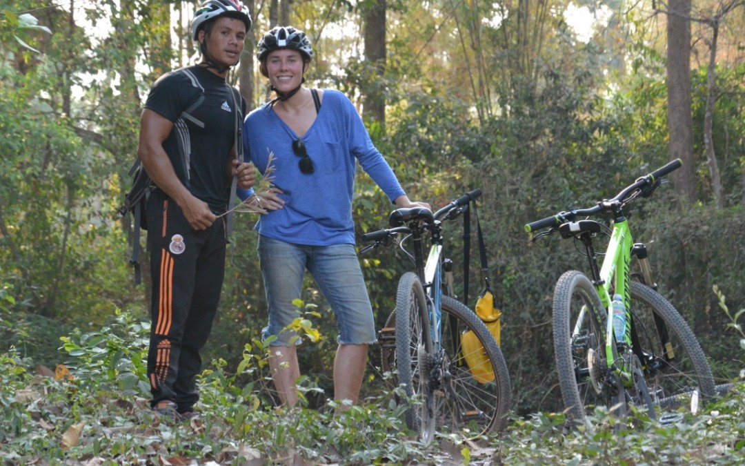
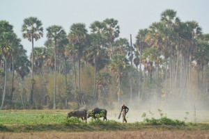
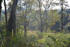
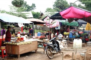
The Siem Reap countryside is changing all the time as the town spreads but its not long before the hard road becomes a track and the houses are raised on stilts.
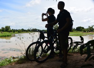
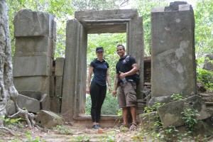
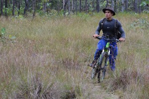
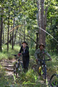
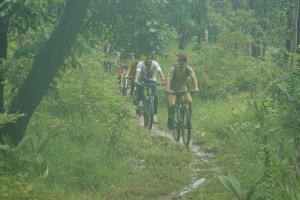
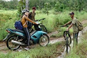
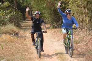 Lors and Taylor cycling one of our mountain bike routes around Siem Reap
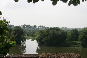
A line of trees shades a canal as it crosses the landscape. Dug to control the flooding lake as it advanced across the countryside then channel the receding water to rice fields surrounding the small villages that dot the floodplain.
 Rural path shaded by beetlenut palm
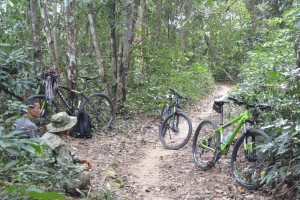
Mountain bikes are the ideal way to explore this varied landscape, cycling along avenues of bamboo through the backyard of farms shaded by beetlenut, sugar and coconut palm.
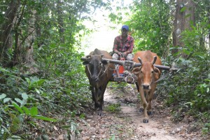
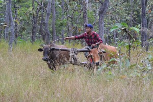
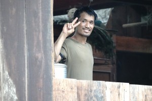
We’ll stop at a smallholding for a coconut, which our more agile guides can climb the palm tree to pick. And meet the family, cows, pigs, chickens, ducks and the farmer to learn a little about how most Khmers live in the countryside.
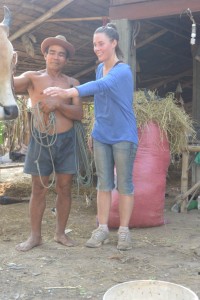
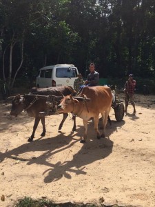
Taylor getting to know a cow & Water-buffalo feeding on paddy field stubble (below)
We’re cycling through the Angkorian metropolis. A millennia ago this land was feeding the armies of Jayavarman VII as he conquered South East Asia.
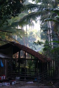
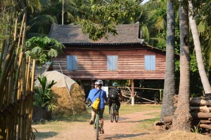 Khmer stilted house
Despite the ravages of time, agriculture, war and weather there are many signs of a sophisticated civilization, none more so than the West Baray. It was the largest completely man made reservoir in the world until the 19th century and that’s where we’re going to finish our countryside exploration cycle.
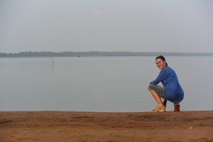
Cold beers and Khmer snacks await as we lean up our bikes and sit beside the water watching fishermen in simple wooden canoes out on the Baray.
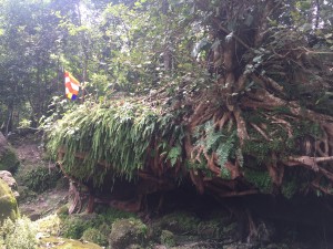
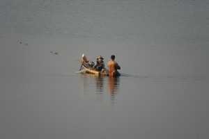 The West Baray
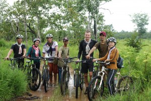
We have many routes, which we vary according to the season and how far and long you want to cycle. We can focus on a rural way of life or search out the secrets of Angkor hidden in the countryside. Morning cycle rides with picnic lunches beside the water or sunset beers / cocktails at the Baray watching the sun sink in the West.
by Nick | Oct 8, 2020 | Angkor, Bike, Blog
Temple Hunting in The Angkor Countryside
The countryside surrounding Angkor is one of paddy fields and sugar palms. Dotted with small villages of traditional wooden houses built on stilts surrounded by fruit trees. Trapaeng or pools, vast ancient baray or reservoirs and the rivers and channels that still connect the ruins of ancient temples shape the landscape. Near Siem Reap it’s flat excepting the isolated Phnom (hill) Bok that serves as a compass to weary cyclists (and incidentally gave Jayavarman V an excuse to build a temple on top).
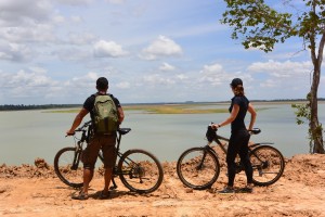
 Lors and Zsuzsa looking out over the dam
Small sandy paths and red earth roads have been usurped by the new Korean ring road that speeds oblivious tourists to Banteay Srei or Citadel of The Woman, North of Angkor. Heads down and legs pumping we ate the Tarmac on our escape from the clutches of tourist town in search of temples.
 Lors showing off on the rickety bridge
It was cheating slightly as a few weeks back we’d recce’d the ruins on dirt bikes with Dave the helicopter pilot who’d plotted them from the air. Our mission today was to find a path between the ruins and the West Baray, where many of our mountain bike rides finish. Google Earth had made it look easy but I made it hard, leading Lors and Zsuzsa along a track that finished in a ploughed rice field. ‘Boss listen to me, I know the way,’ Lors implored. I didn’t so we followed him and found the first landmark we were looking for, a dam across the Siem Reap river.
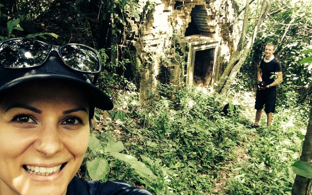
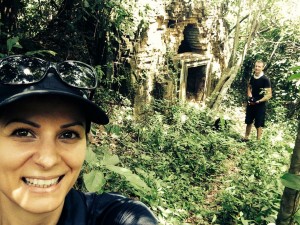 A Zsuzsa selfie with Prasat Sra Laos (and me) in the background
Not really a dam more a muddy earth wall broken by a concrete sluice and a couple of poles that served as a bridge.
A perfect pastoral scene was set in front of us. Farmers tilling their land with buffalo or their mechanical equivalent, kroyun – a sort of hand held tractor. Ladies up to their chest in the small lake formed by the dam gathered lotus flowers until gazing at three barangs cross a rickety bridge became too enticing, especially when one of them, me – fell in.
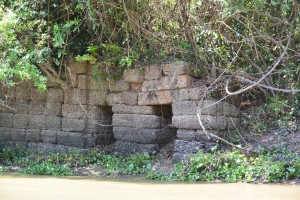
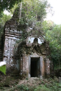
‘It’s just here Boss.’ Unfortunately Lors was right. I was going to have to pass on my Chief Exploration Officer title. An isolated patch of forest lay in front of us. Zsuzsa and I twisted our way through the tangle of vines and thorny branches into a gloomy clearing surrounding the ancient ruins of Prasat Sra Laos. A conical brick tower on top of a sandstone lintel and doorway. I looked inside to see if there were any bats.
Back at the bikes Lors had made friends with a a couple of happy rice farmers who’d given up on ploughing the paddy fields in favour of rice wine. We zigzag’d our way across the countryside on paths between rice fields, through bush and small patches of forest. Picking up sandy tracks all in vaguely the right direction. ‘How do you know the way Lors? This is amazing!’ I exclaimed. ‘I lucky, just find the right route,’ he glibly smiled (he’d checked out the route the day before).
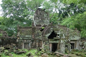
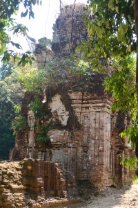
 In front of Prasat Cha, Sanscrit is carved into the inside of the stone doorway
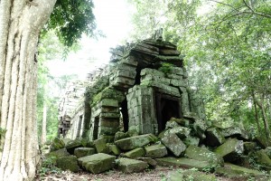
Tall tree’s are valuable, there’s not many left outside the protection of the Angkor Park. Tall trees near ruins though are inhabited by spirits that are best appeased and not pissed off but cutting their home down. Google can show you where the temple should be but it’s the trees that give away where it is.
Prasat Cha was no exception. Unlike Prasat Sra Laos the shade kept the undestory at bay and created an enchanting glade around the artificial mounds on which Prasat Cha was built. The towers are made of brick & laterite, the doorposts (as shown) of sandstone richly ornamented with Sanskrit inscription, which dates back to the 10th century and Jayavarman V. A lot of what we know today about the Angkorian Empire has been learnt from just such carvings, which while mainly describing the temple and who built it give snippets of fascinating information. Or so I’m told – I don’t read Sanskrit, which is just as well as there’s a local story that tells of a five-headed dragon that confronts anyone who reads.
The rest of our way followed well worn paths we knew well, that is that until we reached a new channel cutting us off from the West Baray. We hoisted the bikes on our shoulders and filed across the big muddy ditch to the walls of the Angkorian Reservoir.
 Our last challenge before the Baray.
Eight by two kilometres with no geographical help from a valley or hill, the West Baray was until the 20th century the largest entirely manmade reservoir in the world built a thousand years ago at the beginning of the 11th Century.
Unfortunately The Amansara Food and Beverage Team were not there to meet us with cold towels and iced lemonade, cold beer and lunch boxes. Instead we made do with lukewarm Kulen water
 Looking out over the West Baray.
Nick and Buntha are delighted to take guests exploring the local countryside by mountain bike or hiking. Discovering hidden temples where our cold beers and lunch boxes will be waiting.
by Nick | Mar 19, 2020 | Bike, Blog
A Race to the Middle of Nowhere – The Scramble for Kulen with apologies to Thomas Packenham (The Scramble for Africa*)
We were about a thousand years too late but then it wasn’t for the first time, the Angkorians had been here before. And anyway the British, French, Germans and Italians took it in turns to claim large chunks of Africa*. I reckoned all we needed to do was plant an Indochine Exploration flag on the top of Phnom Srok, Mr Leang said was the tallest hill on Kulen, to guarantee safe rights of passage across Kulen for our Grasshopper guests the following week.
Lors had filled Kuong’s van with enough equipment to rival our pioneering colonial peers on a country conquering expedition. The ‘stuff’ wasn’t the half of what he’d be taking for the guests. We were just using hammocks to swing ourselves to sleep under the stars, though I wasn’t leaving it to chance and had my camping kit of Valium, whisky and ear plugs within easy reach.
 Loading Mr Chou’s oxcart
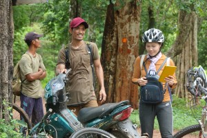
The escarpment up Kulen marks a departure from the dusty plains and chaos of Siem Reap. The forest canopy encloses a calm that penetrated even Kuong’s van. The MoE Station at Preah Ang Thom is where we start our trips and where we emptied the contents of the van onto Mr Chou’s Oxcart, while Phum – our guide for the next 24 hours, rode around the station getting used to the mountain bike we’d brought him.
 Our lunch spot
 The guests arriving
Lors fresh from his muscle contest in Phnom Penh and rippling in lycra, conducted our expedition as we embarked on our mission to cross the empty quarter by way of Porpel Village to Kbal Spean.
We followed a path between chamkar clearings that had been hacked and burnt out of the forest for the cashew nut plantations which, deplete the painstakingly accumulated fertility in a couple of years then wither to a scraggy halt.
We halted where the path went back under the trees and waited for Chou and his cows. Lors had bought a chicken for them. I’d got a squashed breakfast bagel from Little Red Fox. The chamkar finished at an escarpment and so apparently did our way. It was used to get timber out from the forest below but Phum told us that the illegal logging had stopped, incredible! He seemed to be right. It appeared that nobody had been this way for years. There was a path but it was so well disguised that when it changed direction I didn’t and came to an impromptu halt in the bushes*
 Relaxing* on the trail
Chest high grass on the steep slopes gave way to forest as we reached the valley floor. Two years ago the saddest logging was taking out the remaining big trees. Now the vegetation was striking back, linking limbs to lock in the road and block the oxcarts that had born the bloodied corpses of felled trees.
We emerged out of the jungle into a flower-studded meadow bisected by the Kulen River. Our campsite was given away by rusty pilchard tins now hidden by the tall grass, evidence of Alistair’s (my previous business partner) search for Silver Langur Monkeys.
 Arriving at the campsite
It seemed impossible that Phum and Chou would get the oxcart down the escarpment with no apparent path and then through the jungle so we headed back, fully expecting to abort our mission and spend the night in Anlong Thom. We found them a short way back hacking at a fallen tree, while the cows contentedly munched the leaves blocking their path.
 Lors and ….
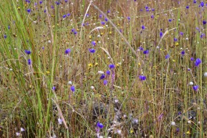 other flowers of the veld
Our mission to cross Kulen was back within our grasp. Chou had a kettle on the boil while Lors and Phum set up the campsite and I drank tea.
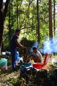 Lors and Phum preparing supper
‘Nick get out of the way,’ warned Lors. Phum was flapping his hammock and stamping on the ground to get rid of black ants. ‘I cant get out of the way! Aaargh’ the little bastards stung, but they weren’t immune to deet.
Only a trickle of water made it down the stream despite the recent rain but the bathing pool remained. I reduced its surface tension by soaping up in the slightly cool water then went back to the campsite to drink beer and watch Lors shirtless cook dinner.
One week on from coming second in The Angkor Body-building Championships, it looked as if he could glide like a flying squirrel with his enormous deltoid muscles. Wielding a large bladed kitchen knife he alternated between slicing onions and swatting mosquitoes on Phum, for some reason remaining immune to their bites.
We were missing Dean but in his stead he’d sent a family sized pack of chicken casserole supposedly just for Lors and I, actually enough to feed all of us for dinner and breakfast. Beer then whisky as Lors and I contentedly chatted about nothing in particular. Mr Chou was wrapped in his hammock betrayed only by his gleaming white smile, 22 and with a baby on the way.
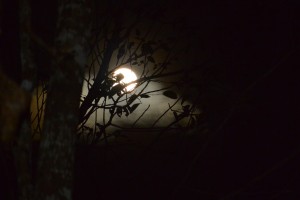
A full moon appeared through the canopy and shined silver on the bark of the trees that seemed to grow taller in the dark.
I lay in my hammock looking up through the branches at the stars, thinking that a simple camp in the forest was worth a million times more than whatever the 5 star Sachaya Resort on Bintan Island had cost where I’d been the week before.
The lingering chill from the night lifted as the sun lit up the leaves around us. Mr Chou and the ox-cart returned to rendezvous with Kuong, while we struck through the wilderness to find a route via the North Escarpment to Kbal Spean, not quite ready for how wild it turned out to be.
Elephant vomit or pig-shit grass life a soft fur covered our way but unlike soft fur it sticks its scratchy seeds to your socks and gets in your shoes. Enchanted glades of dipteropcarp deciduous trees gave way to dark caverns shaded by green and lit with white flowers on the forest floor.
The rocks and ruts were throwing me at every turn sapping confidence such that I pushed the bike as much as rode it.
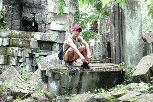
 with Phum on the trail (left)
We met Leang the policeman with Chomran from Porpel village and two rangers with guns though it seemed unlikely they worked. A few months ago they’d arrested two loggers who were in jail and fined five others $1250 each. They were confiscating their chainsaws and fining the owners, which explained why the logging trail was disappearing. Leang had even seen the scratch marks of a bear at Kbal Spean and they reckoned they were still there in the Porpel Community Forest. An old bear had been hunted and killed for its bile. The hunter got $1000 and the middleman $6000 all for some fat ugly bong thom and his libido.
 The North Facing Kulen Escarpment
The North-facing escarpment had been logging central 2 years ago. Oxen and carts congregated with crude cut planks from freshly felled timber, which was stashed at the base of the cliffs and hidden so it couldn’t be spotted from the Wildlife Alliance helicopter that was surveying the mountain. Piled ready to be collected and taken out via the Forestry Administration HQ who extracted their toll and waited for the next batch to extort. Today there were no signs of logging.
Dr Livingstone I presume? Said Stanley, rather more usefully ‘would you like a beer?’ I was asked as we arrived at Kbal Spean. It had only taken 5 hours but as Dave Taylor had said the last time we attempted the route, while lying flat on the grass, ‘this is challenging,’ and technically not a mountain bike ride.
by Nick | Oct 11, 2019 | Bike, Blog, Conservation
A BeTreed Blog or The Adventures of BeTreed
BeTreed by myself in January 2017 (A BeTreed Adventure; https://indochineex.com/blog/a-betreed-adventure),
Then the Phnom Tnaut hike with Buntha and the boys. Hiking in the hills along snake trails and dodging trees while hanging from a zip-line.
And now retracing the forest paths to Preah Khan that we’d cycled with Laura and Ra.
 Manus leading the group on the forest path to Preah Khan
This time with Manus, my partner. I want to see the forest, he said. Buntha and Sreymom, my colleagues and friends – also wanted to come, then Veasna Buntha’s wife and Pov, the van driver, what was he going to do while we were playing in the forest? And finally Mengly the chef, we had to eat so he was welcome.
BeTreed is a lodge that Ben and Sharyn built from fallen timber, where guests can stay (including the fabulous tree-house) to experience the 6000Ha of community forest that Ben is protecting with a few rangers. It’s in the middle of a fast contracting no-where that’s difficult to get to in the dry season and now the rain is here it’s nigh impossible, as we found out.
There’s not much time, said Ben. The waters coming, he added. It all seemed to be going so well. NR6 was clear and Stoung within easy reach of Siem Reap. The new red earth road North had actually been paved most of the way. No rain, no wrong turn through three provinces all the way to the Preah Khan Baray, though we shouldn’t have been at Preah Khan or its Baray.
It was at this point the rain did come. A gentle drizzle at first but before long the clouds were spewing great blobs. We rang Ben but that didn’t help much. I can’t understand what he says face to face but over the phone impossible. Go back to the main road, which main road? The one you were on. That didn’t help. I tried a different tack, which village should we head for? Ben speaks better Khmer that English so I gave the phone to Buntha and we seemed to be on the right road for Ta Bos Village. That’s what I asked!
Ben was waiting in the village with his new pickup truck from the Ministry. We’ve got to go. We threw five of our bikes plus enough food to last a month, which was probably how long we’d be there if it didn’t stop raining, into the back of the truck and set off along the dirt track. Pov was locking up his van and had to run, jump and was caught by Manus and Mengly.
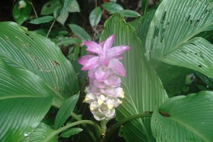 A forest flower
Buntha and I cycled crazy into the rain fuzzed night after the diminishing tail lights scared we’d loose the way.
We thought the car had sunk under the first torrent we crossed just in time to see it emerging on the other side. Energized we followed along the forest track to BeTreed. Drainage ditch planked crossings, rocks and fallen logs we couldn’t see. The trees blanked out what little light there was. Spasmodic bursts of lightening lit up the dark. Where the road turned we carried on into the bush then made a wrong turn. What to do lost in the forest in torrential rain?
Eventually after retracing our route the welcome chaos of BeTreed beckoned and we climbed the steps.
 Veasna and Buntha
Buntha and I made puddles, Pov hovered while Mengly directed Sremom, Veasna and Manus as they sliced and chopped their way through the ingredients of dinner, which was spread out across the table as a vast array of food. I made introductions to Ben, Buntha and Sreymom who work with me, etc. and Manus. The relentless rain just kept pouring. Only 5% chance of precipitation today according to the forecast but more like a hurricane’s hit us, said Ben.
That didn’t help as we made our way up the hill to the tree house along what was now a river. At ten meters high there was a fair chance that the water wouldn’t reach our platform but it was doing its best to get through the roof, which sounded like a kettledrum from exploding water drops and thrashing branches.
We must have slept when the rain stopped and woke to a sodden forest so saturated that many of the branches were broken.
 Sreymom, Manus and Try our guide
The forest was lush, it almost wobbled as we cycled. Mud filled ruts caught our wheels and prevented pushing the pedals. A dripping landscape of infinite biodiversity, Manus and Mengly who were leading the way saw a family of pigs. Sreymom fainted and traded her bicycle for Try, our guide’s motorbike. He followed ready to push her out when she got stuck. Veasna harrumphed and Buntha waited for her.
We left the forest into an illegal chamkar or cashew nut clearing. After Ben and his team cut down the saplings the farmer sprayed it with a sabotage of Roundup in 2017. Despite this it was already sprouting the green precursor to a forest.
Manus the self declared best biker was near the front at least until he got indigestion from eating too much, which coupled with exhaustion from the day meant he was going to die that night.
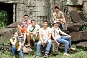
 Left to right; Buntha, Veasna, Pov, Try, Nick, Manus and Sreymom
The hard exercise scarcely dented Try our guide. Also Mengly our chef appeared unfazed. I was tired and aching but kept going.
 Prasat Preah Steung, part of the Preah Khan complex of temples
Finally we reached Ta Siem, the gastronomic capitol of Preah Vihear and had a nice omelet and cold beer in the local restaurant, while a child watched War of the Worlds set against a muddy market.
 Manus soaked in sweat after the ride
We cheated and sent Pov ahead to fetch his van so we could look out over the soaked countryside from the comfort of the aircon vehicle in contrast to a mud clogged mountain bike.
 Ta Siem Village where we had lunch
We regrouped at Ta Bos Village only to be met by a lake on the other side where the day before there had been a river. There was a bridge that Ben had built with most of Ta Bos village but not the owner of the paddy field, which you had to go through to get to it. A push me pull you of gods and demons as good and evil see-saws back and forth. There is no good that cannot be bad and visa versa (see Churning of the Sea of Milk. https://indochineex.com/blog/churning-sea-milk).
The thugs that helped Ben build the bridge later wanted to burn down his house. The paddy field owner thought only about her field and not the rest of the village.
 The ‘road’ from Ta Bos village to BeTreed that we’d driven the night before
That was the easy part. The next flood had no excuse. There hadn’t even been a river the day before. But still we had to wade through, floating our bicycles across then return for the motorbike. Unsurprisingly the engine like everything else was flooded so we sent for Ben and his tool.
After a ‘cup o tea’ and a blissful bath in that empty period before dinner when we should have been supping a cold beer, I asked Ben to tell the story of Ta Bos Village and the Rosewood Tree.
Dense slow growing trees with a rosy tint to the wood and incredibly valuable, there was one big one left. They tried to cut it down with a handsaw but it was too dense so they came back with a chainsaw. Ben found it the next day and placed his rangers around the fallen trunk to catch the loggers when they came back to collect.
A tree so valuable was such big news a timber merchant got to hear of it and offered Ben $100,000 if he could get it legally signed off by the MoE. The provincial governor and minister agreed that Ben could sell the tree and use the money to help the local community.
 Carrying the motorbike across
Back to the gods and demons, the commune chief wanted it for himself so he whipped up the local thugs who surrounded BeTreed and threatened to burn it down with or without Ben’s family inside. Ben called the governor who sent an army of military police with guns, which scared the thugs. They burnt the forest as they left.
Give it to them, said the governor. The commune chief and his thugs got the tree, sold it for a fraction of what it was worth and kept the money. It’s a daily battle that Ben wins while he can pay the police but he’s running out of money, what next?
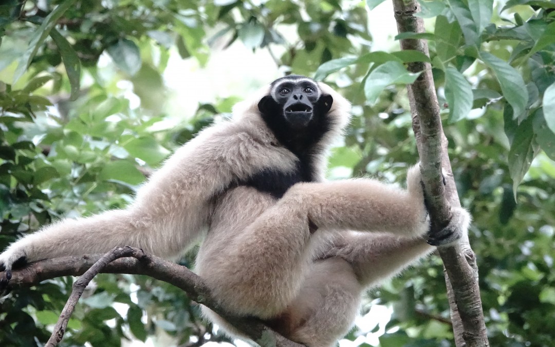
 Molly the Pileated Gibbon
Too much! The table groaned under the weight of food, the team groaned with indigestion and Micky the three legged dog groaned with delight as copious left overs made their way onto the floor.
 Manus the other gibbon
Palming a beer or two Manus and I left for the tree house, ten meters up amidst the forest canopy and now calm in the quiet evening after the crashing rain last night
The calm didn’t last as Manus woke me for the third time with a plaintiff plea for medicine. We traipsed down the hill past a poised pit viper to the lodge to get our first aid kit. Just give him Paracetamol said Ben when we woke him, which meant go away. Combined with Valium and Ibuprofen it was enough to make Manus pass out, snore all night and wake refreshed.
Breakfast was another enormous meal. Don’t eat too much. Can I cycle? No you were dying last night. Ben took those that didn’t want to ride and their bikes in his truck with the idea that he’d drop them off at the high tide’s edge. As fast as it had come up the water had receded so he drove through to the village.
I glowered at any young man who came into eyeshot and felt that no one gave a fuck about anyone else or anything. Like the emaciated dog that got caught under Ben’s truck and now lay in the middle of the road with its brains leaking out. Even Try who’d been my hero the last time I came now won’t work for Ben after he’s taken guests and got a tip.
I swallowed a big lump after Ben had dropped us off in Ta Bos village and said goodbye. The enormity of what he’s trying to achieve for people who don’t care struck home. Uncouth certainly but a hero who dedicates his life for what he believes in; conservation, biodiversity & beauty when the world seems set on greed, destruction and uniformity.
 The Team at the East Entrance to Preah Khan including Mengly (2nd left)
Preah Khan -Kampong Svai (that’s where it is). We got here yesterday but were too tired to take in the temple. JVII’s first, he built it while amassing an army to oust the revolting Cham from Angkor. (read https://indochineex.com/blog/angkor/story-jayavarman-vii-told-temples)
 Inside Preah Khan
Ta Prohm with its twisted tree roots and Beng Melea with its meandering boardwalks, are described as the jungle temples of Angkor but its Preah Khan that really feels like the forgotten forest temple.
A few structures remain relatively intact and there’s been some restoration or shoring up, but most of the complex is littered with carved blocks adorned by butterflies that damp morning.
It seemed too soon that Manus was calling for me to leave as the rest of the team waited by the van.
 The other gibbon inside Preah Khan
And that was the end of the adventure or so we thought but not quite as we still had fifty meters of flooded road to cross, South of Ta Siem, pulled by a kroyun for 15,000R (~$4).
 Just when we thought it was all over – heading South to Stoung
 A flower to finish
Indochine Exploration is pleased to partner with and support BeTreed www.betreed.com with mountain bike and hiking adventures. Please contact us at info@indochineex.com
by Nick | Jun 6, 2019 | Angkor, Bike, Blog, Culture, Hike
HYDROLOGY MADE SEXY
Introduction
Angkor is an amazing place. You cannot fail to be impressed even stunned by the grandeur, detail and scale of the monuments. The true wonder of the Angkorian Empire and what it had achieved only started to dawn on me in the last few years. It was when the findings of the Lidar survey were published that I grasped the extent of what was one of the world’s greatest civilisations.
Lidar in layman terms emits an electromagnetic pulse – a laser that is strapped to a helicopter and fired as it passes over the ground to be surveyed. The reflected light is fed through software that strips away the vegetation to reveal the topography and previously unidentified structures.
The results are phenomenal! Phnom Kulen had a city on top. Angkor Thom was laid out in a grid of roads and canals framing wooden houses and their trapaeng or pools. There were thousands of temples not hundreds, and it was all made possible by the management of water in a climate where at the best of times 6 months of rain is followed by 6 months of drought.
I also began to realise that many of our cycle routes, hiking trails and even kayaking adventures followed these ancient waterways. I’d heard Roland Fletcher give fascinating talks at the Amansara Resort and on the banks of the West Baray. It wasn’t until Damian Evans (also from Sydney University) spoke to the guides I was managing that I knew he could tell us what we needed to understand Angkor.
The Water Connection
Boeung Ta Neue – our Secret Lake where we kayak, was an Angkorian reservoir formed by an extension of the North Wall of the East Baray, a much larger reservoir connected with the Angkorian cities of Ta Prohm and Angkor Thom. Boeung Ta Neue caught the rain run off from the
Kulen Hills to the North, which fed the Baray and in turn the conurbations of Angkor.
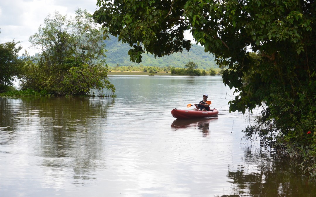
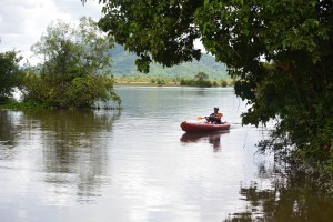 Kayaking on Boeung Ta Neue Angkorian Reservoir (Secret Lake)
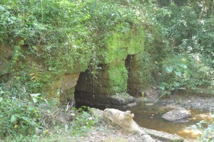
Nearby where the Baray finishes and the wall extension starts, is the 7 arched Spean Tor Bridge. Clearly visible by kayak from the water, we managed to reach it through the bush from the red earth road where Damian* had parked.
*Damian Evans archeologist working for Sydney University
We searched on the Baray side of the road for an exit but with none to be seen we couldn’t work out the purpose of the bridge though to be sure a thousand years ago it had one.
 Spean Toh Bridge (named after the nearby temple Prasat Toh
The main water flow into and out of the East Baray was through Kral Romeas, a sluice built into the banks of the East Wall. Cycling and hiking through Phum Samre, the village that lines the walls I’d noticed large laterite blocks and dismissed them as scattered from some Angkorian ruin, which they were. Closer inspection revealed 1 large thick wall and 30 metres away another running parallel forming two sides of the sluice. The raised ground in front of us was a laterite weir. Kral Romeas depending on time of year and water level, acted as an inlet and outlet to the East Baray and may have been connected by another laterite wall running parallel with the East Bank, to Boeung Ta Neue via Spean Toh.
An outlet has also been discovered opposite in the West Bank of the Baray, which fed into the Ta Prohm moat and then onto Angkor Thom. The East Baray at 14 square kilometers, 7km long and 2km wide would have supplied water to the two cities of Ta Prohm, Angkor Thom as well as the houses in between. It would also have been used for irrigation.
Damian explained the scale by comparing the East with the West Baray of similar size containing 50 million litre3 in the West Baray which provided irrigation for 5000 ha of rice, perhaps 10,000 tonnes for each crop. Feeding a population of hundreds of thousands of priests, the aristocracy and merchants who lived in and around these temple cities.
 The West Baray at the end of the rainy season
It was also unlikely that the 3 great water reservoirs of the West, East and North Barays were in simultaneous use but acted as a stabilising backup during times of drought and flood.
The scale of these man made hydraulics are unparalleled in human history and truly mind-boggling. The 3 spatial dimensions have to be combined with a 4th chronological dimension as the kings and climate changed over time. History seems to have been determined as much by the weather as the peaks in the empire. First during the reign of Suryavarman II in the 12th century then under Jayavarman VII in the 13th century, which coincided with the peaks in rainfall we saw from the ancient records on Damian’s computer screen and heralded the construction of the great temples of Angkor.
It is now suggested that the ultimate decline of Angkor was linked to periods of extreme drought followed by floods, which washed away the channels needed to supply water during the dry season. This is most clearly seen at Spean Thmor between Ta Keo and Angkor Thom where the old bridge lies high up the banks of the river now running meters below.
An as yet unexplained mystery is the adjacent 10 x 10 grid of a 100 mounds a few hundred meters from Prasat Toh. Similar grids have been found beside the ‘River of a Thousand Linga’s’ at Kbal Spean and Sambor Prei Kup near Kampong Thom, both associated with major water systems. No artifacts or remains have been found at either site that give any clues as to what the mounds are.
Walking through the site with Damian we spotted fragments of curved roof tiles in a papaya plantation that in an act of unintended vandalism, has been planted right over the mounds.
Most of what is known about Prasat Toh comes from a 4 sided stele (a stone pillar with carved enscriptions) discovered by the French in the 1930’s and now stored in The Angkor Centre for Conservation in Siem Reap. The Sanskrit engravings were translated and available on line. They explained that the stele had been installed by a Brahmin priest during the 13th century and referred to the Great King Jayavarman VII. The inscription mentions the Ganges River in association with water, which may have had something to do with the Kral Romeas sluice and was the same as an inscription found at Phnom Dai temple to the North, the site of another grid of mounds. The temple itself appears to predate the stele and is maybe contemporary with the 10th century East Baray.
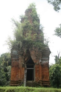
 Prasat Toh and its 3 laterite towers situated near the North West corner of the East Baray
Randomly cast on the ground were the now eroded but once richly carved sandstone blocks that had adorned the structure including the stone crown that sat atop the central tower. Interestingly it had a hole in the middle, where a bronze finial in the form of a trident could have been positioned. Possibly removed at certain auspicious times of the year to bathe the Goddess Shiva sitting 15 meters below in sunlight.
Set amongst brilliant green paddy fields on the other side of Beoung Ta Neue is Leak Neang or Hidden Lady Temple. Dated to the 10th century and built at the same time as the spectacular brick temple of Preah Rup. A stele, which may give some clues to its origins has transferred to the Angkor Conservation for translation.
 Leak Neang with its single brick tower
The bricks used in the construction of the structure are themselves a mystery as no kiln has ever been found. A theory speculates that the bricks were fired in a dedicated kiln close to the temples made of bricks, which were also used. The apparent black scorching seen on the walls seemed to support this idea.
Not only was this masterly management of water used to supply The Angkorians and irrigate their crops, it also conveyed the enormous amount of stone required to build the temples. Laterite is an iron rich clay that is soft and easy to dress into blocks when it comes out of the ground. On exposure to the sun it becomes very hard but relatively light making it ideal for the foundations but not the decoration as its pock-marked surface is not easily carved. The laterite quarries lay in the hills to the North West. Dams collected water from streams which was released into the Great North Channel that carried the stone blocks South to the North Baray from where they were used in the construction of Angkor.
At the Eastern end of the Kulen escarpment were quarries that supplied the sandstone, which was carved into the marvelous facades of the temples. As part of this network another channel ran from Beng Melea near the Eastern Kulen escarpment, past the Temples of Banteay Ampil and Chau Srey Vibol to Prasat Batchum inside Angkor Park. A path still connects these sites and makes for a great cycle ride.
We were beginning to get a handle on the Eastern end of the water connection, now it was time to explore the West. The Siem Reap River flows South from the Kulen Hills to the city and then onto the Tonle Sap Great Lake but during Angkor it was diverted into the North East corner of the Angkor Thom Moat. History is being repeated as subsequent to the floods of 2011 the channels have been reopened and another dug in parallel on the North side of the moat as the river is diverted into the West Baray with the aim of stopping the floods in Siem Reap. The fact that now the town of Puok to the West floods instead is not part of the discussion – tourists don’t go there.
Angkor Thom the largest of all the Angkorian Cities, was the capitol under Jayavarman VII. its wall’s 3km long enclose 900 hectares or 9 km2. Now forested but once the site of a thriving metropolis of wooden houses and trapeang (pools), surrounded by a grid of canals and roads as the Lidar survey revealed.
 View over the moat from the walls at the S.E corner of Angkor Thom
The data was detailed enough to show the individual houses, which can be extrapolated to give a guessed population of 70,000 based on an assumed family size. This would need a lot of water but during the rainy season any excess flowed out of Boeung Thom reservoir in the South West of Angkor Thom and through Runta Dev a canal that runs under the walls of the city into the moat. We’ve got a stunning cycle route that runs along the 8m high walls of Angkor Thom to Prasat Chrung or corner temple. A great late afternoon spot for watching the sun set over the moat, paddy fields and palm trees beyond. We didn’t realise the engineering marvel that lay 8 meters below us until Damian lead us down the inner banks to a stream that on closer inspection disappeared into a laterite tunnel under the walls and out to the glinting light of the moat 30m away.
The West Baray 500m to the West is yet another mystery. How was this vast body of water replenished and released during times of flood? The current outlet of the Angkor Thom moat is a canal running parallel with the road through the West Gate dug by the French, which destroyed any trace of what was there before. It is possible it was a replacement otherwise how did 50 million litres of water get into The Baray?
 Runta Dev runs under the walls of Angkor Thom
What had we learnt that morning?
We understood that water running off the Kulen Hills to the North fed streams, which flowed into the reservoir of Beoung Ta Neue in turn feeding the East Baray, which was a water supply for the population of Angkor Thom and Ta Prohm.
Damian confirmed that our cycling path to Chau Srei Vibol and on to Banteay Ampil, lay along the route a canal had taken bringing sandstone from the quarries at the Eastern end of the Kulen escarpment via Beng Melea to Angkor.
He explained how the laterite blocks used to build the foundations of the Jayavarman VII temples were carried by water released into the Great North Canal which flowed from the quarries at the Western End of the Kulen Hills to the North Baray and father temple of Preah Khan.
And the Western hydrological connection was made by the Siem Reap River coming from the Western end of Kulen flowing into the Angkor Thom moat and maybe on into the West Baray.
And much else besides!
With great thanks to Damian Evans for a really fascinating morning and apologies for any misinterpretations.
Indochine Exploration with Smiling Albino Cambodia is pleased to take our guests on a introductory investigation of the main temples along the water courses described or an adventure to experience this incredible landscape on foot, by bicycle or kayaking.
by Nick | Feb 26, 2018 | Bike, Blog
A Kulen Mountain Bike Temple Odyssey
Phnom Kulen lit Kulen Mountain or Mountain of The Lychees is our mountain bike playground, bisected by the Kulen super highway (in fact a red earth road), which climbs the mountain at the Western end. Runs to the central tourist village of Preah Ang Thom and continues to the Eastern escarpment above the town of Svay Leu. It’s crisscrossed by routes across the rocky plateau, forest paths shaded by canopy 10 meters above, sandy tracks that turn instantly to mud whenever it rains and dry trails through the cashew nut plantations.
The plateau was isolated until the end of last century. Floating 500 meters above the Siem Reap plains and still harboring remnants of Khmer Rouge in what must have been thick forest across the 40,000 hectares of hills.
And you’ve got JII (Jayavarman II) and his God delusion that lead to the whole Angkorian business, which inevitably meant a lot of temples that over the centuries got overtaken by jungle.
We follow the main road from Siem Reap to Banteay Srei Temple past the palm sugar sellers who line the way. I admire their optimism of demand for palm sugar. We climb the escarpment and enter a cool green filtered light as trees close branches above the red earth road and shut out the dusty badlands we’ve left behind.
It all started 1200 years ago in the river, where JII crowned himself emperor of the world, as they knew it then. To mark the spot he left a ..
 …Thousand Lingas
Symbolic phallic symbols carved into the riverbed to ensure the fertility of his reign – and lots of fish. And this being a good Hindu empire the images of Shiva and Vishnu can be made out beneath the glassy waters. A new bridge spans the Kulen River, its easy to miss this magical link to the past – unless you know its there.
A little further and we arrive at a causeway leading up a hill to the Reclining Buddha. A skyscraper size boulder fashioned into an enormous Buddha. A Khmer pilgrimage site where merit is obtained by stuffing 100 riel notes into every stone orifice.
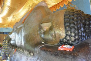 The reclining Buddha at Preah Ang Thom
The Ministry of Environment Station is the start for our adventures accompanied by a wired together moto that mechanically shouldn’t work anymore. Mr Pum or whichever ranger is with us for the day has precariously strapped our cool box to his seat and we set off in search of adventure.
The Silver Langur forest butts up to the village. This is where these rare monkeys thought to be gone were rediscovered in 2013. The biggest trees on the mountain still penetrate the canopy, sometimes supporting chicken wing beehives hanging from the top most branches.
Squirrels bark and occasionally when the Kulen fruit are falling from the trees we spot a Silver Langur. Always spiders, great black and yellow shelobs spin their webs across our paths waiting to catch a tourist.
I feel for the precarious existence of the little red males clinging to the furthermost silken threads of the web.
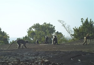
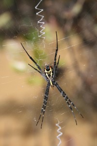
Silver Langur on Mushroom Rock and Golden Orb Spider
We have trails that climb up to Chomran’s hole, nothing personal just an unusual rock formation containing a Buddhist shrine that Chomran climbs into. And descend through a bat-cave to the Kulen River, where we have lunch.
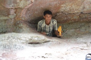
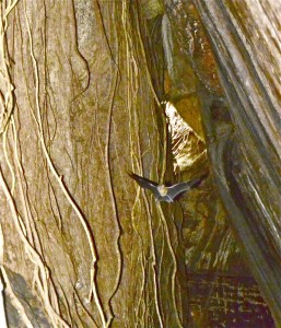
Chomran & his hole and the Bat-cave with a tomb bat
Today we’re slip-sliding through sand on route for Porpel Village and on to Phum Kla Kmum Village for our first temple. It’s a head over handle bar rutted oxcart trail that sort of dwindles to where we walk.
 Soma-sutra at Prasat Krahom & Lors and his linga
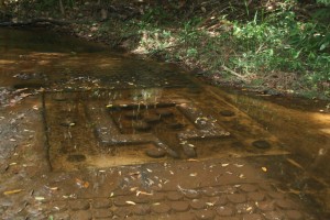
So we leave our bikes and clamber over rocks to a platform above the forest and Prasat Krahom (lit. red temple). There’s a decorated spout or soma-sutra on the outside while inside the temple water falling onto the linga is caught in a yoni (the female part) and fed through the brick walls via the soma-sutra to be collected as holy water fit for a fertility or two.
Today we’re trying out a new trail across the cashew nut plantations to Sangke Leak Village.
Mountain biking on Kulen involves thinking about where your going to cycle and what gear you should be in before you need to change but don’t think too hard or you’ll end in a rut and on your ass. Then there’s the sand, ‘look to the horizon, pedal hard and head straight’. Or shout out expletives, “—-ing sand!” As our guests have been known to do.
 Enjoying the scenery after a disagreement with the track
Kulen is carved into mounds – that you need to cycle up and down and a myriad of small streams that you need to cross. The gradient and terrain are the perfect habitat for a mountain bike.
Cambodia was once a big forest and it wasn’t long ago. The majority of forest has gone but the traditional chamkar or slash and burn agriculture remains. A few villagers across thousands of hectares clearing and burning a couple of hectares for small paddy fields was sustainable. Wholesale logging for cashew nut plantations forcing those villages to cut down what’s left is not but lets not spoil a good story.
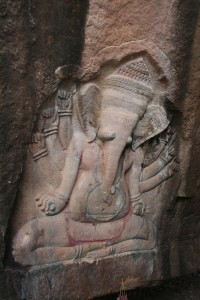 Ganesha @ Perng Komnou
There are not many routes out of or for that matter onto Kulen. Scrambling through the burnt logs and small banana plantations down the steep slopes above Svai Leu Town at the Eastern end of the plateau was one not very good option that has now unfortunately got easier. A logging magnate is dynamiting a road up the mountain for an unknown reason. There’s not enough forest left for the obvious. Nearby are the petroglyphs of Perng Komnou (lit. rock shelter). 9th century engravings of Hindu deities like the Ganesha above chiseled into car sized boulders littered around the base of the hill. The excitement of stumbling across these archeological phenomena is one of the reasons I stay in Cambodia.
Today we turned right and avoided the ominous portent of what the road might bring. Phum Ta Pin, Pum Thma Chruon and Anlong Thom, sandy rutted roads between cashew clearings and through small patches of forest. Not great distances, not great roads and ever changing landscapes equal exciting riding.
Smoky mountain villages with towering coconut palms framing stilted wooden houses, chocolate and tan coated pigs plowing their snouts through the mud and litter. And chickens running for their lives as we ride into the village hungry!
 Anlong Thom in the center of Kulen
Anlong Thom feels like the spiritual center of Kulen surrounded by remnants of its lost kingdom, temples that lie not far from the village.
Sweaty, disheveled but bright with the excitement of the ride we moor our bikes in the shade of coconut palms beside the local blacksmith. The cool box is unstrapped from the remains of the moto. Cold beer is served.
We wait while the lady catches one of those unfortunate chickens or a fish from the stream that runs at the bottom of the village and lunch is served.
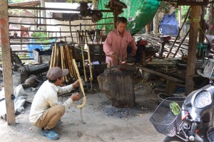 The local blacksmith
The big wooden houses tell of a time when the forest canopy was raised by massive trees providing abundant timber. Lifting your room above the ground stops the rats that eat the insects and the snakes that eat them. Motorbikes, cows and timber are secure in the space underneath. Fires were lit to provide a rudimentary if risky heating system when the world was a little cooler.
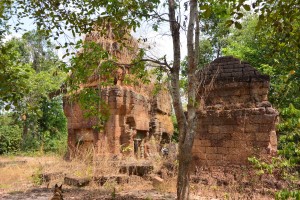
We head out through the cashew that surrounds the village to the islands of forest (protected by Apsara the temple authority) hiding the ruins we’re searching for. Ok we’ve done it before but today we’re connecting a loop across the mountain. The first stop is the single brick tower of Prasat Thma Dap (below).
We cross the dam of what the 2013 Lidar survey revealed to be an Angkorian reservoir. Lidar is a laser strapped to a helicopter that records the topography of the terrain. Data fed through a supporting app strips away the vegetation to show the underlying structures of what was a conurbation 1200 years ago. No new Angkor Wat as the press stated at the time but just as astonishing.
Next are the three brick towers of Prasat Domrey Krab, lit. Temple of the kneeling elephant (left), and a short walk away Perng O Eisei (below).
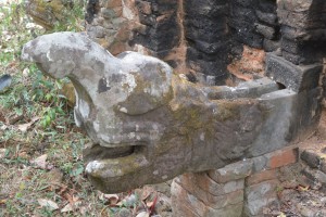
A mysterious and shady hollow, once the home of a hermit, a small spring forms a clear pool with a rock fashioned into a turtle. A stone doorway carved into a boulder is flanked on either side by an Apsara or celestial being.
There’s the sense that the king might not be far away.
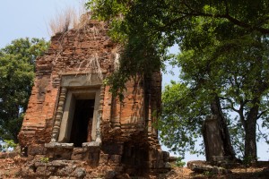
The 10m high brick tower of Prasat O Pong (above) and the pyramid temple of Rorng Chen are not far away. The latter sits on top of a small hill or is a small hill. We could make out the blocks of laterite that form its base but not much else. This was where JII hung out i.e. his palace.
The temples are not far apart but it’s easy to get lost hence the accompanying decrepit moto though of course its main function is to bring cold beer.
Perng Tbal is a first. Tbal means pestle and Perng carving. We didn’t see any carved pestles but a lot gets lost in translation.
A gully between great slabs of stone, not sinister but not explained, a space in a time of its own.
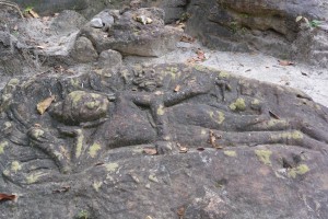 Reclining Vishnu @ Perng Tbal
Another turn in the forest will take you to the kitch Wat Preah Kral. A working pagoda where the wealthy buy their way to heaven via silver and gold stupas perched across the bare rock face. I reclined in Buddha’s chair to view Phnom Bok and on a clear day the Tonle Sap Lake. I sat on his carpet and looked at these strange rock formations. Today we carried on to The Srah Domrey, the most wonderful element of Kulen.
I can remember the hairs on the back of my neck electrified as I first caught sight of this two-thirds life size statue. In those ancient days eleven years ago when I first came to Cambodia there were few visitors to this exceptional place, relative to the swarming hoards that descend on Angkor, there’s not many that make it here now.
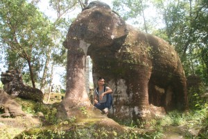
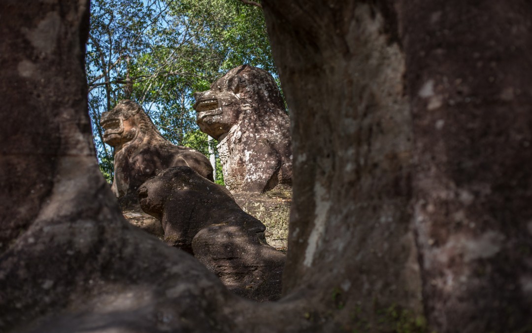
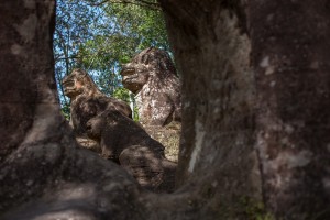 The Sra Domrey above and 3 stone lions seen through its legs.
The story finishes 10 kilometers away at Preah Ang Thom where it started. The mixed evergreen forest around the magical elephant gives way to dry dipteropcarp trees growing out of the rock. The cycle past the village of Phum Thmei and over the bridge across the delightful Kulen mountain stream, where we once swam in its cool pools. Then we’re back in Preah Ang Thom and the hiss of a cold can of beer as I pull the tab. A fitting end to another Kulen adventure.