by Nick | Jan 29, 2020 | Angkor, Uncategorized
The Dry Season Temple Hunting Jeep Safari
We travel in reverse chronological order starting with 2 temples from the Bayon period.
The Buddhist king Jayavarman VII (or JVII for short) crammed into his thirty year rule the largest building program ever undertaken during the Angkorian era. At the center of his empire was the city of Angkor Thom and his state temple the Bayon.
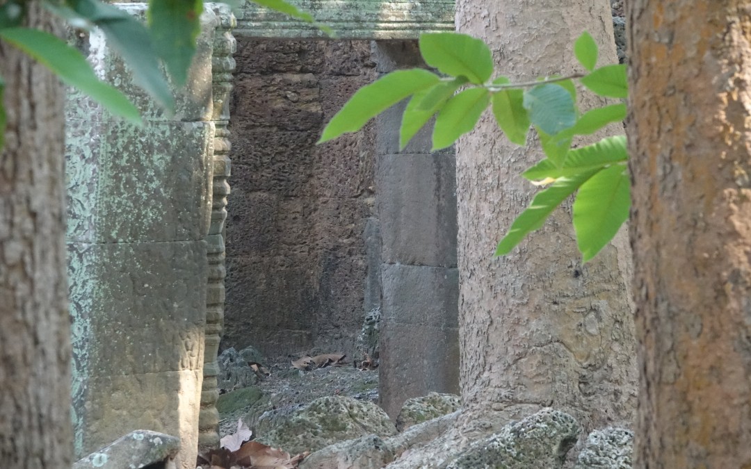
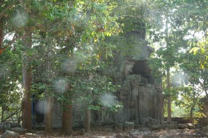
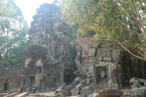
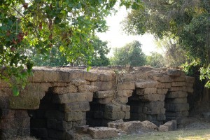
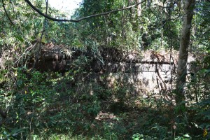
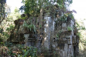
Not far from the North Gate of Angkor Thom, off a red earth road and down a sandy track is Prasat Chan Ta Oun, once upon a time a Buddhist monastery.
 The central tower of Chan Ta Oun
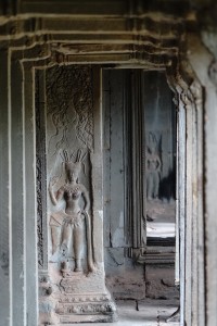
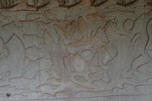
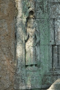 A divine figure from Buddhist mythology
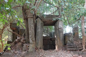
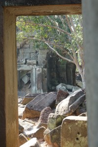 looking into the inner enclosure of Banteay Thom
Banteay Thom also close to Angkor Thom* is built on a larger scale and harder to find, which is part of it’s charm.
*Thom being the Khmer word for big and Prasat means temple
There are two laterite walls with a moat in between and an entrance from the East. The inner enclosure is surrounded by galleries that can still be entered but not recommended for arachnophobes.
 The central towers of Banteay Thom
The three central towers that have been dug out for treasure are looked on by carvings of Buddha in his Bodhisvatta state of enlightenment.
 Phum Char (or Char Village)
Small roads through stilted villages in countryside not much changed since the temples we visit were built. We’ll stop on our way to have a wander through and learn a little about what life is life in rural Cambodia.
We head back in time 200 years and along a red earth road to find Prasat Char (lit. temple of the palm tree) commissioned by Jayavarman V. There are clues as to its construction from the Sanskrit engravings in the stone doorframe.
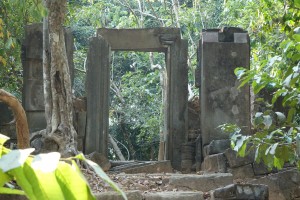 Prasat Char
An uncertain fate is said to befall the translator as a five-headed dragon awaits those who understand the meaning of these runes.
Another 200 years back in time and we’re swapping the Angkorians for the preceding Chenla period when the Hindu brick temple of Prasat Kok Po was first built. ‘The Island Temple’ appears just that, set on a rise and surrounded by a rainy season moat.
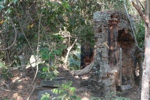 Prasat Kok Po
Restored by JIII in the 9th century as detailed in further Sanskrit engravings but this time with no dragons involved.
Spean Memay or Bridge of the mirror now crosses a dry field but once it lead from the North West corner of the close by West Baray, and headed to the Western borders of the Empire in Thailand.
 Spean Memay
The bridge 79 meters in length and made up of 29 arches built in the 12th century survived Typhoon Ketsana, which washed away many modern bridges in 2009.
From Spean Memay we drive up onto the banks of The 11th century West Baray, which at 8km long and 2km wide was until the industrial revolution the world’s largest entirely man made reservoir.
 The West Baray
A permanent body of water that is still used to irrigate the rice fields to the South and Siem Reap’s beach resort. The traditional Sunday pass time for the family is to lie on a bamboo platform overlooking the water, drinking beer and gnawing BBQ’d chicken.
We’ll finish our temple hunting with a picnic lunch or a cold beer looking out across the water to the forests of Angkor behind.
by Nick | Aug 16, 2019 | Angkor, Blog
The Churning of The Sea of Milk
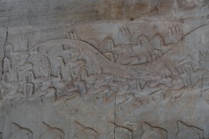
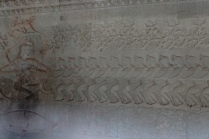
The bas-reliefs on the walls of Angkor Wat are perhaps the pinnacle of Khmer Art. The carvings 2 meters high, stretch for a staggering 600 meters around the temple and depict scenes from the great Hindu stories, including the phantasmagorical if fundamental Churning of The Sea of Milk, which goes something like this;
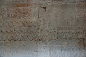
 The outer corridor alongside the Churning of the Sea of Milk
The Gods and Demons decided they had had enough fighting and it was looking like they were going to destroy the world so they went to Vishnu for advice.
Vishnu suggested they put all the medicine they could lay their hands on into the Sea of Milk to create the elixir of life that would bestow indestructibility amongst many other amazing things to whoever drank it, then have a big tug of war to see which lucky team got the joy juice.
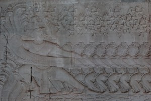 Ravana an Assura (demon) with the head of Vasuki (snake king)
The recipe for Amrita as the elixir of life is known, goes something like this; take one ocean and churn thoroughly with a celestial blender until the ocean thickens, a thousand years is suggested. A good test of when you’re getting close is buxom Apsara or nymphs will start to evaporate from the seminal waters.
But what could they use for a blender. A rope that hundreds maybe thousands of hunky Demons and Gods could tug on and something to tug round was needed. The serpent that lived at the bottom of the ocean of course, actually he was Vasuki king of the snakes and Mount Mandara.
 Buxom nymphs or Apsara arising out of the seminal fluid in anticipation of amrita
The Demons got the head* and the Gods the tail and they tugged for a thousand celestial years (which is a very long time), round the mountain in the middle of the ocean.
*Read on to find out why Vishnu tricky as ever and it has to be said a little biased in favor of the Gods had advised them to take the tail end and leave the head to the demons.
They tugged so hard that the mountain sank. Vishnu in his second reincarnation (there were ten in total) came to the rescue as a convenient and rather large tortoise lifting up the mountain on his back.
 Vishnu sitting on his avatar (reincarnation) the Turtle encouraging the tugging Divas (Gods)
Meanwhile Vasuki, the king of snakes was getting pretty fed up of being tugged by hunky Gods and Demons for a thousand celestial years. Exhausted he sprayed the Demons (since they’d got the head) with halahala that was definitely not going to bring joy to the juice, there was also the small matter of destroying creation.
Shiva to the rescue, he sucked up the halahala thus saving creation and the rather wingy Gods but in the process got a sore throat and turned blue. His wife Parvati was so alarmed that she used Shiva’s chariot to dig a lake, which cooled his throat.
Anyway that’s about the end of the story. It seems in the end everyone was happy and there was enough joy juice to go round. The Gods got lots of divine nymphs while the demons got the grumpy goddess Varuni, who had a bit too much halahala. Vishnu got a new wife Lakshmi and Shiva, now recovered got a moon to wear on his head.
 All the creatures of the ocean getting churned in the Sea of Milk
Another ending to these celestial shenanigans was that as the thousand years stated in the recipe were up and the ocean turned into the elixir of life. There was much singing and dancing. Apsaras flew up from the waters and white elephants trumpeting the occasion also had a go at flying.
The Gods, Demons and cosmic blender, Vasuki had done their job turning the ocean into joy juice now born in an urn by a heavenly physician. Quick as flash the demons grabbed the urn from the Doctor’s arms and were about to drink when the most beautiful girl in the world appeared.
 Hanuman, the monkey god making sure the Divas keep tugging
Will you give me anything I want? She pouted her lips and thrust out her bosom, anything, anything, they cried. Will you give me your joy juice? We will we will, they sighed exhausted. Snatching the moment the beautiful girl, actually Vishnu, gathered up the elixir of life and scarpered over to the Gods, who rubbed whatever Gods rub in anticipation of their impending transformation. They were already Gods so I’m not sure what they were getting transformed into but they were very happy.
This ‘story’ doesn’t end there because the Demon Rahu, who knew what a tricky character Vishnu was, that is if you were a demon. Had managed to get a quick slurp of the amrita but not before he’d been spotted by the sun and moon who told Vishnu what he was doing. Vishnu now back in his chiseled form cast his discus to cut off Rahu’s head. Rahu had managed to get in a quick sip but hadn’t swallowed yet so while his head was impervious to the oiled God’s manly manipulation of his orb, Rahu’s body died.
Not one to forget a grudge Rahu or his head had it in for the Sun and Moon and plunged the world into darkness but his bark was worse than his bite so the Sun and Moon laughed at him and moved out of eclipse.
by Nick | Aug 6, 2019 | Angkor, Blog, Kayak
Background
The rise and fall of the Angkorian Empire, which lasted nearly 600 years from the 9thto the 14th century, was centered in what is now Siem Reap Province, around its greatest religious monument Angkor Wat. The metropolis of Angkor comprising nearly a million people covered a thousand square kilometers servicing what remained the largest city in the world until London eclipsed it seven hundred years later.
 Angkor Thom Moat, one of the great waterways that maintained ground water below the temple and prevented subsidence
Key to the success of the civilization was the management of water in a region of inundation and drought. An elaborate system of canals and barays or reservoirs channeled water from the Kulen Hills to the North into the city bringing food security in the form of rice and flood mitigation during the monsoon.
The availability of water ensured that food went in and shit went out. Canals facilitated the construction of the temples conveying the stone from the quarries to the North. And the temples were built with defensive moats that maintained ground water levels preventing subsidence (as well as looking pretty).
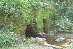
 Runta Dev, the tunnel under the 8m high walls of Angkor Thom that channeled waste-water out of the city into the moat
Just as water was the key to the empire’s success it is now thought to be instrumental in its decline. Not long after the death of the great king JVII in 1218 the kingdom was hit with a double whammy. First 30 years of drought followed by exceptional floods, which washed away the elaborate and sophisticated water management system that JVII in particular had built.
In recent years the importance of these systems has been recognized again as the massive increase in tourism has lead to ground water levels falling and the potential collapse of the temples. It is no coincidence that the best preserved are those with functioning moats.
One man has been championing the restoration of the Angkorian water management. His excellency Hang Peou now Director General of Apsara, the authority responsible for managing the UNESCO world heritage site, has overseen the construction of canals that channel the Siem Reap River into the North Baray, the moats of Preah Khan, Ankgor Thom and even Angkor Wat. Reducing the possibility of Siem Reap flooding as it did in 2011. And maintaining the ground water levels that prevent subsidence of the temples.
 Peou overseeing our progress up the North Baray Channel
These small matters aside obviously the most important function of Angkorian hydrology is to allow us to paddle through the Angkor Park, Cambodia’s best preserved 400 km2 of lowland mixed evergreen and deciduous forest.
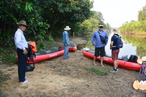 Peou and Jady with Buntha contemplating our adventure
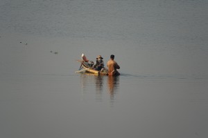
And so it was one Monday morning that Peou, then Director of Water Management at Apsara, facilitated by Jady, a consultant working with Apsara together with Buntha and myself kayaked through the heart of the Angkor Park. Jady and I had previously recce’d Peou’s canal so this time we didn’t get lost and anyway Peou knew the way, but – we hadn’t followed the river as it heads South to the city.
The current had cut deep into the soft ground leaving 7meter high banks that we had to scramble down with our kayaks and then awkwardly get in them*.
*Evidence of the destruction of JVII’s waterworks as floods washed away his canals and gouged deep scars through Angkor.
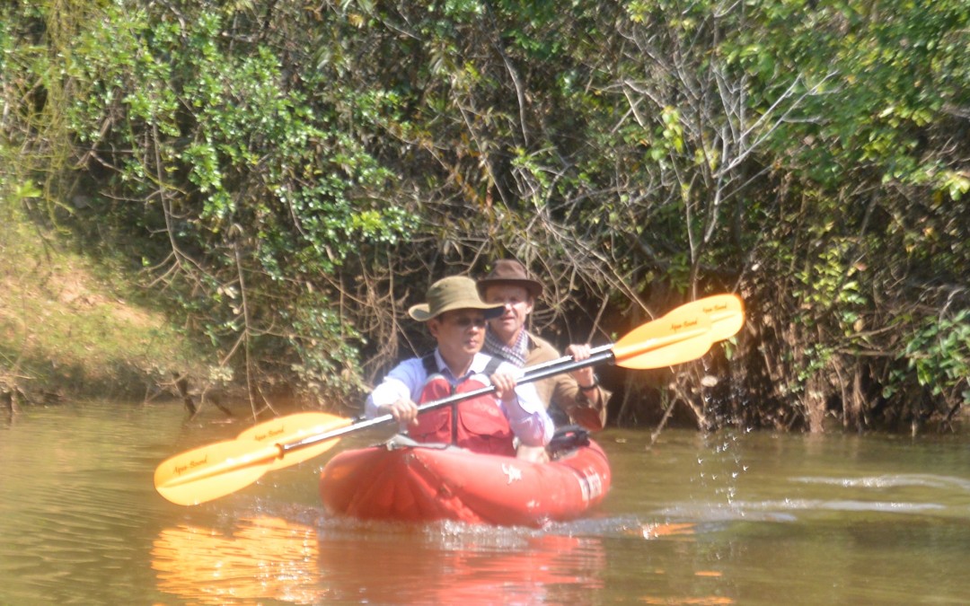
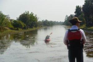
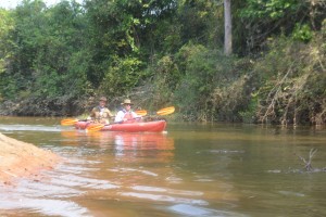 Paddling down the Siem Reap River
A few fallen branches had accumulated enough flotsam and jetsam to block the river with no way through but a messy scramble. Jady and Buntha paved the way. Poeu and I made it easy.
There are 700 Angkorian structures inside the Angkor Park but only 180 of them can be called temples, they’re the ones with moats. These monumental stone edifices need solid ground for their structural integrity, without it they crumble to a pile of stones. Siem Reap is a built on a light sandy soil, water gives it substance, which is what the moats do for the temples.
A few hundred meters on either side there were no doubt bus loads of Asian tourists but here in the heart of Angkor we paddled passed explosions of bamboo erupting on either side. White-collared Kingfishers taunted Buntha to catch a photo. A Snake Eagle followed our progress from above, while a Shikra watched us with disinterest from a fallen branch. All manner of other birds sang from the trees on either side obliterating any thoughts of tourists or even other people.
We’d catered for 5 pax kayaking but one of the water management guys came along for the ride so the third kayak was one paddle power short and we had visions of Kosal, Jady’s assistant unable to move his shoulders for a month or 2. They’d had the sense to share the work and caught up beaming and claiming the big adventure.
Our driver had accumulated helpers by the time we reached the sluice gates at the French Bridge (confusingly built by Americans), who pulled us up the steep stairs to Peou and Jady’s vehicles.
It took a while to sink in that we had paddled through one of the wonders of the world, visited by 3 million people but seen none, instead thick riparian forest as if we were discovering it for the first time.
by Nick | Jun 6, 2019 | Angkor, Bike, Blog, Culture, Hike
HYDROLOGY MADE SEXY
Introduction
Angkor is an amazing place. You cannot fail to be impressed even stunned by the grandeur, detail and scale of the monuments. The true wonder of the Angkorian Empire and what it had achieved only started to dawn on me in the last few years. It was when the findings of the Lidar survey were published that I grasped the extent of what was one of the world’s greatest civilisations.
Lidar in layman terms emits an electromagnetic pulse – a laser that is strapped to a helicopter and fired as it passes over the ground to be surveyed. The reflected light is fed through software that strips away the vegetation to reveal the topography and previously unidentified structures.
The results are phenomenal! Phnom Kulen had a city on top. Angkor Thom was laid out in a grid of roads and canals framing wooden houses and their trapaeng or pools. There were thousands of temples not hundreds, and it was all made possible by the management of water in a climate where at the best of times 6 months of rain is followed by 6 months of drought.
I also began to realise that many of our cycle routes, hiking trails and even kayaking adventures followed these ancient waterways. I’d heard Roland Fletcher give fascinating talks at the Amansara Resort and on the banks of the West Baray. It wasn’t until Damian Evans (also from Sydney University) spoke to the guides I was managing that I knew he could tell us what we needed to understand Angkor.
The Water Connection
Boeung Ta Neue – our Secret Lake where we kayak, was an Angkorian reservoir formed by an extension of the North Wall of the East Baray, a much larger reservoir connected with the Angkorian cities of Ta Prohm and Angkor Thom. Boeung Ta Neue caught the rain run off from the
Kulen Hills to the North, which fed the Baray and in turn the conurbations of Angkor.
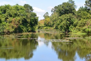
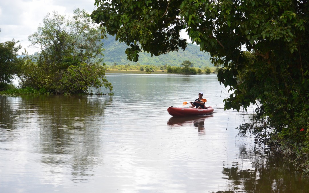
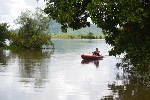 Kayaking on Boeung Ta Neue Angkorian Reservoir (Secret Lake)
Nearby where the Baray finishes and the wall extension starts, is the 7 arched Spean Tor Bridge. Clearly visible by kayak from the water, we managed to reach it through the bush from the red earth road where Damian* had parked.
*Damian Evans archeologist working for Sydney University
We searched on the Baray side of the road for an exit but with none to be seen we couldn’t work out the purpose of the bridge though to be sure a thousand years ago it had one.
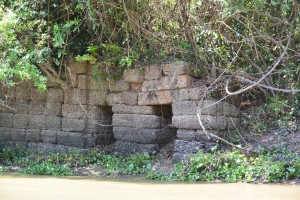 Spean Toh Bridge (named after the nearby temple Prasat Toh
The main water flow into and out of the East Baray was through Kral Romeas, a sluice built into the banks of the East Wall. Cycling and hiking through Phum Samre, the village that lines the walls I’d noticed large laterite blocks and dismissed them as scattered from some Angkorian ruin, which they were. Closer inspection revealed 1 large thick wall and 30 metres away another running parallel forming two sides of the sluice. The raised ground in front of us was a laterite weir. Kral Romeas depending on time of year and water level, acted as an inlet and outlet to the East Baray and may have been connected by another laterite wall running parallel with the East Bank, to Boeung Ta Neue via Spean Toh.
An outlet has also been discovered opposite in the West Bank of the Baray, which fed into the Ta Prohm moat and then onto Angkor Thom. The East Baray at 14 square kilometers, 7km long and 2km wide would have supplied water to the two cities of Ta Prohm, Angkor Thom as well as the houses in between. It would also have been used for irrigation.
Damian explained the scale by comparing the East with the West Baray of similar size containing 50 million litre3 in the West Baray which provided irrigation for 5000 ha of rice, perhaps 10,000 tonnes for each crop. Feeding a population of hundreds of thousands of priests, the aristocracy and merchants who lived in and around these temple cities.
 The West Baray at the end of the rainy season
It was also unlikely that the 3 great water reservoirs of the West, East and North Barays were in simultaneous use but acted as a stabilising backup during times of drought and flood.
The scale of these man made hydraulics are unparalleled in human history and truly mind-boggling. The 3 spatial dimensions have to be combined with a 4th chronological dimension as the kings and climate changed over time. History seems to have been determined as much by the weather as the peaks in the empire. First during the reign of Suryavarman II in the 12th century then under Jayavarman VII in the 13th century, which coincided with the peaks in rainfall we saw from the ancient records on Damian’s computer screen and heralded the construction of the great temples of Angkor.
It is now suggested that the ultimate decline of Angkor was linked to periods of extreme drought followed by floods, which washed away the channels needed to supply water during the dry season. This is most clearly seen at Spean Thmor between Ta Keo and Angkor Thom where the old bridge lies high up the banks of the river now running meters below.
An as yet unexplained mystery is the adjacent 10 x 10 grid of a 100 mounds a few hundred meters from Prasat Toh. Similar grids have been found beside the ‘River of a Thousand Linga’s’ at Kbal Spean and Sambor Prei Kup near Kampong Thom, both associated with major water systems. No artifacts or remains have been found at either site that give any clues as to what the mounds are.
Walking through the site with Damian we spotted fragments of curved roof tiles in a papaya plantation that in an act of unintended vandalism, has been planted right over the mounds.
Most of what is known about Prasat Toh comes from a 4 sided stele (a stone pillar with carved enscriptions) discovered by the French in the 1930’s and now stored in The Angkor Centre for Conservation in Siem Reap. The Sanskrit engravings were translated and available on line. They explained that the stele had been installed by a Brahmin priest during the 13th century and referred to the Great King Jayavarman VII. The inscription mentions the Ganges River in association with water, which may have had something to do with the Kral Romeas sluice and was the same as an inscription found at Phnom Dai temple to the North, the site of another grid of mounds. The temple itself appears to predate the stele and is maybe contemporary with the 10th century East Baray.
 Prasat Toh and its 3 laterite towers situated near the North West corner of the East Baray
Randomly cast on the ground were the now eroded but once richly carved sandstone blocks that had adorned the structure including the stone crown that sat atop the central tower. Interestingly it had a hole in the middle, where a bronze finial in the form of a trident could have been positioned. Possibly removed at certain auspicious times of the year to bathe the Goddess Shiva sitting 15 meters below in sunlight.
Set amongst brilliant green paddy fields on the other side of Beoung Ta Neue is Leak Neang or Hidden Lady Temple. Dated to the 10th century and built at the same time as the spectacular brick temple of Preah Rup. A stele, which may give some clues to its origins has transferred to the Angkor Conservation for translation.
 Leak Neang with its single brick tower
The bricks used in the construction of the structure are themselves a mystery as no kiln has ever been found. A theory speculates that the bricks were fired in a dedicated kiln close to the temples made of bricks, which were also used. The apparent black scorching seen on the walls seemed to support this idea.
Not only was this masterly management of water used to supply The Angkorians and irrigate their crops, it also conveyed the enormous amount of stone required to build the temples. Laterite is an iron rich clay that is soft and easy to dress into blocks when it comes out of the ground. On exposure to the sun it becomes very hard but relatively light making it ideal for the foundations but not the decoration as its pock-marked surface is not easily carved. The laterite quarries lay in the hills to the North West. Dams collected water from streams which was released into the Great North Channel that carried the stone blocks South to the North Baray from where they were used in the construction of Angkor.
At the Eastern end of the Kulen escarpment were quarries that supplied the sandstone, which was carved into the marvelous facades of the temples. As part of this network another channel ran from Beng Melea near the Eastern Kulen escarpment, past the Temples of Banteay Ampil and Chau Srey Vibol to Prasat Batchum inside Angkor Park. A path still connects these sites and makes for a great cycle ride.
We were beginning to get a handle on the Eastern end of the water connection, now it was time to explore the West. The Siem Reap River flows South from the Kulen Hills to the city and then onto the Tonle Sap Great Lake but during Angkor it was diverted into the North East corner of the Angkor Thom Moat. History is being repeated as subsequent to the floods of 2011 the channels have been reopened and another dug in parallel on the North side of the moat as the river is diverted into the West Baray with the aim of stopping the floods in Siem Reap. The fact that now the town of Puok to the West floods instead is not part of the discussion – tourists don’t go there.
Angkor Thom the largest of all the Angkorian Cities, was the capitol under Jayavarman VII. its wall’s 3km long enclose 900 hectares or 9 km2. Now forested but once the site of a thriving metropolis of wooden houses and trapeang (pools), surrounded by a grid of canals and roads as the Lidar survey revealed.
 View over the moat from the walls at the S.E corner of Angkor Thom
The data was detailed enough to show the individual houses, which can be extrapolated to give a guessed population of 70,000 based on an assumed family size. This would need a lot of water but during the rainy season any excess flowed out of Boeung Thom reservoir in the South West of Angkor Thom and through Runta Dev a canal that runs under the walls of the city into the moat. We’ve got a stunning cycle route that runs along the 8m high walls of Angkor Thom to Prasat Chrung or corner temple. A great late afternoon spot for watching the sun set over the moat, paddy fields and palm trees beyond. We didn’t realise the engineering marvel that lay 8 meters below us until Damian lead us down the inner banks to a stream that on closer inspection disappeared into a laterite tunnel under the walls and out to the glinting light of the moat 30m away.
The West Baray 500m to the West is yet another mystery. How was this vast body of water replenished and released during times of flood? The current outlet of the Angkor Thom moat is a canal running parallel with the road through the West Gate dug by the French, which destroyed any trace of what was there before. It is possible it was a replacement otherwise how did 50 million litres of water get into The Baray?
 Runta Dev runs under the walls of Angkor Thom
What had we learnt that morning?
We understood that water running off the Kulen Hills to the North fed streams, which flowed into the reservoir of Beoung Ta Neue in turn feeding the East Baray, which was a water supply for the population of Angkor Thom and Ta Prohm.
Damian confirmed that our cycling path to Chau Srei Vibol and on to Banteay Ampil, lay along the route a canal had taken bringing sandstone from the quarries at the Eastern end of the Kulen escarpment via Beng Melea to Angkor.
He explained how the laterite blocks used to build the foundations of the Jayavarman VII temples were carried by water released into the Great North Canal which flowed from the quarries at the Western End of the Kulen Hills to the North Baray and father temple of Preah Khan.
And the Western hydrological connection was made by the Siem Reap River coming from the Western end of Kulen flowing into the Angkor Thom moat and maybe on into the West Baray.
And much else besides!
With great thanks to Damian Evans for a really fascinating morning and apologies for any misinterpretations.
Indochine Exploration with Smiling Albino Cambodia is pleased to take our guests on a introductory investigation of the main temples along the water courses described or an adventure to experience this incredible landscape on foot, by bicycle or kayaking.
by Nick | Jan 11, 2019 | Angkor, Blog
Christmas Lunch in Prasat Pong Keou Temple
In the glory days of our romance with Amansara* we had helicopters and oxcarts to and from the Tamarind Temple in the city of Angkor as a standard trip. Last year Apsara, the temple authority built a road and put an end to our white tablecloth champagne temple lunches. So we needed a new one – temple that is.
*The uber luxury Siem Reap Resort
It all started 8 years go when a monk came to see me about a forest and we discovered a temple ………..
Skip 8 years and we were trying to find it again not helped by its many names. Prasat Yoni or Temple of the Vagina being the most mentioned. Our adventure guide was given the mission and came back with a photo and tales of a temple but not the one I remembered.
 Chum Nean the monk, who in 2010 was trying to protect his village from the encroaching rubber plantation and took me to Pong Keou
Yet another year and now motivated by an enquiry for a temple lunch we set off as a team on mountain bikes through the bush. Armed with local knowledge gleaned from villagers on route, we came upon a patch of forest but still no sight of it. Then hacking through the vegetation with machetes the laterite walls appeared.
 Our first sight of Prasat Pong Keou in August 2018
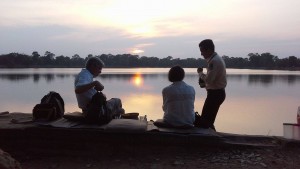
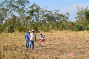
Skip to October at The Ivy Restaurant in Chelsea and a lady called Di who had a client called Peter and we’ve almost got to the start of the story on Christmas Eve. But not so fast, there was a helicopter to organize. It seemed simple in August when we first found the temple but by October when we went to choose a place to land and record the GPS coordinates, the dusty dry countryside had become a large lake. Forget helicopters kayaks would have been more useful, we went back again at the beginning of December to choose the landing site.
Let me introduce the supporting cast for this performance; Ra our temple host, Buntha AKA Mr Fixit, Miss Wong master chef Dean. Then there was Black-dog the van driver and Bong Kroyun, who steered the tractor or kroyun *and Mr Pal who made mince meat of helipad construction. Oh and myself. My main job was to panic and pester to the point where it was easier to get the logistics sorted than put up with me.
*kroyun lit. motorised buffalo cart
Things go at their own pace, to be messed with at your own peril or most likely slowing down whatever you want speeded up. So while I hadn’t a clue why we were waiting at Buntha’s house in Samrong his village on Christmas Eve, it became clear as events took their own course.
Logging, encroaching agriculture and forest fires had taken their toll since we last visited. The paths looked different and we went down the wrong one. Not an auspicious start to our big adventure.
Who was our guest? I can’t really say, client confidentiality and all that but suffice to tell his online profile was considerable and intellectually engaging. The rest of his family; Sarah his wife and 3 fey daughters, Princesses sheathed in gossamer gowns, crowned by coronets – lady’s of the lake.
Mr Pal, Buntha, Black-dog and myself hacked our way through the undergrowth, finally glimpsing the blocks of laterite that made up the walls of the etheral Prasat Pong Keou, as much a myth as reality. As if that wasn’t hard enough termites had colluded to prevent entry. There was a tantalizing peek at the West entrance but short of wriggling across a bed of ants no way in. Illegal logging and vandalism had bulldozed a hole in the wall to get at a valuable rosewood tree, our necessary entry point.
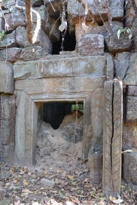 What used to be the entrance to Prasat Pong Keou
The gash in the wall was like a link in time to a thousand years ago when a different world was inhabited by a culture that hadn’t yet outgrown its environment. A microclimate of intense humidity and heavy mystery hung over the ancient remains of what the kroyun driver told us was a halfway house along a long gone Angkorian road between the major temples of Koh Ker and Beng Melea. Our presence was like a warp in time but not space as we carefully cleared away the secondary growth since whoever had been here last.
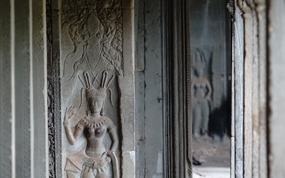
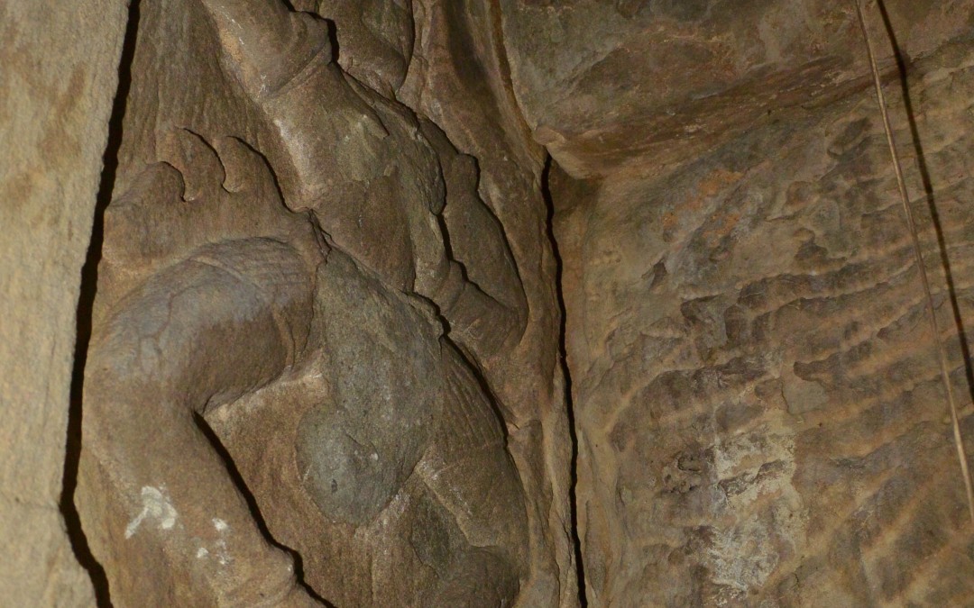
Tripping over tilting stones we found a central tower block with multiple entry points. One lead to a blind chamber adorned by primitive Apsara*. Four had been defaced but the furthermost corner carving had escaped the vandals. Fern fronds hung from the temple terraces like they were planted at a Chelsea Flower Show feature garden.
*Celestial dancers
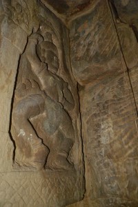
Unique Apsara (left) and the central tower block at Prasat Pong Keou (right)
More to the point where were we going to balance the table and chairs for Christmas lunch? We retreated to clear a route through the vegetation and coarse grass back to the rutted laterite road we’d left. We saved the helipad for the next day. We leap frogged each other as our motorbikes took it in turns to get punctures and made it back to Buntha’s house in Samrong.
A house if you’re lucky enough to have one is just a space in Cambodia. We furnish and decorate our rooms according to what we’re going to use them for in a way that pleases us. In Cambodia if you want to wash you find a space where you can scoop water from a pool. If you want to cook you use a clay charcoal pot to boil or fry whatever you’re cooking. And when you want to sleep you roll out a mattress, hang a mosquito net and if you’re lucky position a fan. In spite of or because of this different approach I lay on my comfortable mattress in relative cool, clean and well fed.
Christmas morning and there was a kroyun* where Buntha had organized one to be and another on its way so we set off to scythe rice straw. I seemed to miss the straw and hit worm mounds sending the blade flying from its handle and quickly turning the callus on the palms of my hands into blisters. I realized that my future career didn’t lie with rice farming.
 Preparing the helipad; Buntha (left), Mr Pal and Bong (Brother) Kroyun
I was much better at making an H. It started as an H but we cleared some more rice stubble so added an I and connected it to the H with a hyphon = I-H. Since our retiring temple seemed to change location each time we visited I went to check that it was still there and see if I was better at hacking vines than rice straw.
Dean had arrived on the second kroyun, so we ported the provisions through the gap in the walls and proffered the stage from which he was going to work miracles, so far so good. We cycled back to the helipad to see if the helicopter carrying our precious guests had arrived.
Meanwhile the rice farmer whose field we’d appropriated had turned up. He’d heard on the jungle grapevine that a barang* was digging up his land. Pacified by Buntha he saw instead that we’d cut his straw for him so he retreated to a safe distance to watch the fun with his wife.
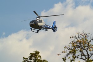
A while later a whir could be heard across the forest and the speck in the sky materialized into our aircraft. It circled the landing site a couple of times, deciphered my I-H and descended amidst a blitz of rice straw.
*barang lit. Frenchman but used as a general term for all white foreigners
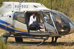 Our guests approach and land
“Mr Fletcher I presume,” I’d been saving it up for a long time. “Good to meet you,” he generously replied. We arranged his family on the kroyun trailer and set off on the trail for lunch.
It had been a good call to mechanically convey these gentle creatures rather than line up mountain bikes and expect them to wade through the sand. A chain of boys was waiting to guide them through the laterite portal to where Dean like a big mother hen dispensed cold towels and bonhomie. “Your temple.” There was a collected wow before they started exploring its nooks and crannies then settled for champagne and turkey.
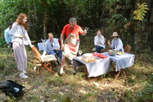 Mr Wong performing Christmas culinary magic inside the temple
I sat slightly aside on a stone with a glass of Moet and for the first time in 36 hours started to relax. The Moet gone and half a bottle of Dean’s Prosecco later, I was definitely relaxed as I said goodbye to the guests. Replete with the considerable remnants of the guest lunch, the ‘team’ lined up to convey the cool boxes and general paraphernalia back to the kroyuns.
Buntha and I raced ahead on mountain bikes too elated to notice the clogging sand we glided over. We caught a glimpse of the helicopter circling above the trees and that was the last we saw of our guests for Christmas lunch at Prasat Pong Keoy.
As a footnote the kroyun drivers were well rewarded and anybody to hand back at Ta Siem Village got a can of soda. Everyone involved in the undertaking was generously tipped. ‘Could we do it again Buntha?’ ‘Yes,’ he said confidently, ‘we’d just have to pay more.’
I received several messages that night from Mr Foster – not his real name thanking us for an extraordinary event. Di had asked for something that nobody else had done before. It’s very unlikely that in the temple’s thousand year old history anybody has had Christmas lunch there, especially not a family from London.
by Nick | May 31, 2018 | Angkor, Blog, Uncategorized
Introduction
Angkor is an amazing place. You cannot fail to be impressed even stunned by the grandeur, detail and scale of the monuments. The true wonder of the Angkorian Empire and what it achieved has only started to dawn on me in the last few years. It was when the findings of the Lidar survey surfaced that I grasped the extent of what was one of the world’s greatest civilisations.
Lidar in layman terms emits an electromagnetic pulse i.e. a laser, that is strapped to a helicopter and fired as it passes over the ground to be surveyed. The reflected light is fed through the software that strips away the vegetation to show the topography and reveal previously unidentifiable structures.
The results are phenomenal! Phnom Kulen had a city on top. Angkor Thom was laid out in a grid of roads and canals framing wooden houses and their trapaeng or pools. There were thousands of temples not hundreds, and it was all made possible by the management of water in a climate where at the best of times 6 months of rain is followed by 6 months of drought.
I also began to realise that many of our cycle routes, hiking trails and even kayaking adventures followed these ancient waterways. I’d heard Roland Fletcher give fascinating talks at Amansara and on the banks of the West Baray. It wasn’t until Damian Evans (also from Sydney University) spoke to the guides that I knew he could tell us what we needed to understand Angkor.
The Water Connection
Boeung Ta Neue – our Secret Lake where we kayak, was an Angkorian reservoir formed by an extension of the North Wall of the East Baray, a much larger reservoir connected with the Angkorian cities of Ta Prohm and Angkor Thom. Boeung or lake Ta Neue caught the rain run off from the Kulen Hills to the North, which fed the Baray and in turn the conurbations of Angkor.

Kayaking on Lake Ta Neue
Nearby the corner of the East Baray, where we discovered a wall separating the Baray from Lake Ta Neue, is the 7 arched Spean Tor Bridge. Clearly visible by kayak from the water, we managed to reach it through the bush. We searched on the Baray side for a connection with Lake Ta Neue but none was to be seen. We couldn’t work out the purpose of the bridge though to be sure a thousand years ago it had one.
![]()

Spean Tor Bridge
The main water flow in and out of the East Baray was through Kral Romeas, a sluice built into the banks of the East Wall. Cycling and hiking through Phum Samre, the village that lines the walls I’d noticed large laterite stone blocks. Closer inspection revealed 1 large thick wall and 30 metres away another running parallel. These formed the sides of the sluice, the raised ground in front of us was a laterite weir. Kral Romeas acted over time as an inlet and outlet to the East Baray and may have been connected by another laterite wall running parallel with the East Bank, to Lake Ta Neue via the bridge Spean Tor.
An outlet has also been discovered opposite in the West Bank at the far end of the Baray, which provided water for the wooden houses between Angkor Thom and fed into the Ta Prohm moat. 7km long and 2km wide the Baray seems to have been a huge body of water to supply what appeared as a compact area of habitation but it would also have been used for irrigation.
Damian put this into context by working out that the 50 million litre3 in the West Baray reservoir of similar size to the East Baray, could provide irrigation for 5000 ha of rice, perhaps 10,000 tonnes for each crop. The rice fed a population of hundreds of thousands of priests, the aristocracy and merchants who lived in and around the ancient temple cities.

The West Baray at the end of the rainy season
It was also unlikely that the 3 great water reservoirs of the West, East and North Barays were in simultaneous use but acted as a safe-guard for times of drought and flood.
The scale of these man made hydraulics are unparalleled in human history and mind-boggling. To truly understand you have to think about the 3 spatial dimensions in combination with a 4th dimension – time, the chronology of the kings and climate. History seems to have been determined by the weather as the peaks in the empire, first during the reign of Suryavarman II in the 12th century and second under Jayavarman VII in the 13th century coincided with the peaks in rainfall we saw from the ancient records on Damian’s computer screen.
The ultimate decline of Angkor was also linked to periods of extreme drought followed by flood years, which washed away this finely tuned hydrological infrastruture needed to supply water during the dry season and get rid of it during the flood. This is most clearly seen at Spean Thmor near Angkor Thom where the old bridge lies high up the banks of the Siem Reap River, which now runs meters below.
Prasat Tor (prasat meaning temple) and Troung Chruk (pigs temple) it’s ruined sister temple to the South lie between Lake Ta Neue and the East Baray next to an unexplained mystery, a 10 x 10 grid of a 100 mounds.
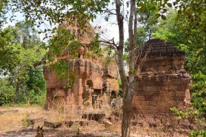
Prasat Tor and it’s 3 laterite towers
Similar grids have been found beside the River of a Thousand Linga’s, Kbal Spean at the West end of Phnom Kulen and Sambor Prei Kup near the modern day city of Kampong Thom, both associated with major water systems. No artifacts or remains have been unearthed to help solve the mystery of what the mounds are.
Walking across where the grids were revealed by Lidar, we spotted fragments of curved roof tiles in a papaya plantation that in an act of unintended vandalism, has been planted right over the mounds, which may help solve the mystery.
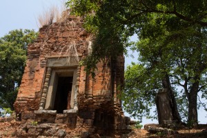
Most of what is known about Prasat Tor comes from a 4 sided stele (a stone pillar with carved enscriptions) discovered by the French in the 1930’s and now stored in The Angkor Centre for Conservation. The Sanskrit engravings were translated and available on line, which Damian translated for us in his office that morning. The stele had been installed by a Brahmin priest during the 13th century referring to the Great King Jayavarman VII. The inscription mentions the Ganges River in association with water, which may have had something to do with the Kral Romeas sluice and was the same as an inscription found at Phnom Dai temple to the North, also the site of another grid of mounds. The temple itself appears to predate the stele and may have been built at the same time as the 10th century East Baray.
Randomly cast on the ground around Prasat Tor were the now eroded but once richly carved blocks that adorned the structure including the stone crown that sat atop the central tower. Interestingly it had a hole in the middle, where a bronze finial in the form of a trident could have been positioned. Possibly removed at certain auspicious times of the year to bathe the Goddess Shiva sitting 15 meters below in sunlight.
Now set amongst brilliant green paddy fields in November, on the other side of Lake Ta Neue is Leak Neang Temple dated to the 10th century. A stele has recently been removed from the site to the Angkor Conservation but has yet to be translated.
Leak Neang with its single brick tower
The bricks themselves are another mystery as no kiln has ever been found. A theory speculates that the bricks were fired close to the temples then used in it’s construction. The apparent black scorching seen on the walls seemed to support this idea.
Not only was this masterly management of water used to supply The Angkorians and irrigate their crops, it was also conveyed the enormous amount of stone required to build the temples. Laterite is an iron rich clay that is soft and easy to dress into blocks when it comes out of the ground. On exposure to the sun it becomes very hard but relatively light making it ideal for the foundations but not the decoration as its pock-marked surface is not easily carved. The laterite quarries lay in the hills to the West. Dams collected water from streams, which was released into the Great North Channel that carried the stone blocks South to Angkor.
At the Eastern end of the Kulen escarpment were quarries that supplied sandstone, which was carved into the marvelous facades of the temples.
A channel ran from Beng Melea past the Temples of Banteay Ampil and Chau Srey Vibol to Prasat Batchum inside Angkor. A path still connects these sites and makes for a great cycle ride with temple stops for sustenance heading East to the Tamarind Temple – Banteay Ampil.
We were beginning to get a handle on the Eastern end of the water connection, now it was time to explore the Western end. The Siem Reap River flows South from the Kulen Hills to the the city and then onto the Tonle Sap Great Lake but during Angkor it was diverted into the North East corner of the Angkor Thom Moat. History is being repeated as subsequent to the floods of 2011 the channels have been reopened and another dug in parallel on the North side of the moat as the river is diverted into the West Baray with the aim of stopping the floods in Siem Reap. The fact that now the town of Puok to the West floods instead is not part of the discussion – tourists don’t go there.
Angkor Thom was Jayavarman VII’s and his 2 wives, city. The largest of all the Angkorian Cities its wall’s 3km long enclose 9 km2, which is now mainly forest but once housed a thriving metropolis of wooden houses and their trapeang, surrounded by a grid of canals and roads as the Lidar survey revealed.
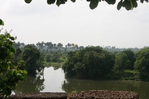
View over the moat from the walls at the S.E corner of Angkor Thom
The data was detailed enough to show the individual houses, which can be extrapolated to give a guessed population of 70,000 based on an assumed family size. This would need a lot of water but during the rainy season any excess flowed out of Boeung Thom reservoir in the South West of the city and through Runta Dev a canal that runs under the city walls into the Angkor Thom moat. We’ve got a stunning cycle route that runs along the 8m high walls of Angkor Thom to Prasat Chrung or corner temple – there’s one at each corner. A great late afternoon spot for watching the sun set over the moat, paddy fields and palm trees beyond. We didn’t realise the engineering marvel that lay 8m below us until Damian lead us down the inner banks to a stream that on closer inspection disappeared into a laterite tunnel under the walls and out to the glinting light of the moat 30m away.
The West Baray 500m to the West is one more mystery. How was this vast body of water replenished and released during times of flood? The current outlet of the Angkor Thom moat is a canal running parallel with the road through the West Gate dug by the French, which destroyed any trace of what was there before. It is possible it was a replacement otherwise how did 50 million litres of water get into The Baray.
Runta Dev runs under the walls of Angkor Thom
What had we learnt that morning?
We understood that water running off the Kulen Hills to the North fed streams, which flowed into the reservoir / lake of Beoung Ta Neue in turn feeding the East Baray, which was a water supply for the population of Angkor Thom and Ta Prohm.
Damian confirmed that our cycling path to Chau Srei Vibol and on to Banteay Ampil, lay along the route a canal had taken bringing sandstone from the quarries at the Eastern end of the Kulen escarpment via Beng Melea to Angkor.
He explained how the laterite used to build the foundations of the J VII temples were carried by water released into the Great North canal which flowed to the North Baray and Preah Khan.
And the Western hydrological connection was made by the Siem Reap River coming from the Western end of Kulen flowing South into the Angkor Thom moat and maybe on into the West Baray.
And much else besides!
With great thanks to Damian Evans for a really fascinating morning and apologies for any misinterpretations.
Indochine Exploration with Smiling Albino Cambodia is pleased to take our guests on a introductory investigation of the main temples along the water courses described or an adventure to experience this incredible landscape on foot, by bicycle or kayaking.