by Nick | Feb 16, 2021 | Angkor, Blog
Route 66 – An Angkorian Adventure
This is the story of a family’s adventures along an ancient Angkorian Highway in search of temples hidden in the forest.
A thousand years ago a canal was dug to ferry the giant blocks of stone that were used to build the temples of Angkor from Kulen Mountain where they were quarried. The canal has long since gone but the road that ran beside remains, now a sandy path for much of the way.
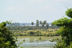 A rural landscape of sugar palm trees and paddy fields
Our mission was to cycle where our families had not gone before, along the buffalo track past bright green paddy fields, between picturesque sugar palm trees and through Khmer villages of wooden houses built on stilts to stand proud of the floods. Children rushed out to get a glimpse of the strange ‘barangs’ (foreigners), shrieking goodbye and hello at random. Boys loosely herded buffalo that gently moved apart to let us through.
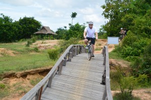 The River Bridge across the Kampong Phluk River
The bridge across the Kampong Phluk River was still strong but the piles had sunk to different depths leaving it twisted like a fairground ride. One by one we cycled across and onto our first stop. A hilltop temple with a pagoda in front constructed of stones looted from the ancient site. The 18 stages of Buddhist hell were graphically depicted on the outer walls. Sinners filed up to receive judgment as to how far they would sink into the eternal flames, which included the novel twist of attaching leeches to the nipples of ‘loose’ women.
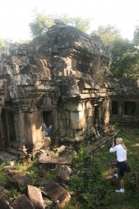 Chau Srey Vibol Temple
Grey clouds swelled and darkened until too heavy for the sky they fell as torrential rain. We reached the Jeeps just in time and set off for the next stage in our adventure.
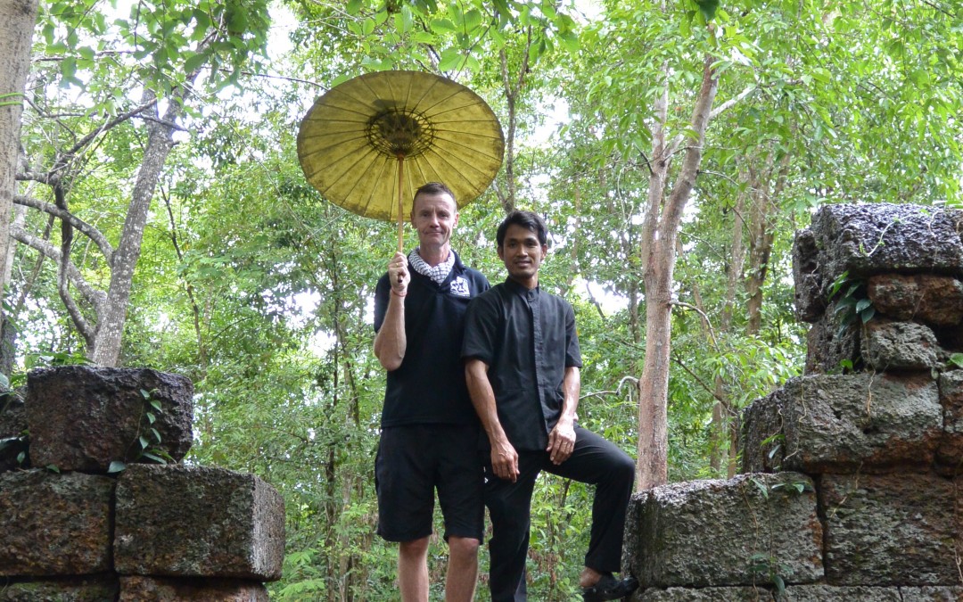
Walking single file along the dikes between fields and through forest alongside the old road now flooded from recent rains. We came upon a clearing in the jungle and there lay the ancient ruins of the Tamarind Temple. We were lead through the portals of the Eastern Gate into a courtyard where a gleaming white tablecloth was adorned with flowers and the promise of a delicious lunch. Cold towels to wipe our sweaty brows and chilled coconut water to revive our flagging souls. To complete the cure Tern, in a smart black uniform popped the champagne cork and we toasted our adventure before the gazpacho was served.
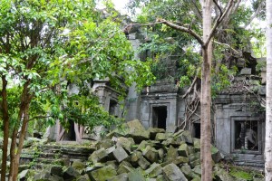 Banteay Ampil Temple
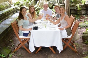 The reward for our morning’s adventures
There are many ways to leave a temple, Uri and I walked. The oxcarts were readied for Beth, Julie, Eve and Brian, cushions laid and tarpaulins hung as we bade them farewell. The sound of whirring rotor blades drowned out the crescendo of cicadas as the helicopter appeared over the tree line and settled onto the field next to the temple. We waved as Danny and Eric took off. Cycling is an option during the dry season and we can always kayak if it gets really wet.
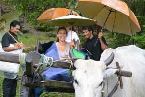
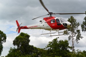 There are many ways to leave a temple including oxcarts (above), helicopters (below) and kayaks if its been raining.
Indochine Adventures in Cambodia organizes bike, hike and simple picnics or champagne lunches in the Tamarind Temple with the different options described to return to Siem Reap.
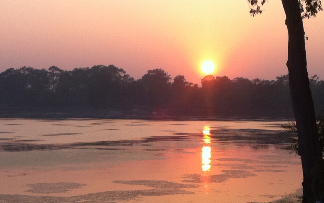
by Nick | Dec 15, 2020 | Angkor, Blog, Hike
Ngin and Nicola’s Temple Hunting Saturday Morning Adventure
An essential Large Little Red Fox latte while Loklak snapped at a French lady then into Panya’s tuktuk for the ride to Phnom Bok.
Panya had the unnecessary ability to find every pothole on the admittedly disintegrating road to Pradark. At Phnom Bok we were greeted with an after party dance party. A wall of speakers sent a reverberating thud up the mountain as we set off through the forest in search of temples.
It’s hot work chasing temples in the woods so Loklak, who remembered the trail from his walk with Emma, a posh dog – charged off to the lake on the other side and was splashing amongst the lotus leaves by the time we arrived.
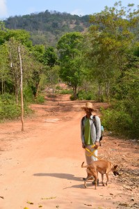 Loklak checking out the temple trail
The road runs along a raised bank beside the lake, which suggests it was an Angkorian reservoir. Half way through April and about as dry as it gets, it had shrunk to a quarter of its rainy season area. Manus suggested kayaking when it is full.
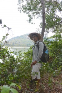 Manus framed by Phnom Bok and it’s lake
It wasn’t very difficult, there was a sign but Manus was very proud to have seen it and to be fair Buntha and I had passed by many times oblivious to the little temple that lay about fifty meters from the road
We crossed the empty but still green moat to a central mound and three laterite towers with a looted lintel over the doorway.
The temple was built in the 13th century by a Brahmin priest and intriguingly lies at the corner of two Angkorian reservoirs and a sluice to control the water between them.
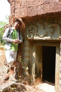
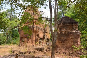 Prasat Toh
Apparently the moat wasn’t completely empty. Loklak had found a muddy wallow and ran out the same colour as a wet water buffalo then rolled in the sand and became a fantastical demon from an Angkorian legend.
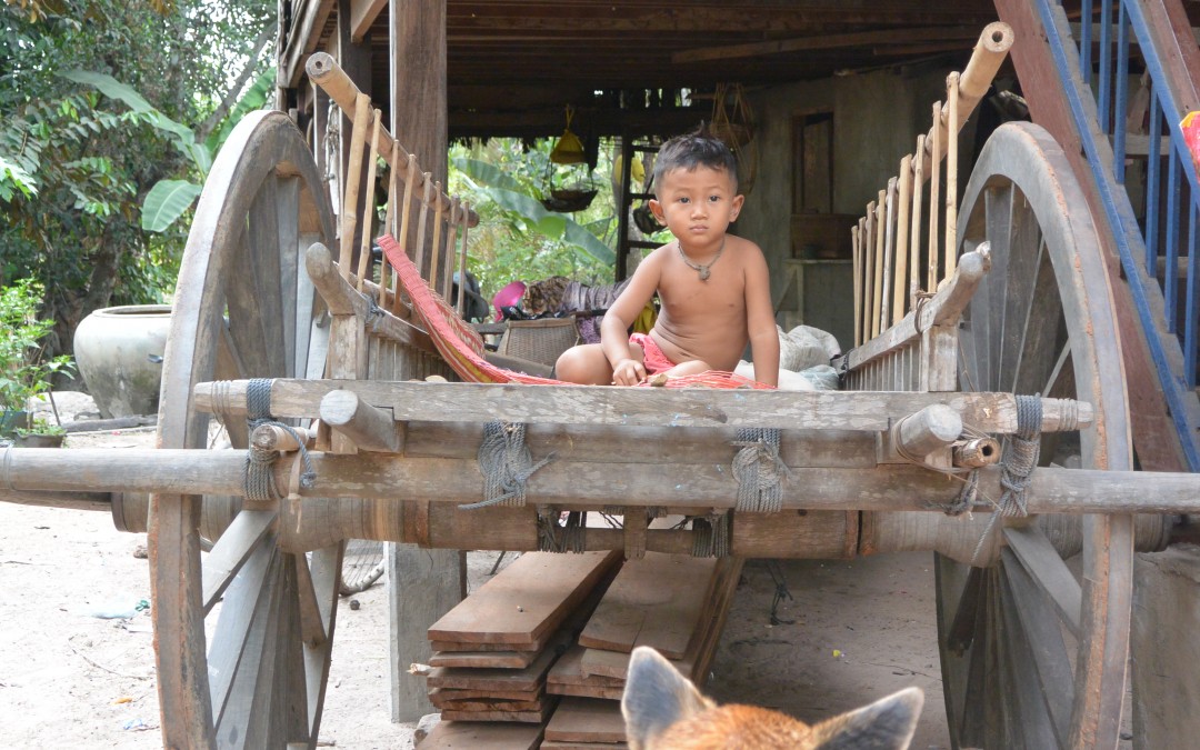
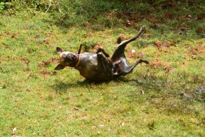 Angkorian demon (left) and Oxcart (below)
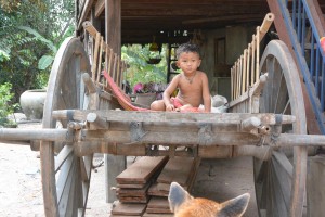
We walked into the village of Phum Samre near Banteay Samre.
A small boy sat on an oxcart and asked for a hopeful dollar, a sugar palm juice collector had two full pots suspended from a pole over his shoulder and wet jeans so low you could almost see his linga.
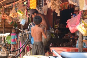 Phum Samre Market
Sticky rice wrapped in banana leaves from the little market and sugar palm juice from the man with the wet jeans, Manus knew him. They’d been in a movie together. I’m waiting for it to make the multiplex in Phnom Penh.
Past the village the houses were bigger, the taller trees and pineapples grew in the filtered sunlight.
Loklak was getting hot and with a loud sigh punctuating his panting collapsed in each thicket of shade we passed.
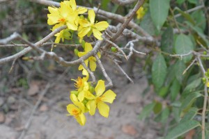 Chinese New Year Flower
We turned left instead of right to look for the temple Mr Heng our taxi driver had told me about. In front of us lay baking brown rice paddy’s on what felt like the hottest day of the year. A welcome relief when we entered the gloom under the tall trees near Wat Pradark and a spooky trail between burial mounds strewn with forlorn streamers.
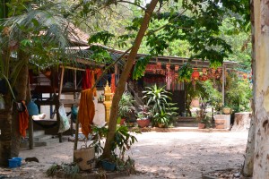 Pradark Pagoda
A boy monk told us where the temple actually was but first the pagoda pool for another Loklak wallow watched by a frog on a lotus leaf.
A lady wrapped in a wet kroma pointed and in the hundred degree heat we came upon the archaeological excavation of Prasat Kamnap, stepped trenches showed the extent of the structure but gave no secrets away such as why was it buried*
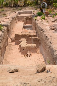 Prasat Kamnap
*I later found out that a dig had unearthed Sanskrit inscribed stele from what had been an Angkorian monastery, once the secrets had been gleaned in accordance with archaeological practise they were reburied.
We stopped at a stall for Loklak to slurp water from Manus’s cupped hands but that didn’t last long so Loklak beyond caring got carted like a sack of rice until we left the hot red earth road.
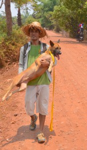
We followed a path under tall sugar palm trees between paddy fields until we came on a woman sluicing herself under a pump. Manus asked if he could sluice Loklak instead and ladled water over the hot dog
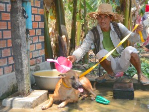 Rehydrating Loklak
Ripping my scalp on a projecting thorn we made it through for Loklak with a last gasp to get to the muddy waters of the shrinking baray where he sat with an expression of ‘no more’ across his face.
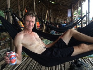 A beer beside the baray
Our final obstacle was a belt of thick vegetation around the West Baray where Panya might be waiting, and our lunch of road kill chicken, rice and most currently appealing cold Cambodia beer.
Something was not quite right? A tough countryside dog gasping his way through a Saturday morning stroll, while the only concern of the admittedly sweat soaked barang was a cold beer. Manus of course was oblivious to the exercise and played games on his phone.
He went to find our lunch while Loklak and I sat amongst the post Khmer New Year debris on the banks of the baray and watched the buffalo bathe. Or at least I did, Loklak had summoned up enough energy to steal a fish head from a small boy then growled when the boy tried to get it back. He ran screaming to his daddy and I looked the other way.
Indochine Exploration would love to take you on a hiking or cycling temple discovery adventure along the paths described in this blog
by Nick | Nov 3, 2020 | Angkor, Blog, Kayak
A million miles from the dusty city center and the tour buses jamming the road to Angkor lies the ancient lake of Boeung Ta Neue. Our mission that morning was to discover if this was a kayaking adventure or just a paddle on a large pond.
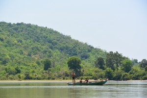 Lake Ta Neue
The lake lies at the base of Phnom Bok, a 250 meter hill that looms large over the surrounding countryside and a reference point for our cycle rides, hikes and now we hope kayaking. To give you a flavor of all three I’ve taken a bit of poetic license and combined our adventures together.
Our story starts and finishes in Pradark as so many do, we later found out. Pradark for those who haven’t been there is a crossroads with a market on one side and restaurant (loose description) shacks on the other selling rice noodles with fermented fish Khmer num ban chok. We started our bike ride on the old road that leads to Pradark Pagoda, a wat shaded by tall trees protected by the monastery.
 A monk’s house at Pradark Pagoda
Cycle left from the well by the lady washing her breasts, continue through scratchy bushes and there in front of you is the excavation site of Prasat Kom Nat. Eleven hundred years ago this was a hermitage for monks and place to store the Sanskrit encrypted stellae that recorded the history of the Angkorian Empire including how the king happened to be feeling that day.
 Prasat Kom Nat
Crunching rice stubble we paddy bashed back to the shady path that runs along the banks of the East Baray. The ancient reservoir is a perfect rectangle 12km long by 2km wide once brimming with water. Now it’s a fertile patch of irrigated land, where multiple crops of rice shine bright green the year round.
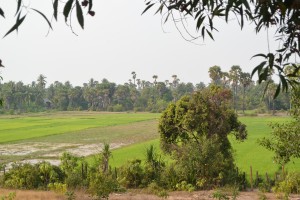 View of the Baray from the East bank
The Village of Pum Samre is built on either side of the path where we cycled, that is until we reached a wedding. A tent had been erected over the dirt track and a bank of speakers piled ominously in front of the family’s house. We rode between the tables of spangled women in tight nylon dresses and drably clothed men in ill fitting long sleeve shirts and trousers, who oblivious to our bikes continued to toast with Angkor beer and ice. And wash down whatever offal was on the wedding menu that day.
Village life was on show; buffalo snorted, cows chewed, dogs barked, children shouted hello then goodbye, adults the customary greeting ‘mow pi na?’ Where do you come from, moto-dops and bicycles, beautifully crafted oxcarts and the mechanical kroyun or tactors that are replacing them.
 The village of Pum Samre
Wooden houses built on stilts to provide shelter from the rain, sun and insects. Mango trees to give ripe mangoes, coconut palms – well its obvious and sugar palms, you’ve guessed it sugar and the wine that ferments in plastic bottles hung beneath the flowers, reached by a bamboo ladder tied to the side of the tree.
Ahead of us lay the lake that laps up to the base of Phnom Bok, or at least it will when the rains come, but first Prasat Tor. We nosed through the thickening vegetation that cloaks the temple. Three laterite towers on a raised mound, where shaded by a leafy tree our table will be laid for our guest’s lunch (will because we haven’t done it yet).
 Prasat Tor
Suitably fortified by our imaginary repast we (will) find our kayaks ready on the lake shore
– what happened actually;
A barang (foreigner) on a dirt bike with a big bag is reason enough to abandon whatever you are doing. When the big bag turns out to be a boat – our kayak, it becomes a day to remember. So by the time we were ready to start we had a launch committee. The fishermen in underpants stopped casting their nets in wonderment while those submerged to their noses turned to stare.
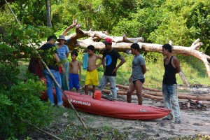 The launch committee
Clad in a mantle of green forest the mountain dominates the lake. At its base cows grazed and fishermen returned with their catch, from which the women make prahoc (fermented fish). Ladies cut spiky leaves to weave baskets and buffalo munched on water hyacinth.
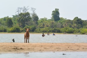 Cast net fishermen (and a dog)
We set off to find the West channel , a bamboo fishing fence. The North channel, clogged by mats of impenetrable water hyacinth and the South Channel, no water. So we paddled back to where we’d started. In a few months the lake will have swelled opening up the rivers and canals for us to explore and paddle to our pick up point.
Postscript;
Lunch was back at Pradark where we’d started with Num Bang Chok and Angkor beer. Mixing the required vegetation into the coconut noodles, first a white taxi and a fat driver who’d just ordered his noodles and coconut when a second blue taxi screeched to a halt beside our table. The driver of the second taxi jumped out handed some dollars to the fat driver, while a lady sitting in the back seat pulled a barely conscious girl out of the car and carried her across to the white taxi, which sped off before she could close the door.
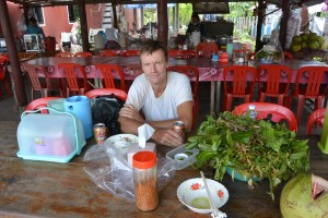 Num ban Chok in Pradark
by Nick | Oct 8, 2020 | Angkor, Bike, Blog
Temple Hunting in The Angkor Countryside
The countryside surrounding Angkor is one of paddy fields and sugar palms. Dotted with small villages of traditional wooden houses built on stilts surrounded by fruit trees. Trapaeng or pools, vast ancient baray or reservoirs and the rivers and channels that still connect the ruins of ancient temples shape the landscape. Near Siem Reap it’s flat excepting the isolated Phnom (hill) Bok that serves as a compass to weary cyclists (and incidentally gave Jayavarman V an excuse to build a temple on top).
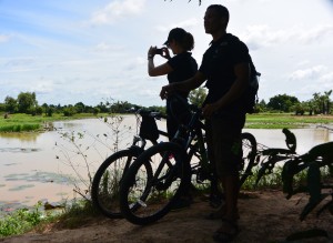 Lors and Zsuzsa looking out over the dam
Small sandy paths and red earth roads have been usurped by the new Korean ring road that speeds oblivious tourists to Banteay Srei or Citadel of The Woman, North of Angkor. Heads down and legs pumping we ate the Tarmac on our escape from the clutches of tourist town in search of temples.
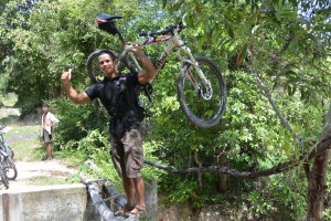 Lors showing off on the rickety bridge
It was cheating slightly as a few weeks back we’d recce’d the ruins on dirt bikes with Dave the helicopter pilot who’d plotted them from the air. Our mission today was to find a path between the ruins and the West Baray, where many of our mountain bike rides finish. Google Earth had made it look easy but I made it hard, leading Lors and Zsuzsa along a track that finished in a ploughed rice field. ‘Boss listen to me, I know the way,’ Lors implored. I didn’t so we followed him and found the first landmark we were looking for, a dam across the Siem Reap river.
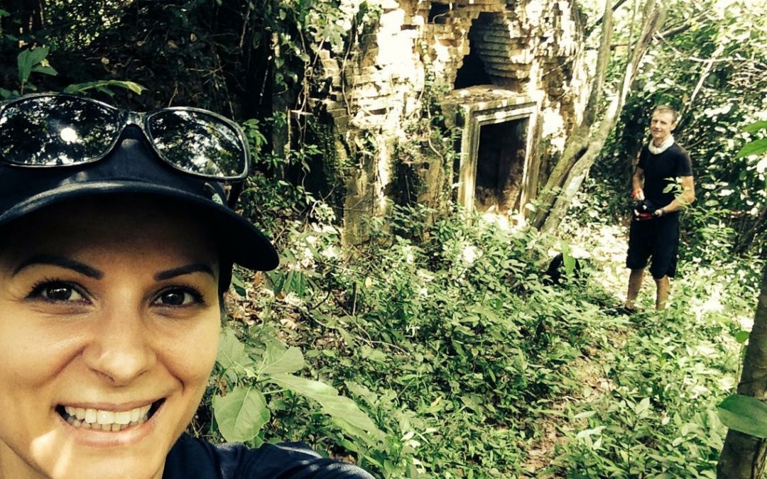
 A Zsuzsa selfie with Prasat Sra Laos (and me) in the background
Not really a dam more a muddy earth wall broken by a concrete sluice and a couple of poles that served as a bridge.
A perfect pastoral scene was set in front of us. Farmers tilling their land with buffalo or their mechanical equivalent, kroyun – a sort of hand held tractor. Ladies up to their chest in the small lake formed by the dam gathered lotus flowers until gazing at three barangs cross a rickety bridge became too enticing, especially when one of them, me – fell in.
‘It’s just here Boss.’ Unfortunately Lors was right. I was going to have to pass on my Chief Exploration Officer title. An isolated patch of forest lay in front of us. Zsuzsa and I twisted our way through the tangle of vines and thorny branches into a gloomy clearing surrounding the ancient ruins of Prasat Sra Laos. A conical brick tower on top of a sandstone lintel and doorway. I looked inside to see if there were any bats.
Back at the bikes Lors had made friends with a a couple of happy rice farmers who’d given up on ploughing the paddy fields in favour of rice wine. We zigzag’d our way across the countryside on paths between rice fields, through bush and small patches of forest. Picking up sandy tracks all in vaguely the right direction. ‘How do you know the way Lors? This is amazing!’ I exclaimed. ‘I lucky, just find the right route,’ he glibly smiled (he’d checked out the route the day before).
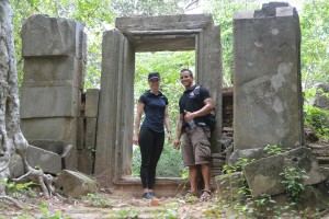 In front of Prasat Cha, Sanscrit is carved into the inside of the stone doorway
Tall tree’s are valuable, there’s not many left outside the protection of the Angkor Park. Tall trees near ruins though are inhabited by spirits that are best appeased and not pissed off but cutting their home down. Google can show you where the temple should be but it’s the trees that give away where it is.
Prasat Cha was no exception. Unlike Prasat Sra Laos the shade kept the undestory at bay and created an enchanting glade around the artificial mounds on which Prasat Cha was built. The towers are made of brick & laterite, the doorposts (as shown) of sandstone richly ornamented with Sanskrit inscription, which dates back to the 10th century and Jayavarman V. A lot of what we know today about the Angkorian Empire has been learnt from just such carvings, which while mainly describing the temple and who built it give snippets of fascinating information. Or so I’m told – I don’t read Sanskrit, which is just as well as there’s a local story that tells of a five-headed dragon that confronts anyone who reads.
The rest of our way followed well worn paths we knew well, that is that until we reached a new channel cutting us off from the West Baray. We hoisted the bikes on our shoulders and filed across the big muddy ditch to the walls of the Angkorian Reservoir.
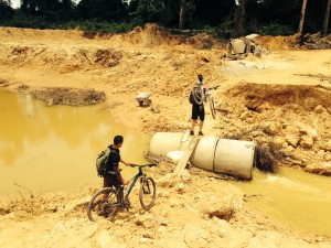 Our last challenge before the Baray.
Eight by two kilometres with no geographical help from a valley or hill, the West Baray was until the 20th century the largest entirely manmade reservoir in the world built a thousand years ago at the beginning of the 11th Century.
Unfortunately The Amansara Food and Beverage Team were not there to meet us with cold towels and iced lemonade, cold beer and lunch boxes. Instead we made do with lukewarm Kulen water
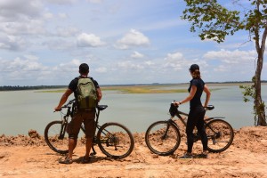 Looking out over the West Baray.
Nick and Buntha are delighted to take guests exploring the local countryside by mountain bike or hiking. Discovering hidden temples where our cold beers and lunch boxes will be waiting.
by Nick | Jul 8, 2020 | Angkor, Blog, Kayak
Background
The rise and fall of the Angkorian Empire, which lasted 500 years from the 9th to 14th century, was centered in what is now Siem Reap Province, around its greatest monument Angkor Wat. A population of a million in an area of 1000 km2 serviced the empire and built the religious structures the remnants of which we see today.
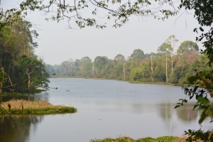 Angkor Wat Moat
Key to the success of the civilization was the management of water in a region of inundation and drought. An elaborate system of canals and barays or reservoirs channeled water from the Kulen Hills to the North into the city.
The availability of water ensured that food went in and shit went out. Canals facilitated the construction of the temples conveying the stone from the quarries to the North. And the temples were built with defensive moats that maintained ground water levels preventing their subsidence.
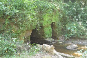 Runta Dev, the tunnel under the 8m high walls of Angkor Thom that channeled waste-water into the moat
It is now thought that the decline in management and maintenance of the hydrology coincided with that of the empire.
In recent years the importance of these systems has been recognized again as the massive increase in tourism has lead to ground water levels falling and the potential collapse of the temples. It is no coincidence that the best preserved are those with functioning moats.
One man has been championing the restoration of the Angkorian water management. He has overseen the construction of canals that channel the Siem Reap River into the North Baray, the moats of Preah Khan, Ankgor Thom and even Angkor Wat. Reducing the possibility of Siem Reap flooding as it did in 2011, while maintaining ground water levels and preventing the temples falling down.
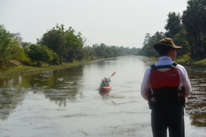 Overseeing our progress up the North Baray Channel
These small matters aside obviously the most important function of Angkorian hydrology is to allow us to paddle through the Angkor Park, Cambodia’s best preserved 400 km2 of lowland mixed evergreen and deciduous forest.
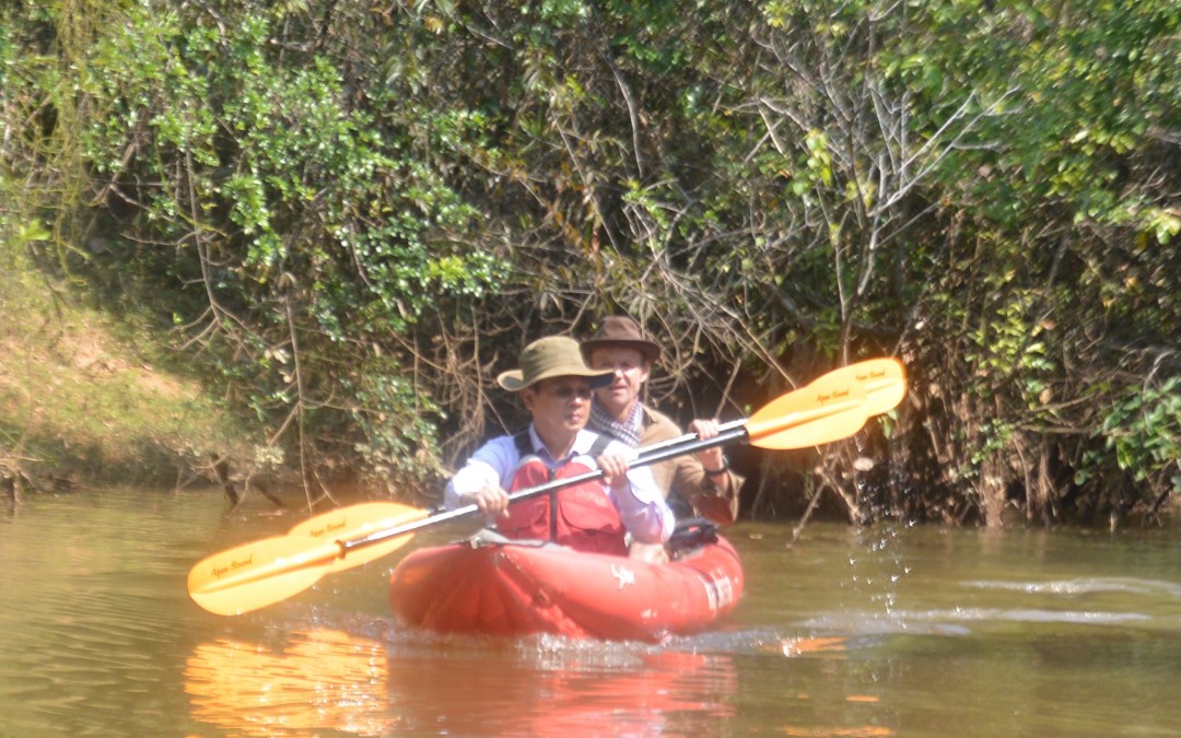
And so it was one Monday morning that his excellency the Director of Water Management at Apsara and now Director General, facilitated by Jady together with Buntha and myself kayaked through the heart of a Unesco declared world heritage site. Jady and I had previously recced Peou’s canal that diverts the flow from Siem Reap into the North Baray and round to the West Baray. This time we didn’t get lost and anyway Peou knew the way, but – we hadn’t followed the river as it heads South towards the Tonle Sap Lake.
The current had cut deep into the soft ground leaving 7meter high banks that we had to scramble down with our kayaks and then awkwardly get in them.
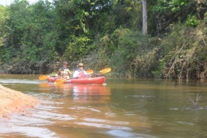 Paddling down the Siem Reap River
A few fallen branches had accumulated enough flotsam and jetsam to block the river with no way through but a messy scramble. Jady and Buntha paved the way. Poeu and I made it easy.
There are 700 Angkorian structures inside the Angkor Park but only 180 of them can be called temples, they’re the ones with moats. These monumental stone edifices need solid ground for their structural integrity, without it they crumble to a pile of stones. Siem Reap is a built on a light sandy soil, water gives it substance, which is what the moats do for the temples.
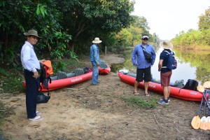 Contemplating our adventure
A few hundred meters on either side there were no doubt bus loads of Asian tourists but here in the heart of Angkor we paddled passed explosions of bamboo erupting on either side. White-collared Kingfishers taunted Buntha to catch a photo. A Snake Eagle followed our progress from above, while a Shikra watched us with disinterest from a fallen branch. All manner of other birds sang from the trees on either side obliterating any thoughts of tourists or even other people.
We’d catered for 5 pax kayaking but one of the water management guys came along for the ride so the third kayak was one paddle power short and we had visions of Kosal, Jady’s assistant unable to move his shoulders for a month or 2. They’d had the sense to share the work and caught up beaming and claiming the big adventure.
Our driver had accumulated helpers by the time we reached the sluice gates at the French Bridge (confusingly built by Americans), who pulled us up the steep stairs to Jady’s vehicle.
It took a while to sink in that we had paddled through one of the wonders of the world, visited by 3 million people but seen none, instead thick riparian forest as if we were discovering it for the first time.
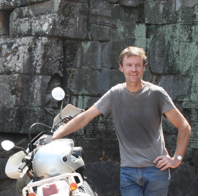
by Nick | Apr 13, 2020 | Angkor, Blog
THE STONE CITIES OF CAMBODIA
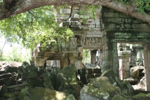 Banteay Chma
We cheated. We had a helicopter. It would have taken the late nineteenth century French explorers years to hack through the jungles of Cambodia to alight on the lost Atlantis (plural) that we’d planned for our guests that Christmas Day.
We were at the airport for seven to make the best use of the next ten hours of daylight. Strapped in, our mikes and headsets tuned then that exhilarating sensation as the aircraft seemingly does the impossible and lifts straight up, and if the pilot is feeling playful, does a nose down turn that speeds a few meters above the ground before wheeling up and heading West to our first destination.
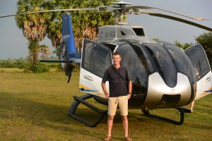 Taking off from Siem Reap Airport
A thousand years ago Jayavarman VII, lets call him JVII ruled his rather large empire via highways that radiated out like the spokes of a wheel that extended to the far flung dominions of the realm, including Route 66 to Thailand by way of Banteay Chma.
Today’s science and earth moving machinery cannot compare to the Angkorians when it comes to the Cambodian landscape. I looked down on the perfectly straight line of the ancient road now marked by a canal that leads to the vast reservoir of Ang Trapaeng Thmor, now a wildlife sanctuary for the endangered Saurus Crane. We flew over the precarious towers of Prasat Troap, a temple I’ve yet to visit and spied the Angkorian city of Banteay Chma.
A site had been cleared for us in a dried out paddy field with a vague H where we were supposed to land then all became lost in a whirlwind of debris from the powerful downward thrust of the rotor-blades. Cold towels and refreshments at the ready, we were lead off to explore JVII’s second largest stone construction after Angkor Thom at Angkor.
Like Angkor Thom his capitol, the towers are adorned with loksvara thought to be a benign image in his likeness. Ever present ever watching, maybe not so benign as they looked over the scheming Hindu priests during his Buddhist reign.
There was a Hindu temple here before, which became integrated into JVII’s construction.
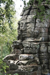
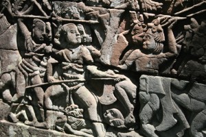 Loksvara (left) Bas-relief on outer gallery wall
Despite or maybe because of religious dissent the King allowed a secular society to coexist. He also tolerated a central shrine to his son and the four servants who lost their lives on the frontline defending the crown prince from the marauding Cham.
We walked across the causeway and entered the jumble of towers and galleries, engulfed by foliage and blocked by fallen stones adorned with beautiful carvings.
The outer galleries similar to Angkor Thom are carved with bas-reliefs that seem to come to life as you stare, and act out the battles, religious rituals and daily life of twelfth century Angkor.
We needed to cover a fair chunk of the country to reach the next stone city perched on the Thai border. Strung out for nearly a kilometer along the edge of a 500 meter escarpment in The Dangkrek Mountains. The stone edifice faced North to Thailand and looked out South over what were once the vast forests of Cambodia.
Preah Vihear, which in Sanskrit loosely means sacred shrine was built and added to by successive kings but eleventh century Suryavarman I gets most of the credit. A linear construction built on five levels along the cliff edge with the main structure at the highest point.
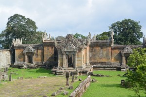
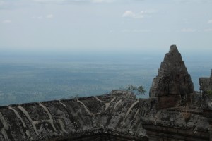 A temple with a view.
We touched down beside our 4WD pick up truck, needed for the incline up the mountain and slowly drove into the clouds. Preah Vihear is Cambodian, UNESCO said so but Thailand disagrees, quite violently in 2008 when the Thais started lobbing shells into Cambodia, which were duly returned.
A market on the North side of the temple where bush meat was bought and sold had Thai soldiers milling around as we climbed up the first set of steps towards the summit and the main sanctuary. The temple is stunning but it’s the view I remember.
A quick beer and we were up again with the surreal mountain top temple behind us heading for the lost city of Koh Ker. Lost because the Varman’s had a falling out over Angkor so JIV in a fit of pique upped sticks and built another capitol of the empire. Cambodia’s second largest temple town with the remnants of more than 180 temples spread over 8000 hectares discovered so far and running since Lidar* surveys have revealed more structures, who’s discovery up until recently was hampered by landmines.
*Lidar is a lazer usually mounted on a helicopter that has been used to map out the topography of archeological sites.
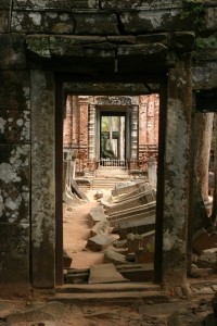 Prasat Thom to Prasat Prang @ Koh Ker
Koh Ker was on a different spoke of the Angkor wheel, which extended via Preah Vihear to Wat Phu in Southern Laos and on to the China Sea. Known as Lingapura or Phallus City, it certainly had some big ones most notably a 4.5 meter statue in Prasat Prang.
The city, which in the early 900‘s had a population of ten thousand is dominated by Prasat Prang, The Pyramid Temple. It rises 35 meters high above the surrounding forest and on a clear day affords views back to the Dangrek Mountains where we’d flown from.
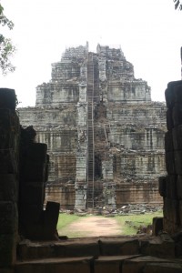 Prasat Prang
Where there’s a temple there’s a baray or reservoir and Koh Ker has a big one. Rahal as it was called is over a kilometer long and half a kilometer wide. Surrounded by reasonably protected forest there’s a diversity of birdlife and on it’s banks a great place for a picnic. Three stone cities under our belt so a chilled glass of wine and a spread of cold cuts and salad hit the spot.
Today is a travesty, scholars have studied each of these archeological marvels for years and we’re squeezing in four in one day but beggars cant be choosers so its back into the helicopter for another wonder of the world.
Ta Prohm with its twisting tree roots and Beng Melea overgrown with vegetation are described in the guide books as the jungle temples but the real Indiana Jones fantasy is Preah Khan or The Bakan (Kampong Svay District not Angkor).
I first went to Preah Khan on my dirt bike in 2009, a difficult off road journey along forest paths, fording rivers and crossing flooded paddy fields. More recently we’ve turned the trip into an enjoyable if hard mountain bike ride through a forest from BeTreed about 20km away.
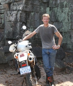 At the entrance to Preah Khan in 2009
Wet with sweat and exhausted from the cycle just imagine what it feels like when there in a jungle clearing ahead of you a stone monument testament to the power of the king towers above. A few hundred meters further and the scale of the city revealed itself.
Preah Khan now represented by many ruins covers about 25 square kilometers and includes a three by half a kilometer baray with an island temple in the middle. The Bakan, bigger than Angkor Wat in area is enclosed by five kilometers of walls surrounded by a moat. Like Banteay Chma much of it is a jumble of stones but more spread out such that a visit feels more like a journey.
Different kings left their mark, Suryavarman I in the 10th century dedicated what he built to Shiva but as with most of the mega temples of Angkor it was JVII who really left his mark with a purpose.
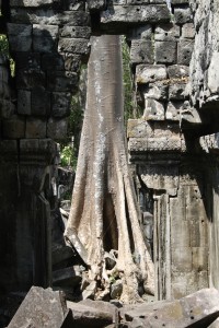
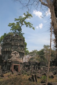 A silk cotton tree as seen through the broken doorway of a temple (above) and part of the Bakan being reclaimed by the forest
The area around Preah Khan was rich in iron ore and the local Kouy people a distinct indigenous group had learnt how to make iron, necessary for the weapons JVII needed to defeat the Cham who’d occupied Angkor.
Our aircraft had caused the usual excitement with the general populace emerging to watch the big event as the helicopter landed but inside the temple we were left along. Carefully picking our way through the stones contemplating the surrealism of what, for a short time, we were part of.
All too soon we were back in the helicopter flying over a rural landscape of paddy fields and patches of forest. Too much in one day but an awesome experience!

 A rural landscape of sugar palm trees and paddy fields
 The River Bridge across the Kampong Phluk River
 Chau Srey Vibol Temple
 Banteay Ampil Temple
 The reward for our morning’s adventures
 There are many ways to leave a temple including oxcarts (above), helicopters (below) and kayaks if its been raining.

 Loklak checking out the temple trail
 Manus framed by Phnom Bok and it’s lake
 Prasat Toh
 Angkorian demon (left) and Oxcart (below)
 Phum Samre Market
 Chinese New Year Flower
 Pradark Pagoda
 Prasat Kamnap
 Rehydrating Loklak
 A beer beside the baray
 Lake Ta Neue
 A monk’s house at Pradark Pagoda
 Prasat Kom Nat
 View of the Baray from the East bank
 The village of Pum Samre
 Prasat Tor
 The launch committee
 Cast net fishermen (and a dog)
 Num ban Chok in Pradark
 Lors and Zsuzsa looking out over the dam
 Lors showing off on the rickety bridge
 A Zsuzsa selfie with Prasat Sra Laos (and me) in the background
 In front of Prasat Cha, Sanscrit is carved into the inside of the stone doorway
 Our last challenge before the Baray.
 Looking out over the West Baray.
 Angkor Wat Moat
 Runta Dev, the tunnel under the 8m high walls of Angkor Thom that channeled waste-water into the moat
 Overseeing our progress up the North Baray Channel
 Paddling down the Siem Reap River
  Contemplating our adventure
 Banteay Chma
 Taking off from Siem Reap Airport
 Loksvara (left) Bas-relief on outer gallery wall
 A temple with a view.
 Prasat Thom to Prasat Prang @ Koh Ker
 Prasat Prang
 At the entrance to Preah Khan in 2009
 A silk cotton tree as seen through the broken doorway of a temple (above) and part of the Bakan being reclaimed by the forest