by Nick | Aug 3, 2020 | Blog, Kayak
In Search of a White Elephant
Our quest for the day was to find Boeung P’Rieng, a lake amidst flooded forests on the edge of The Great Tonle Sap that is subsumed when the back flow begins and the water levels in the lake rise.
Previous attempts had started in much the same way though today was Wednesday so it was Sister Srei not Little Red Fox, where we congregated for the essential injection of caffein before setting off on our quest.
The first try was thwarted by 2 flat tyres and a serious compromise in a sense of direction. I emerged from the forest beside the tourist boat channel at Chong Khneas no where near Boeung P’Rieng or nearby Chreav Village. The second attempt got closer but we reached the trips zenith in the corner of a big rice field where it met the channel leading to Boeung P’Rieng, a local family told us.
This morning’s adventure was a more serious affair; Buntha, Lors and I were joined by Bo our ubiquitous boatman and Mr Ly, the managing director no less of the Chreav Village Information Centre. In his spare time he had taken on the role of promoting the lake as a possible source of employment for the Chreav villagers in who’s commune it is situated. We assumed this might mean he knew where it was.
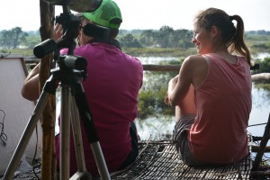
 Lors, our guide receiving the tour guide treatment from Mr Ly, director of the village information center with Taylor behind the camera
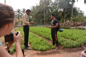
As part of the party political broadcast we were taken to a well managed market garden in a pretty part of Chreav village where basil and other herbs were grown. An oxcart was included in the agenda but our bicycles gave us the excuse to continue in our search of the elusive lake.
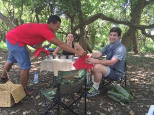
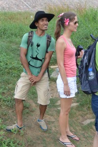
 A water stop. Left to right; Buntha, Taylor, Ly, Lors & Bo.
Bo’s plans for differentiation in the tourism industry became evident as Taylor and I became his unwitting models when we cycled between paddy fields behind the plume of white dust thrown up by his motorbike.
Our cares started to slip away as the horizon stretched to the distance. We spotted sandpipers on the moist earth and a Pied Kingfisher over the irrigation ditch. Two pranticoles skulked amongst the rice stubble. The impenetrable bush revealed when the Tonle Sap recedes had been cleared to make a path to where we assumed the lake would be.
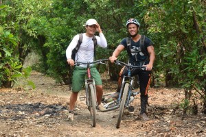 Buntha and Lors cycling through the seasonally flooded forest
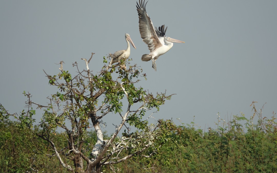
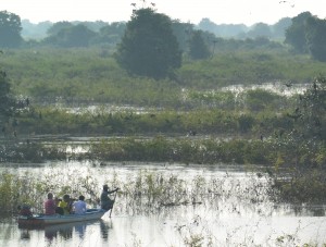
Circling pelicans soaring high confirmed that third time lucky and after a patch of proper forest we met our welcoming committee and The Lake.
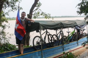
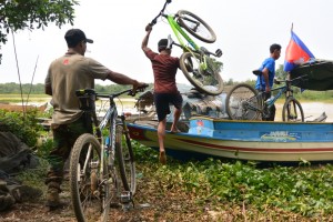 Loading our bikes on board
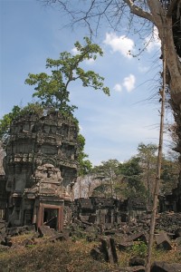
Five years ago Bo had tried to persuade us to send bird watchers to what was designated a fish conservation area, hence the birds but as with many a well intentioned project in Cambodia, the fishing rights to the fish protection area were sold.
 And setting off to explore the lake
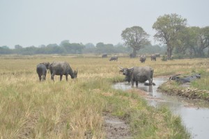
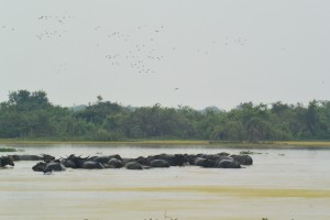 Wallowing Water Buffalo in the shallow waters of Boeung P’Rieng (hence the renaming as Buffalo Lake)
Mr Ly according to Mr Ly was now the lakes protector and the fishing traps hauled out of the water and piled high to be burnt suggested that this time it might be more than words.
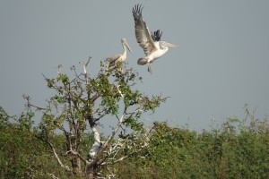 Spot-billed Pelicans taking off as we get too close
The community protected area covers 300 hectares and the lake itself twenty though that must change by the day. As we nosed our way through the sage green algae the scale was hard to fathom. Pools were funneled through channels to broad expanses of muddy suspension where buffalo wallowed pecked clean of ticks by white egrets, a prefect focal for a photo that never happened as they flapped off before I could press the shutter.
 A cool forest lunch-spot for our guests
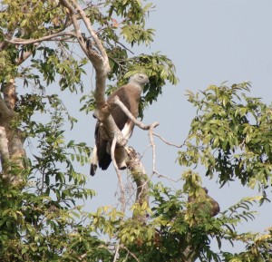
Bo’s enthusiasm for the birds was infectious as we struggled to keep up with the calls of new
species; Black-headed Ibis, Open-billed Storks everywhere, Painted Storks, prehistoric pelicans sailing like galleons, cormorants and a Grey-headed Fishing Eagle lazily flew off as we entered a new lagoon. Above all were the great flocks of duck, Spot-billed and Whistling, more than we’d seen at Prek Toal and only compared with the reservoir at Ang Trapaeng Thmor.
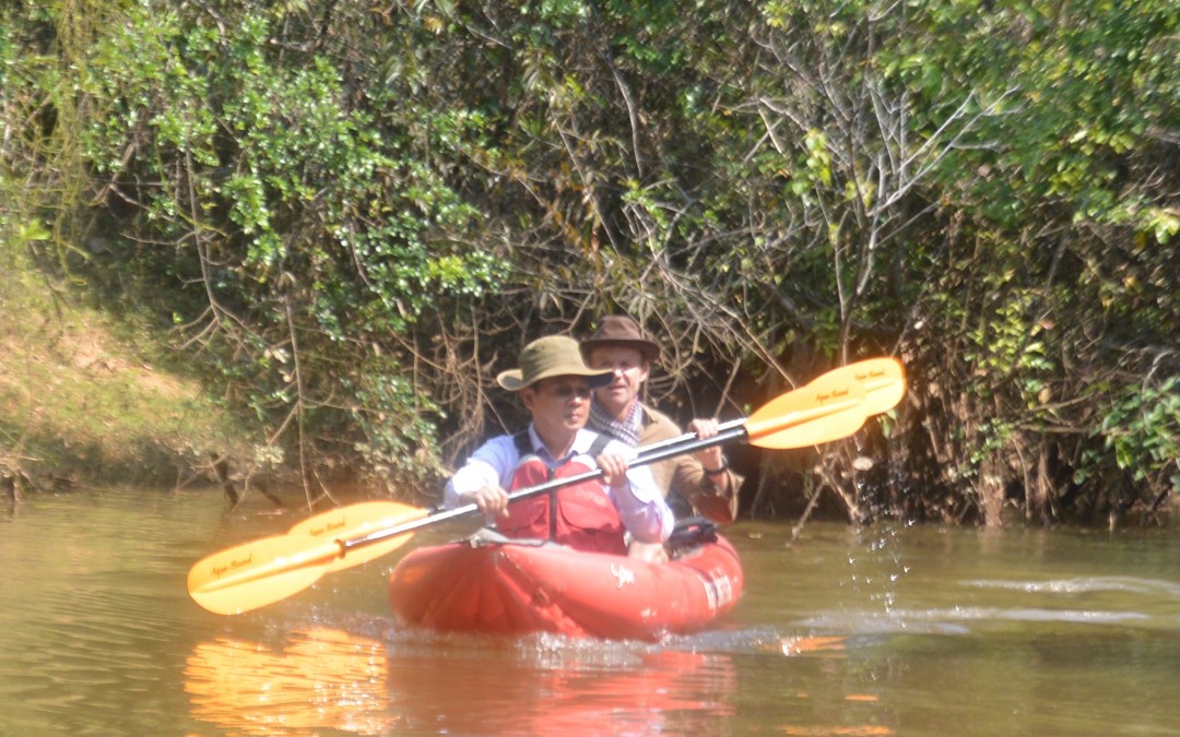
Our destination proved to be a patch of cool forest with a clear understory shaded under the canopy, the perfect lunch spot after a mornings meandering by kayak.
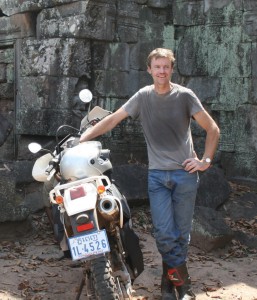
 Birds, bikes, boats and Nick
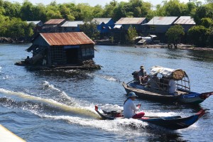
I remembered that we had been able to drive our motorbikes here but now the route was cut by the channel that offered our only way out. Our impressively muscled boatman manoeuvred us along the twists and turns of the waterway between the trees and pushed our path through the congregated water hyacinth.
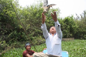 Bo releasing a trapped Water Cock
Something fluttered in a fish trap. A bird was caught in the cage. Bo’s good at this and confidently reached in and pulled out the distressed Water Cock, which calmed in his hands.
In quasi moment of religious release he cast the creature into the sky to regain its freedom, whereupon it nosed dived into the next fishing trap. There was a happy ending as it swam off underwater.
 Disembarking from the Water Hyacinth Channel
 The Floodplain around Phnom Kraum now a buffalo haven
Somehow Bo’s motorbike was where we disembarked then I recognised the community member who’d said goodbye and figured it out!
We set off across the dry paddy, which even in these dry El Nino years will be a meter under the flood in 4 months time. Where there was water the buffalo wallowed. I racked my brains to remember the path we cycled on.
Surely I’d been here? We’d turned off too late, it dawned on me as we crossed a bridge over the Siem Reap River on its way to Phnom Kraum and Chong Khneas, the ugly tourist port.
Next was a promotional detour engineered by Bo, who sort of seemed to be taking over the day. A new homestay venture complete with wi-fi and a bar. Surely that makes it a guesthouse? I thought but obviously Bo reckoned that business lay with a homestay and the activities there with as now modeled by Taylor and Nick.
 Recharging after the morning’s exertions
More to the point and definitely on cue, Mr Doitch an Indochine Exploration driver had cooked us lunch, chicken and cabbage, chnang! (delicious).
Boeung P’Rieng is a birding spectacle on the scale of the world famous Prek Toal 15km as the adjutant flies to the South. And a testament to the work of My Ly and his community members in enforcing the protection of the fish conservation area that attracts the birds.
Indochine Exploration is pleased to support this project with an out of the world adventure combining combining bikes, boats, birds and a paddy field Jeep tour (pulling apart a chicken carcass is optional).
PS The white elephant reference is that white elephants are hard to find and make you very happy when you do!
by Nick | Jul 8, 2020 | Angkor, Blog, Kayak
Background
The rise and fall of the Angkorian Empire, which lasted 500 years from the 9th to 14th century, was centered in what is now Siem Reap Province, around its greatest monument Angkor Wat. A population of a million in an area of 1000 km2 serviced the empire and built the religious structures the remnants of which we see today.
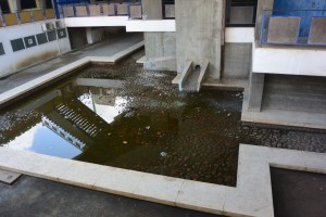
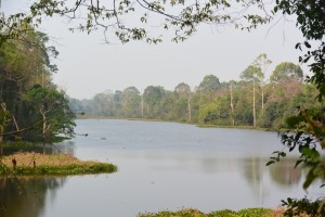 Angkor Wat Moat
Key to the success of the civilization was the management of water in a region of inundation and drought. An elaborate system of canals and barays or reservoirs channeled water from the Kulen Hills to the North into the city.
The availability of water ensured that food went in and shit went out. Canals facilitated the construction of the temples conveying the stone from the quarries to the North. And the temples were built with defensive moats that maintained ground water levels preventing their subsidence.
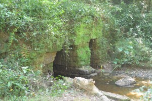 Runta Dev, the tunnel under the 8m high walls of Angkor Thom that channeled waste-water into the moat
It is now thought that the decline in management and maintenance of the hydrology coincided with that of the empire.
In recent years the importance of these systems has been recognized again as the massive increase in tourism has lead to ground water levels falling and the potential collapse of the temples. It is no coincidence that the best preserved are those with functioning moats.
One man has been championing the restoration of the Angkorian water management. He has overseen the construction of canals that channel the Siem Reap River into the North Baray, the moats of Preah Khan, Ankgor Thom and even Angkor Wat. Reducing the possibility of Siem Reap flooding as it did in 2011, while maintaining ground water levels and preventing the temples falling down.
 Overseeing our progress up the North Baray Channel
These small matters aside obviously the most important function of Angkorian hydrology is to allow us to paddle through the Angkor Park, Cambodia’s best preserved 400 km2 of lowland mixed evergreen and deciduous forest.
And so it was one Monday morning that his excellency the Director of Water Management at Apsara and now Director General, facilitated by Jady together with Buntha and myself kayaked through the heart of a Unesco declared world heritage site. Jady and I had previously recced Peou’s canal that diverts the flow from Siem Reap into the North Baray and round to the West Baray. This time we didn’t get lost and anyway Peou knew the way, but – we hadn’t followed the river as it heads South towards the Tonle Sap Lake.
The current had cut deep into the soft ground leaving 7meter high banks that we had to scramble down with our kayaks and then awkwardly get in them.
 Paddling down the Siem Reap River
A few fallen branches had accumulated enough flotsam and jetsam to block the river with no way through but a messy scramble. Jady and Buntha paved the way. Poeu and I made it easy.
There are 700 Angkorian structures inside the Angkor Park but only 180 of them can be called temples, they’re the ones with moats. These monumental stone edifices need solid ground for their structural integrity, without it they crumble to a pile of stones. Siem Reap is a built on a light sandy soil, water gives it substance, which is what the moats do for the temples.
 Contemplating our adventure
A few hundred meters on either side there were no doubt bus loads of Asian tourists but here in the heart of Angkor we paddled passed explosions of bamboo erupting on either side. White-collared Kingfishers taunted Buntha to catch a photo. A Snake Eagle followed our progress from above, while a Shikra watched us with disinterest from a fallen branch. All manner of other birds sang from the trees on either side obliterating any thoughts of tourists or even other people.
We’d catered for 5 pax kayaking but one of the water management guys came along for the ride so the third kayak was one paddle power short and we had visions of Kosal, Jady’s assistant unable to move his shoulders for a month or 2. They’d had the sense to share the work and caught up beaming and claiming the big adventure.
Our driver had accumulated helpers by the time we reached the sluice gates at the French Bridge (confusingly built by Americans), who pulled us up the steep stairs to Jady’s vehicle.
It took a while to sink in that we had paddled through one of the wonders of the world, visited by 3 million people but seen none, instead thick riparian forest as if we were discovering it for the first time.
by Nick | Jun 8, 2020 | Blog, Culture
NEW KHMER ARCHITECTURE
Architecture was part of a new exuberant and modernistic Khmer movement encouraged by King Sihanouk and expressed in music, dance, film and architecture, not seen in neighboring parts of Indochina when Cambodia gained independence in 1953. The movement lasted until Sihanouk was deposed by Lon Nol in the 1970 coup, which heralded the start of the civil war.
Vann Molyvann was foremost among the city’s architects during this time, designing nearly 100 public and private projects. He’d studied in France and drew inspiration from Le Corbusier and his five principles of design, most of which can be seen in traditional Khmer wooden houses.
The five principles being;
- The building is raised from the ground
- It has an open facade
- The columns are not connected
- There is a roof top garden
- Concrete and wood are used in the construction
Together with the UN expert Gerald Hanning, he advised the King as to how the city should be developed.
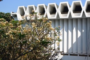
The Institute of Languages The last work of Molyvann before he left the country in 1971 and Sihanouk overthrown was the Institute of Languages, where he used all the devices he’d developed in adapting to the climate with his own unique style. Among these were;
The first floor is larger than the ground floor providing shade below in a style of passive protection, while the whole building is raised on columns from the ground as with traditional Khmer architecture.
A polygon roof separates the working space from the glare and heat of the sun and channels the breeze giving a natural cool. Vertical panels provide shade to the interior
 The Institute of Languages showing the cooling polygon roof and shading vertical panels
The building is orientated to shade the stage and those inside who can see out and those outside in, connecting them by visualization.
The ground floor as with traditional Khmer wooden houses was open though now outside walls have been added on some of the buildings, somewhat of a design travesty but the Ministry of Education doesn’t speak to the Ministry of Culture.
 The main building in The Institute of Languages showing the larger 2nd & 3rd floors shading the ground floor and stage
Arial walkways over pools connect the different buildings offering a view over the forty five hectare campus and shelter from the rain and sun underneath. They give an example of how Molyvann incorporated Angkorian design, which uses bridges to cross the temple moats. He even finished off the handrails with nagas or snakes.
The four lecture halls appear as jumping frogs creating a sense of dynamism, while the double walls faced by brick divert heat from the laboring students inside. And sculpture not painting is used to play with the shadows.
 The 4 Lecture Halls
The library (not shown) is shaped like a Khmer straw hat, where outside columns support the building with no structure inside. The gutters act as fountains falling into a surrounding pool cooling the building without the need for air-conditioning (in case of the library aircon was used to control the humidity). A Le Corbusier inspired style called ‘brise soleil’ seen in Chandigargh India, where the walls are protected from the wind, rain and sun, was also used by Molyvann.
 The Conference Hall
The conference hall, not designed by Molyvann, is a parabolic shape supported from outside and traditionally open sided which killed the sound and allowed a breeze. Now the sides have been filled with glass it has to be air-conditioned and there’s an echo to even the smallest sound.
 Interior
There were air vents in the ceiling to further cool the space but they have been covered. There’s a mistake in the orientation of the hall as it faces South West catching the sun unlike the Institute of Languages.
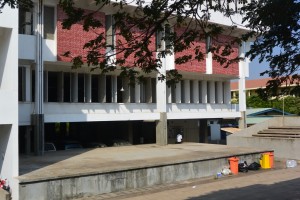
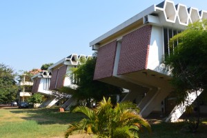
The Hundred Houses The next stop on our tour of new Khmer architecture was The hundred houses, built between 1965 – 1967, providing social housing to National Bank of Cambodia employees who were entitled to the buildings after 20 years paying rent.
 A Hundred House
The design incorporates that of a Khmer wooden house and modern architecture. The houses appear to be randomly orientated but are actually carefully laid out to maximise the view and space.
The open space underneath is important providing an area for shelter and storage like a traditional Khmer wooden house and there’s an Angkorian style pool in every garden. There are 2 staircases, one into the living room and a back stair to the kitchen and the WC so guests would avoid the smell and traipsing through the house. Unlike most Khmer houses Molyvann designed big windows the size of doors for ventilation and light.
The main columns are made of concrete not wood as are the beams between them. This is so the thickness of the beams can be increased and the span widened, allowing more space. The roof is like a policeman’s helmet raised above the walls and channeling any breeze from outside in.
In 1975 the estate became a military camp and every house got a number. After the civil war the Vietnamese Air Force took them and in 1986 they were given back to the people. Today most are being demolished or altered as land becomes increasingly expensive.
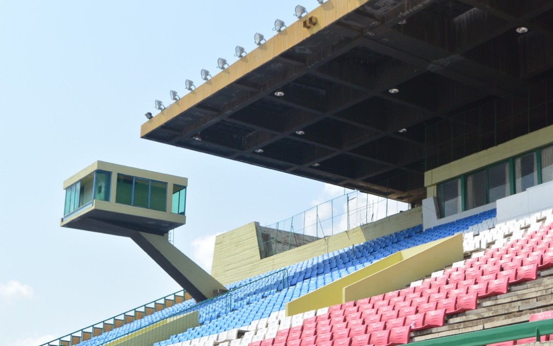
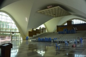
The National Stadium The most spectacular project was saved for last on our tour. The Olympic Stadium started in 1962 was planned for the Asian Games in 1963 but actually finished in 1964. In 1966 it was used for the Non-aligned Asian Games. The architect was Molyvann who worked with a Ukranian engineer named Vladimir Bondetsky.
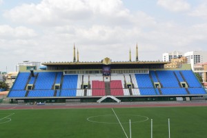
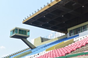 The royal pavilion (top right) with a War of the Worlds timing box over the VIP seats
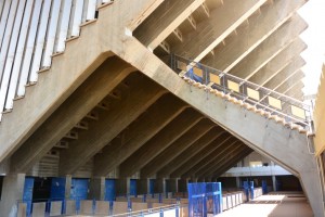 External staircase and tiered seating showing the ventilation holes
The building was Angkorian inspired and became known as the second Angkor Wat consuming most of the national budget in its construction.
The materials excepting aluminum panels were all Cambodian. As with Angkor Wat the indoor stadium is surrounded by pools fed from gutters.
 One of the pools surrounding the auditorium showing the guttering and reflecting the stairs
External stairs allow for a speedy and non claustrophobic exit. There are no walls as such just tiers of seating surround the auditorium, each seat has an open space underneath providing cooling ventilation to the entire area. The ceiling is supported by 4 columns 2 meters wide, 25 m high allowing a span of 32 m resembling a square mushroom. The ventilation allowed a breeze and light to get through during the day and the building to glow with light at night.
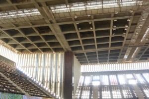 1 of the 4 columns supporting a square 32m span and the tiered seating illuminating the auditorium
As you leave the indoor stadium you pass under a low ceilinged corridor, the contrast with the vast space of the 70,000 seat outdoor arena is stunning. As Frank Lloyd Write said detail is the key, this can be seen in all of Molyvann’s designs and the Olympic Stadium is no exception. Originally covering a 24 ha site the different aspects of the complex mirrored each other, while the 4 towers on the roof of the stadium provide orientation around the 4 cardinal points.
 View across the pitch to central auditorium, Royal Box and VIP seating with towers at the 4 cardinal points
The elevation of the stadium is the same as Angkor Wat’s and allowed the seats facing East to towards the river to see the Royal Palace. It was built up using the soil from the pools surrounding it, saving money on concrete and speeding up the construction process.
The National Stadium is now under threat and on the World Monument’s Fund watch list. Much of the original 24 ha has been sold for development, the original buildings demolished and construction has started on skyscrapers. There’s talk of a new Chinese funded national stadium on the outskirts of the city, which will increase the pressure to release what is now valuable land.
Phnom Penh can be overlooked in the rush to see the temples from Siem Reap but this Vann Molyvann focused architectural tour along with others concentrating on religious and colonial architecture are a good reason to extend your stay by a night or two.
by Nick | Apr 13, 2020 | Angkor, Blog
THE STONE CITIES OF CAMBODIA
 Banteay Chma
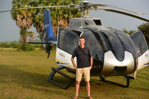
We cheated. We had a helicopter. It would have taken the late nineteenth century French explorers years to hack through the jungles of Cambodia to alight on the lost Atlantis (plural) that we’d planned for our guests that Christmas Day.
We were at the airport for seven to make the best use of the next ten hours of daylight. Strapped in, our mikes and headsets tuned then that exhilarating sensation as the aircraft seemingly does the impossible and lifts straight up, and if the pilot is feeling playful, does a nose down turn that speeds a few meters above the ground before wheeling up and heading West to our first destination.
 Taking off from Siem Reap Airport
A thousand years ago Jayavarman VII, lets call him JVII ruled his rather large empire via highways that radiated out like the spokes of a wheel that extended to the far flung dominions of the realm, including Route 66 to Thailand by way of Banteay Chma.
Today’s science and earth moving machinery cannot compare to the Angkorians when it comes to the Cambodian landscape. I looked down on the perfectly straight line of the ancient road now marked by a canal that leads to the vast reservoir of Ang Trapaeng Thmor, now a wildlife sanctuary for the endangered Saurus Crane. We flew over the precarious towers of Prasat Troap, a temple I’ve yet to visit and spied the Angkorian city of Banteay Chma.
A site had been cleared for us in a dried out paddy field with a vague H where we were supposed to land then all became lost in a whirlwind of debris from the powerful downward thrust of the rotor-blades. Cold towels and refreshments at the ready, we were lead off to explore JVII’s second largest stone construction after Angkor Thom at Angkor.
Like Angkor Thom his capitol, the towers are adorned with loksvara thought to be a benign image in his likeness. Ever present ever watching, maybe not so benign as they looked over the scheming Hindu priests during his Buddhist reign.
There was a Hindu temple here before, which became integrated into JVII’s construction.
 Loksvara (left) Bas-relief on outer gallery wall
Despite or maybe because of religious dissent the King allowed a secular society to coexist. He also tolerated a central shrine to his son and the four servants who lost their lives on the frontline defending the crown prince from the marauding Cham.
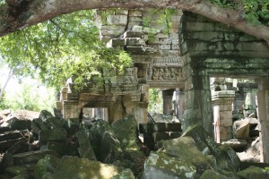
We walked across the causeway and entered the jumble of towers and galleries, engulfed by foliage and blocked by fallen stones adorned with beautiful carvings.
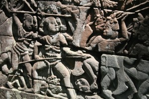
The outer galleries similar to Angkor Thom are carved with bas-reliefs that seem to come to life as you stare, and act out the battles, religious rituals and daily life of twelfth century Angkor.
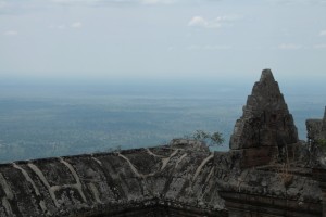
We needed to cover a fair chunk of the country to reach the next stone city perched on the Thai border. Strung out for nearly a kilometer along the edge of a 500 meter escarpment in The Dangkrek Mountains. The stone edifice faced North to Thailand and looked out South over what were once the vast forests of Cambodia.
Preah Vihear, which in Sanskrit loosely means sacred shrine was built and added to by successive kings but eleventh century Suryavarman I gets most of the credit. A linear construction built on five levels along the cliff edge with the main structure at the highest point.
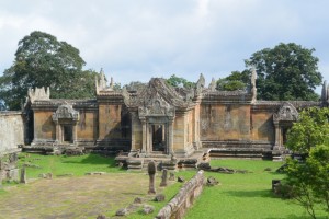
 A temple with a view.
We touched down beside our 4WD pick up truck, needed for the incline up the mountain and slowly drove into the clouds. Preah Vihear is Cambodian, UNESCO said so but Thailand disagrees, quite violently in 2008 when the Thais started lobbing shells into Cambodia, which were duly returned.
A market on the North side of the temple where bush meat was bought and sold had Thai soldiers milling around as we climbed up the first set of steps towards the summit and the main sanctuary. The temple is stunning but it’s the view I remember.
A quick beer and we were up again with the surreal mountain top temple behind us heading for the lost city of Koh Ker. Lost because the Varman’s had a falling out over Angkor so JIV in a fit of pique upped sticks and built another capitol of the empire. Cambodia’s second largest temple town with the remnants of more than 180 temples spread over 8000 hectares discovered so far and running since Lidar* surveys have revealed more structures, who’s discovery up until recently was hampered by landmines.
*Lidar is a lazer usually mounted on a helicopter that has been used to map out the topography of archeological sites.
 Prasat Thom to Prasat Prang @ Koh Ker
Koh Ker was on a different spoke of the Angkor wheel, which extended via Preah Vihear to Wat Phu in Southern Laos and on to the China Sea. Known as Lingapura or Phallus City, it certainly had some big ones most notably a 4.5 meter statue in Prasat Prang.
The city, which in the early 900‘s had a population of ten thousand is dominated by Prasat Prang, The Pyramid Temple. It rises 35 meters high above the surrounding forest and on a clear day affords views back to the Dangrek Mountains where we’d flown from.
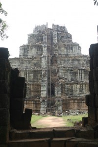 Prasat Prang
Where there’s a temple there’s a baray or reservoir and Koh Ker has a big one. Rahal as it was called is over a kilometer long and half a kilometer wide. Surrounded by reasonably protected forest there’s a diversity of birdlife and on it’s banks a great place for a picnic. Three stone cities under our belt so a chilled glass of wine and a spread of cold cuts and salad hit the spot.
Today is a travesty, scholars have studied each of these archeological marvels for years and we’re squeezing in four in one day but beggars cant be choosers so its back into the helicopter for another wonder of the world.
Ta Prohm with its twisting tree roots and Beng Melea overgrown with vegetation are described in the guide books as the jungle temples but the real Indiana Jones fantasy is Preah Khan or The Bakan (Kampong Svay District not Angkor).
I first went to Preah Khan on my dirt bike in 2009, a difficult off road journey along forest paths, fording rivers and crossing flooded paddy fields. More recently we’ve turned the trip into an enjoyable if hard mountain bike ride through a forest from BeTreed about 20km away.
 At the entrance to Preah Khan in 2009
Wet with sweat and exhausted from the cycle just imagine what it feels like when there in a jungle clearing ahead of you a stone monument testament to the power of the king towers above. A few hundred meters further and the scale of the city revealed itself.
Preah Khan now represented by many ruins covers about 25 square kilometers and includes a three by half a kilometer baray with an island temple in the middle. The Bakan, bigger than Angkor Wat in area is enclosed by five kilometers of walls surrounded by a moat. Like Banteay Chma much of it is a jumble of stones but more spread out such that a visit feels more like a journey.
Different kings left their mark, Suryavarman I in the 10th century dedicated what he built to Shiva but as with most of the mega temples of Angkor it was JVII who really left his mark with a purpose.
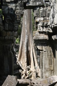
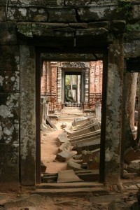
 A silk cotton tree as seen through the broken doorway of a temple (above) and part of the Bakan being reclaimed by the forest
The area around Preah Khan was rich in iron ore and the local Kouy people a distinct indigenous group had learnt how to make iron, necessary for the weapons JVII needed to defeat the Cham who’d occupied Angkor.
Our aircraft had caused the usual excitement with the general populace emerging to watch the big event as the helicopter landed but inside the temple we were left along. Carefully picking our way through the stones contemplating the surrealism of what, for a short time, we were part of.
All too soon we were back in the helicopter flying over a rural landscape of paddy fields and patches of forest. Too much in one day but an awesome experience!
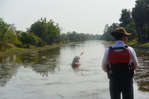
by Nick | Apr 2, 2020 | Blog, Cambodian Journeys, Conservation, Culture, Kayak, Uncategorized
Lena & Seb’s Battambang Adventure
Day 1
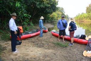
Vans, big motorboats, little motorboats, kayaks, bicycles, trains and taxis all had a part to play in our adventure on route from Siem Reap to Battambang. Overnight in the floating village of Prek Toal and the flooded forests of the Core Bird Reserve. Across the floodplains of the Tonle Sap Great Lake and up the Sangke River through the lush rural countryside of Battambang Province to the centre of the farming town in twenty four hours and a bit.
The expedition started at the boat station near Maichrey floating village, where Mr Heang and Finfoot, our comfortably converted fishing boat were waiting. The water was still high enough for us to cross the flooded scrub where we moored to a submerged tree. Lena and Seb were apt pupils as I explained the hydrological phenomena of the Mekong River system until I was rudely interrupted by a virulent green pit viper wrapped around a branch overhanging the deck.
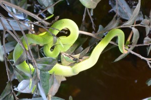 Pit Viper in tree beside boat
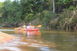
The afternoons adventure was to explore Prek Toal floating village and the surrounding flooded countryside by kayak. The police chief took photos as we paddled past his station, children came out to stare as we floated by their houses, while those who were working ignored us.
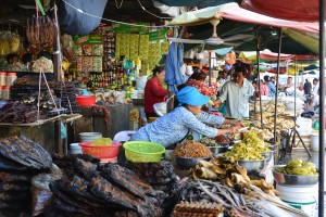
Our improvised route went between the blackened trunks of flooded trees, under their dense green canopy and emerged beside the floating Catholic Church. We crossed the channel to where a muscled boy was ladling fish into piles in front of squatting ladies who chopped them up with meat cleavers, making a pulp that would ferment into Prahoc or Khmer cheese. So named because it stinks.
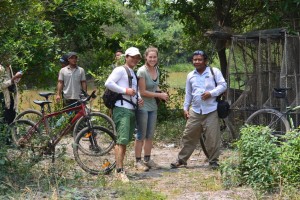
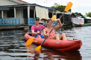 Seb and Lena setting off from their homestay
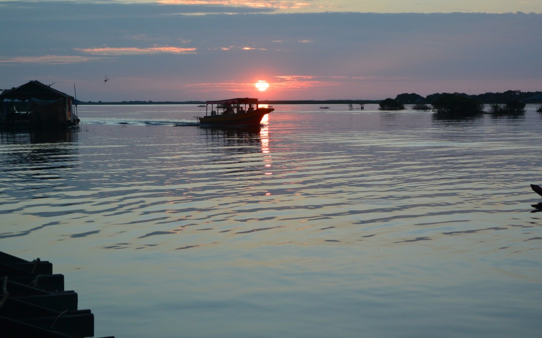
We watched the sun – a blood red orange, set over the Core Bird Reserve from the watchtower on top of the environmental research station, then motored over to the Saray Platform for supper.
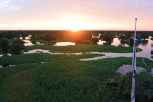 Sunset over the Prek Toal Core Bird reserve
Reflections twisted by the wake of motorboats, a cool breeze playing over the boat’s spume.
Hosing the prahok tables ready for tomorrow. Alien clumps of hyacinth drifting on the water.
Single pin pot lights overly bright in the blackness.
Cotton wool fluff of half seen cloud and the glare of a television set as we came close to people’s houses.
The women weavers on the water hyacinth workshop had gone home but their piers were cooking us a supper of fish, vegetables and fruit with rice and a good bottle of chardonnay to wash it down.
Swinging in a hammock in Veasna’s house our home for the night. Manus hid a lime in Baby Buntha’s nappy. His sister heaved the heavy little lump across the floor. The Mother in Law busied herself with not much. The Grandmother on all fours played with the baby. Little sister went skipping to her mummy then wrapped the baby in plastic, all the while pool hall play by the lads in the village. Hide and seek by the water jar, doubled up Grandmother.
Day 2
Streaky orange lighting the village as the first long tails cacaphonic clatter echoed across the water, the old lady hawked, the batteries ran out on the night lanterns. We awkwardly crossed the tilting boats to the pool hall barge to meet Heang, who took us for breakfast back at the Saray Platform.
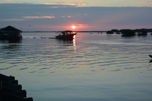 Dawn over Prek Toal
Bunhoeurn was waiting in the community boat for the ride into the magical landscape of the post dawn flooded forest. The light of the warming sun reflected by the delicate yellow flowers of floating saray plants. Squadrons of cormorants flew in slip-stream formation. A profusion of black and white; Oriental darters mixed with egrets, pelicans riding the thermals like galleons in the sky and the bird colonies. Avian cities built in the tallest trees.
Back in the village by 9am our journey into the heart of darkness (actually lush, pastoral Battambang) began.
The core bird reserve & view from observation platform
The waterway was fringed by hyacinth and undulating green margins of scrub with the occasional hamlets of floating houses or shacks tied to trees. The first proper village was Kampong Prahoc, which sort of translates into waterside place of good fermented fish paste. I wouldn’t want to be there when the water is low and rotten fish undiluted!
After an hour or so we began to get an idea of how vast the floodplain is. Over 40 kilometres wide where the water rises and falls by 10 meters submerging all but the tallest trees. In the floating villages along our route the only permanent constructions were pagodas on stilts.
Around a bend and Wat Cheu Khmao or temple of the black wood, came into view like a Burmese monastery with a beautiful modern pagoda framed by sugar palms behind. It was built in 1944 copying the Bayon Temple in Angkor and completed with Loksvara, the smiling faces at the cardinal points but they were blamed after accidents and disease struck the village then removed.
 The salapali or space for teaching of Wat Cheu Kmao
Great clumps of yellow green bamboo towered over the floating houses. The stems are harvested to provide the floating platforms on which the villages are built.
A regal Grey-headed fish eagle on guard beside its nest in a tall tree, while on a lower branch a hunched up night heron the servile vizier to the magnificent bird above.
We passed a tacky tourist lunch stop as bad as any bus station for the back packers crammed inside and on top of the fibreglass tourist boat.
 Grey-headed Fish Eagle
A single file short cut through the scrub, stopping for long tail boats loaded with beer and rice and wooden boats with giant water jars. We emerged onto an open plain where the trees had been cut down. Home to a transient people living on their small house-boats or shelters on the river bank as the water receded. Strange pivoting bamboo fishing nets were lowered into the water then raised revealing a whicker basket tied to the bottom to trap the fish.
 A floating house being towed to deeper water through a village of stilted houses
A fat pelican sat on the porch of a floating house. An unhappy monkey ran around on a chain in the full sun on a bamboo fishing platform and a full grown otter seemed ok as it scampered round the girl who held it’s leash.
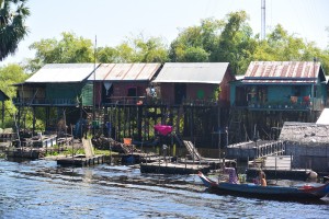 The stilted houses lining the still flooded banks of the middle Sangke River
Telephone masts were visible in the distance. Riverbanks rose above the water and motorbikes parked beside houses. We’d reached the upper Sangke.
Beautifully painted pagodas in stark contrast to Cham mosques. Elegant stilted wooden houses with tiled roofs between sugar palm and kapok trees.
 A pagoda on the riverbank not far from Battambang
Lena and Sebastian safely delivered to their garden enclave in Phum Wat Kor upstream of the town, I breathed a sigh of relief as the extra hot, double shot latte created by Chenda was placed on the little wooden table in front of me at Knyei Cafe.
Twice cooked beef with Seb and Lena at Jaan Bai cooking school restaurant then Jamesons and bed.
Weddingitis had infected the town and the Seng Hout Hotel where we’d booked to stay had a particularly virulent attack so we kept on going to find another bland box like building with half the Cardamon Forest used to make the furniture but ice cool rooms with no aesthetic distractions to sleep.
Day 3 The Battambang bicycle tour of the city with San.
First stop gold, bras, wigs, fruit, meat & fish, the crammed Psa Thmei or new market, built by the French.
 Psa Thmei
We crossed the quayside and down the dry banks to the ferry man who took us across the river to the monk school at Bovil Pagoda.
 Manus & Lena crossing the river and a monk house at Bovil Pagoda
Singing rang out from the Catholic Church, which had the enthusiasm of an American black baptist congregation not the stilted formality of a Catholic communion. Time was getting short and the Bamboo Train beckoned so we had to forgo the black man in the middle of the road, another of Battambang’s attractions.
Giant wood spiders had weaved their webs over the rail tracks. The view extended across bright green rice fields to Phnom (hill) Sampeou in the distance.
A one-way system, lift off the bamboo platform, remove the axles and let the oncoming norrie through before putting it back together again.
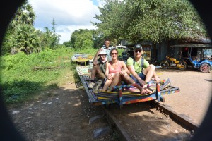 Nick (left), Lena & Sebastian on board a norrie